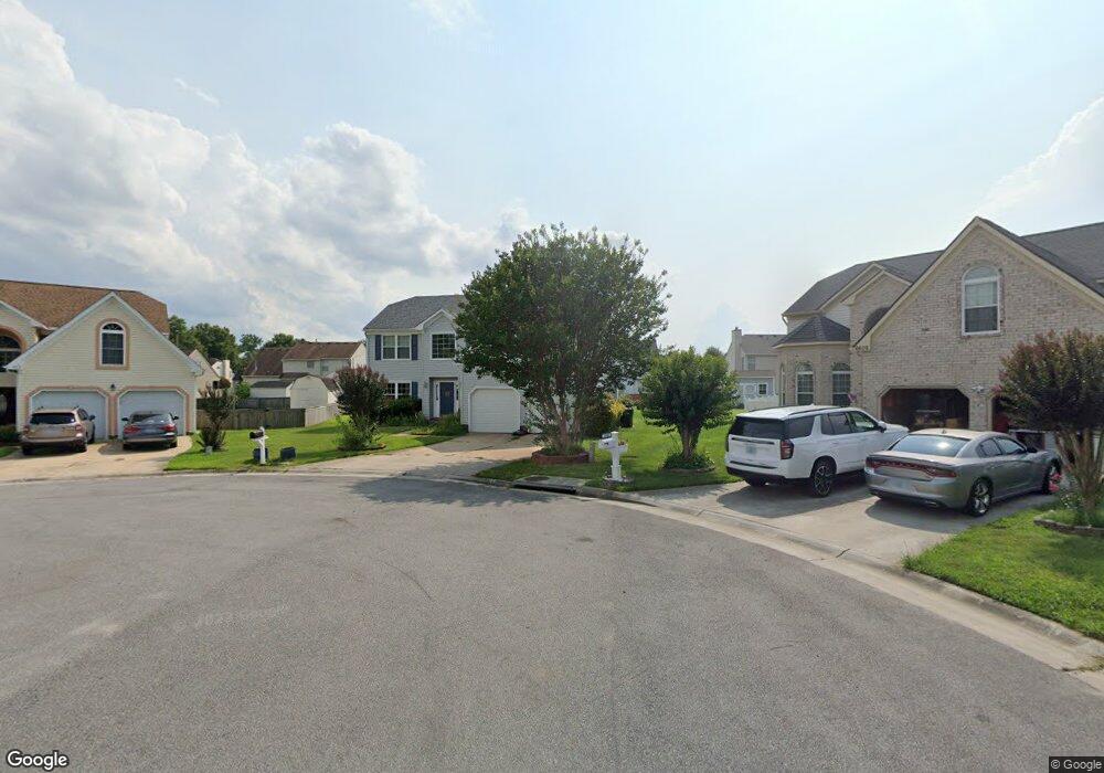
6610 James Point Ct Suffolk, VA 23435
Nansemond NeighborhoodEstimated Value: $464,000 - $479,081
4
Beds
4
Baths
2,916
Sq Ft
$162/Sq Ft
Est. Value
About This Home
This home is located at 6610 James Point Ct, Suffolk, VA 23435 and is currently estimated at $471,520, approximately $161 per square foot. 6610 James Point Ct is a home located in Suffolk City with nearby schools including Northern Shores Elementary School, John Yeates Middle School, and Nansemond River High School.
Ownership History
Date
Name
Owned For
Owner Type
Purchase Details
Closed on
Aug 24, 2022
Sold by
Clarke Lloyd I and Clarke Kathleen K
Bought by
Bonds Chanel N and Jones Jason W
Current Estimated Value
Home Financials for this Owner
Home Financials are based on the most recent Mortgage that was taken out on this home.
Original Mortgage
$392,755
Outstanding Balance
$377,266
Interest Rate
6.13%
Mortgage Type
FHA
Estimated Equity
$94,254
Create a Home Valuation Report for This Property
The Home Valuation Report is an in-depth analysis detailing your home's value as well as a comparison with similar homes in the area
Home Values in the Area
Average Home Value in this Area
Purchase History
| Date | Buyer | Sale Price | Title Company |
|---|---|---|---|
| Bonds Chanel N | $400,000 | First American Title |
Source: Public Records
Mortgage History
| Date | Status | Borrower | Loan Amount |
|---|---|---|---|
| Open | Bonds Chanel N | $392,755 |
Source: Public Records
Tax History Compared to Growth
Tax History
| Year | Tax Paid | Tax Assessment Tax Assessment Total Assessment is a certain percentage of the fair market value that is determined by local assessors to be the total taxable value of land and additions on the property. | Land | Improvement |
|---|---|---|---|---|
| 2024 | $5,297 | $438,000 | $85,000 | $353,000 |
| 2023 | $5,080 | $410,700 | $85,000 | $325,700 |
| 2022 | $4,065 | $372,900 | $85,000 | $287,900 |
| 2021 | $3,573 | $321,900 | $71,200 | $250,700 |
| 2020 | $3,441 | $310,000 | $71,200 | $238,800 |
| 2019 | $3,280 | $295,500 | $71,200 | $224,300 |
| 2018 | $3,204 | $288,700 | $71,200 | $217,500 |
| 2017 | $3,009 | $281,200 | $71,200 | $210,000 |
| 2016 | $3,009 | $281,200 | $71,200 | $210,000 |
| 2015 | $1,439 | $274,100 | $64,100 | $210,000 |
| 2014 | $1,439 | $272,800 | $64,100 | $208,700 |
Source: Public Records
Map
Nearby Homes
- 6602 James Point Ct
- 6750 Burbage Landing Cir
- 6832 Ivanhoe Ct
- 5028 Bay Cir
- 5109 Hoffler St
- 4913 Marina Dr
- 4726 River Shore Rd
- 6446 Olde Bullocks Cir
- 4071 Long Point Blvd
- 6417 Pelican Crescent N
- 8 Compass Ct
- 17 Shoal Ct
- 21 Windy Pines Crescent
- 6215 Cambridge Dr
- 6109 Compton Ct
- 4619 River Shore Rd
- 1132 Samuel Greene Way
- 1018 Ashworth Way
- 2002 Ashworth Way
- 1130 Samuel Greene Way
- 6611 James Point Ct
- 6608 James Point Ct
- 6908 Campbell Ct
- 6912 Campbell Ct
- 6606 James Point Ct
- 6906 Campbell Ct
- 6609 James Point Ct
- 6607 James Point Ct
- 6914 Campbell Ct
- 6604 James Point Ct
- 6761 Burbage Landing Cir
- 6904 Campbell Ct
- 6759 Burbage Landing Cir
- 6763 Burbage Landing Cir
- 6605 James Point Ct
- 6757 Burbage Landing Cir
- 6909 Campbell Ct
- 6902 Campbell Ct
- 6822 Burbage Landing Cir
- 6907 Campbell Ct