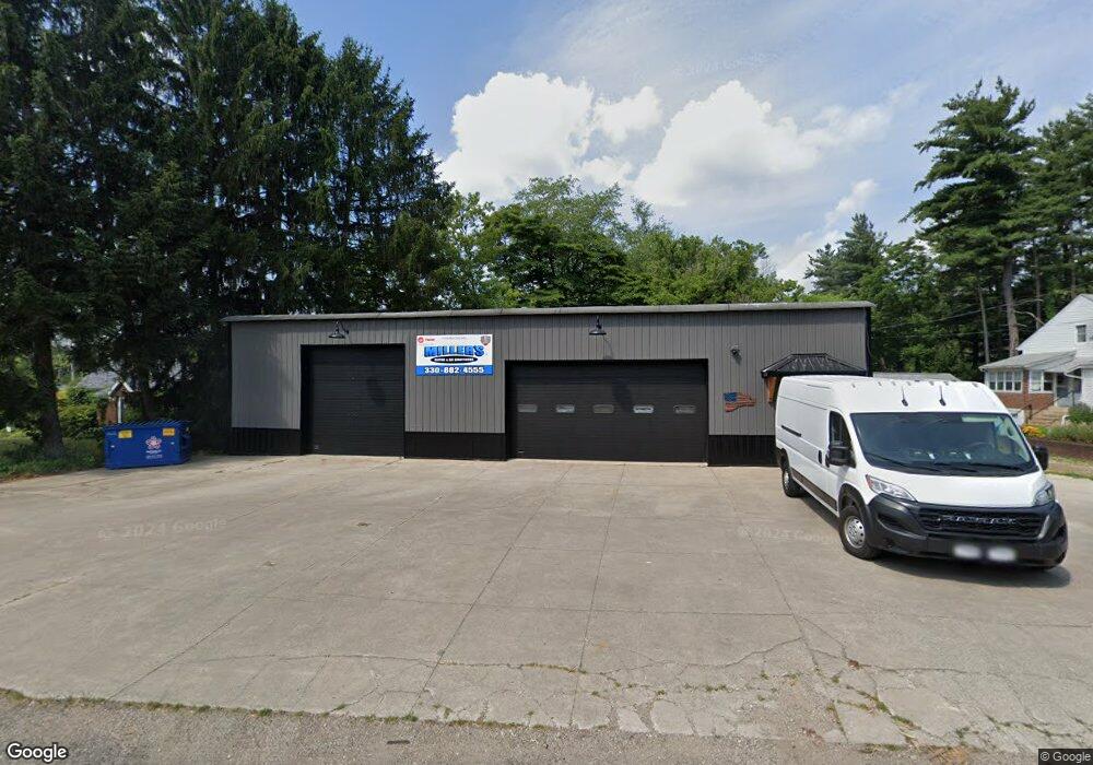
6612 Manchester Rd New Franklin, OH 44216
Estimated Value: $187,594
--
Bed
--
Bath
14,355
Sq Ft
$13/Sq Ft
Est. Value
About This Home
This home is located at 6612 Manchester Rd, New Franklin, OH 44216 and is currently estimated at $187,594, approximately $13 per square foot. 6612 Manchester Rd is a home located in Summit County with nearby schools including SS Philip and James Elementary and St. Francis de Sales School.
Ownership History
Date
Name
Owned For
Owner Type
Purchase Details
Closed on
Mar 27, 2024
Sold by
Balazowich Dale A
Bought by
Miller Earl W
Current Estimated Value
Home Financials for this Owner
Home Financials are based on the most recent Mortgage that was taken out on this home.
Original Mortgage
$125,000
Outstanding Balance
$117,465
Interest Rate
6.12%
Mortgage Type
Credit Line Revolving
Estimated Equity
$70,129
Purchase Details
Closed on
Sep 2, 2015
Sold by
Nemer William and Nemer Sandra
Bought by
Balazowich Dale A
Create a Home Valuation Report for This Property
The Home Valuation Report is an in-depth analysis detailing your home's value as well as a comparison with similar homes in the area
Home Values in the Area
Average Home Value in this Area
Purchase History
| Date | Buyer | Sale Price | Title Company |
|---|---|---|---|
| Miller Earl W | $175,000 | None Listed On Document | |
| Balazowich Dale A | $82,500 | First Security Title |
Source: Public Records
Mortgage History
| Date | Status | Borrower | Loan Amount |
|---|---|---|---|
| Open | Miller Earl W | $125,000 |
Source: Public Records
Tax History Compared to Growth
Tax History
| Year | Tax Paid | Tax Assessment Tax Assessment Total Assessment is a certain percentage of the fair market value that is determined by local assessors to be the total taxable value of land and additions on the property. | Land | Improvement |
|---|---|---|---|---|
| 2025 | $2,478 | $39,855 | $20,034 | $19,821 |
| 2024 | $2,478 | $39,855 | $20,034 | $19,821 |
| 2023 | $2,478 | $39,855 | $20,034 | $19,821 |
| 2022 | $2,159 | $27,741 | $13,818 | $13,923 |
| 2021 | $2,157 | $27,741 | $13,818 | $13,923 |
| 2020 | $2,125 | $27,740 | $13,820 | $13,920 |
| 2019 | $2,230 | $24,230 | $13,130 | $11,100 |
| 2018 | $1,989 | $24,230 | $13,130 | $11,100 |
| 2017 | $2,093 | $24,230 | $13,130 | $11,100 |
| 2016 | $2,064 | $25,490 | $13,820 | $11,670 |
| 2015 | $2,093 | $25,490 | $13,820 | $11,670 |
| 2014 | $2,078 | $25,490 | $13,820 | $11,670 |
| 2013 | $2,009 | $24,110 | $12,440 | $11,670 |
Source: Public Records
Map
Nearby Homes
- 899 Loway Dr
- 6407 Southview Dr
- 451 Yager Rd
- 0 W Comet Rd Unit 5079117
- 7060 Manchester Rd
- 6387 Hampsher Rd
- 6090 Manchester Rd Unit 6096
- 5776 Harter Home Dr
- 1062 Stump Rd
- 0 Babst Ave NW
- 8714 Greenmeadow Ave NW
- 781 Leeman Dr
- 11391 Michelle Dr NW
- 715 Highland Park Dr
- 427 Center Rd
- 5892 Woodward Dr
- 765 Longview Ave
- Ballenger w/ Basement Plan at Heritage Village
- Columbia w/ Basement Plan at Heritage Village
- Allegheny w/ Basement Plan at Heritage Village
- 6622 Manchester Rd
- 6604 Manchester Rd
- 6601 Manchester Rd
- 6570 Manchester Rd
- 6642 Manchester Rd
- 6595 Manchester Rd
- 6562 Manchester Rd
- 6558 Manchester Rd Unit 6562
- 6639 Manchester Rd
- 6569 Manchester Rd
- 6613 Manchester Rd
- 6559 Manchester Rd
- 6624 Manchester Rd
- 6657 Manchester Rd
- 6550 Manchester Rd
- 6670 Manchester Rd
- 6646 Manchester Rd
- 6665 Manchester Rd
- 6536 Manchester Rd
- 6542 Manchester Rd