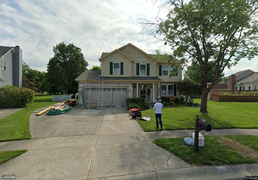
6614 Pheasant Ridge Rd Dayton, OH 45424
Pheasant Hill NeighborhoodEstimated Value: $297,522 - $341,000
4
Beds
3
Baths
2,016
Sq Ft
$162/Sq Ft
Est. Value
About This Home
This home is located at 6614 Pheasant Ridge Rd, Dayton, OH 45424 and is currently estimated at $327,131, approximately $162 per square foot. 6614 Pheasant Ridge Rd is a home located in Montgomery County with nearby schools including Wayne High School.
Ownership History
Date
Name
Owned For
Owner Type
Purchase Details
Closed on
Aug 22, 2003
Sold by
Maksym Paul M and Maksym Debra
Bought by
Wong Paul A and Wong Robin L
Current Estimated Value
Home Financials for this Owner
Home Financials are based on the most recent Mortgage that was taken out on this home.
Original Mortgage
$164,322
Outstanding Balance
$72,361
Interest Rate
5.62%
Mortgage Type
VA
Estimated Equity
$254,770
Purchase Details
Closed on
Oct 8, 1999
Sold by
Dewine Kevin R and Dewine Kelle C
Bought by
Maksym Paul M and Maksym Debra
Home Financials for this Owner
Home Financials are based on the most recent Mortgage that was taken out on this home.
Original Mortgage
$161,000
Interest Rate
7.87%
Purchase Details
Closed on
Apr 30, 1997
Sold by
Howley Brian P and Howley Diana L
Bought by
Dewine Kevin R and Dewine Kelle C
Create a Home Valuation Report for This Property
The Home Valuation Report is an in-depth analysis detailing your home's value as well as a comparison with similar homes in the area
Home Values in the Area
Average Home Value in this Area
Purchase History
| Date | Buyer | Sale Price | Title Company |
|---|---|---|---|
| Wong Paul A | $179,000 | -- | |
| Maksym Paul M | $169,500 | -- | |
| Dewine Kevin R | $155,000 | -- |
Source: Public Records
Mortgage History
| Date | Status | Borrower | Loan Amount |
|---|---|---|---|
| Open | Wong Paul A | $164,322 | |
| Closed | Maksym Paul M | $161,000 |
Source: Public Records
Tax History Compared to Growth
Tax History
| Year | Tax Paid | Tax Assessment Tax Assessment Total Assessment is a certain percentage of the fair market value that is determined by local assessors to be the total taxable value of land and additions on the property. | Land | Improvement |
|---|---|---|---|---|
| 2024 | $4,692 | $82,760 | $17,920 | $64,840 |
| 2023 | $4,692 | $82,760 | $17,920 | $64,840 |
| 2022 | $4,376 | $62,230 | $13,480 | $48,750 |
| 2021 | $4,388 | $62,230 | $13,480 | $48,750 |
| 2020 | $4,393 | $62,230 | $13,480 | $48,750 |
| 2019 | $4,255 | $52,970 | $12,860 | $40,110 |
| 2018 | $4,268 | $52,970 | $12,860 | $40,110 |
| 2017 | $4,241 | $52,970 | $12,860 | $40,110 |
| 2016 | $4,211 | $51,430 | $12,860 | $38,570 |
| 2015 | $4,160 | $51,430 | $12,860 | $38,570 |
| 2014 | $4,160 | $51,430 | $12,860 | $38,570 |
| 2012 | -- | $61,580 | $14,700 | $46,880 |
Source: Public Records
Map
Nearby Homes
- 6620 Pheasant Ridge Rd
- 6387 Ring Neck Dr
- 6322 Ring Neck Dr
- 5474 Bellefontaine Rd Unit 5468
- 6520 Marino
- 6463 Ring Neck Dr
- 6456 Pheasant Finch Dr
- 6732 Grovebelle Dr
- 6432 Gander Rd E
- 5333 Heather Way
- 6535 Semmes Ln
- 6303 Copper Pheasant Dr
- 5685 Cottonwood Ct
- 5732 Benedict Rd
- 6286 Pheasant Hill Rd
- Juniper with Finished Basement Plan at Heathermere Woods
- 4061 Hemlock Ct
- 4067 Hemlock Ct
- 5630 Botkins Rd
- 6669 Lexington Place N
- 6303 Pheasant Valley Rd
- 6313 Pheasant Valley Rd
- 6617 Pheasant Ridge Rd
- 6626 Pheasant Ridge Rd
- 6605 Pheasant Ridge Rd
- 6319 Pheasant Valley Rd
- 6632 Pheasant Ridge Rd
- 6525 Pheasant Ridge Rd
- 6329 Pheasant Valley Rd
- 5600 Powell Rd
- 5610 Powell Rd
- 5530 Powell Rd
- 6304 Pheasant Valley Rd
- 5620 Powell Rd
- 6314 Pheasant Valley Rd
- 6517 Pheasant Ridge Rd
- 6339 Pheasant Valley Rd
- 6322 Pheasant Valley Rd
- 5524 Powell Rd
- 5630 Powell Rd