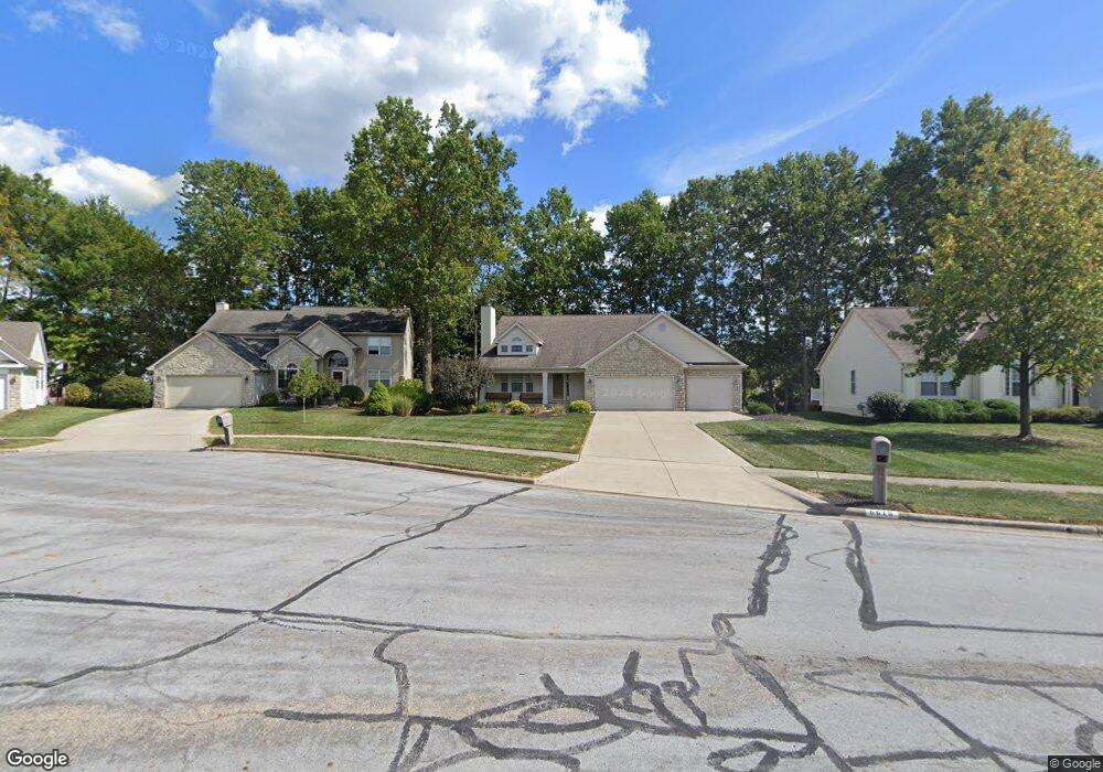
6615 Burbank Place Westerville, OH 43082
Genoa NeighborhoodEstimated Value: $500,000 - $520,000
4
Beds
4
Baths
2,160
Sq Ft
$236/Sq Ft
Est. Value
About This Home
This home is located at 6615 Burbank Place, Westerville, OH 43082 and is currently estimated at $508,906, approximately $235 per square foot. 6615 Burbank Place is a home located in Delaware County with nearby schools including Alcott Elementary School, Genoa Middle School, and Westerville Central High School.
Ownership History
Date
Name
Owned For
Owner Type
Purchase Details
Closed on
Mar 22, 2002
Sold by
Rockford Homes Inc
Bought by
Vincent Brian and Vincent Nancy R
Current Estimated Value
Home Financials for this Owner
Home Financials are based on the most recent Mortgage that was taken out on this home.
Original Mortgage
$125,450
Outstanding Balance
$51,998
Interest Rate
6.95%
Mortgage Type
New Conventional
Estimated Equity
$456,908
Create a Home Valuation Report for This Property
The Home Valuation Report is an in-depth analysis detailing your home's value as well as a comparison with similar homes in the area
Home Values in the Area
Average Home Value in this Area
Purchase History
| Date | Buyer | Sale Price | Title Company |
|---|---|---|---|
| Vincent Brian | $230,905 | -- |
Source: Public Records
Mortgage History
| Date | Status | Borrower | Loan Amount |
|---|---|---|---|
| Open | Vincent Brian | $125,450 |
Source: Public Records
Tax History Compared to Growth
Tax History
| Year | Tax Paid | Tax Assessment Tax Assessment Total Assessment is a certain percentage of the fair market value that is determined by local assessors to be the total taxable value of land and additions on the property. | Land | Improvement |
|---|---|---|---|---|
| 2024 | $8,107 | $155,760 | $33,080 | $122,680 |
| 2023 | $7,947 | $155,760 | $33,080 | $122,680 |
| 2022 | $7,279 | $109,730 | $22,050 | $87,680 |
| 2021 | $7,351 | $109,730 | $22,050 | $87,680 |
| 2020 | $7,395 | $109,730 | $22,050 | $87,680 |
| 2019 | $6,646 | $94,610 | $18,380 | $76,230 |
| 2018 | $6,445 | $94,610 | $18,380 | $76,230 |
| 2017 | $6,092 | $80,710 | $15,890 | $64,820 |
| 2016 | $5,917 | $80,710 | $15,890 | $64,820 |
| 2015 | $5,870 | $80,710 | $15,890 | $64,820 |
| 2014 | $5,799 | $80,710 | $15,890 | $64,820 |
| 2013 | $5,589 | $78,230 | $15,890 | $62,340 |
Source: Public Records
Map
Nearby Homes
- 6410 Steinbeck Way
- 0 Paul Rd Unit 225001038
- 7268 Clancy Way
- 6082 Hilmar Dr
- 6086 Hemingway Place
- 6685 Tussic Street Rd
- 6623 Henschen Cir
- 6394 Mission Hills Place
- 7581 Lanetta Ln
- 6460 Bromfield Dr
- 754 Kingsmead Rd Unit 18754
- 6050 Medallion Dr W
- 6311 Legends Ct
- 7663 Rolling Ridge Way
- 6618 Wild Rose Ln
- 7568 Park Bend Ct
- 6573 Kenwood Place
- 656 Olde Mill Dr
- 5552 Quail Hollow Way
- 5983 Congressional Dr
- 6627 Burbank Place
- 6632 Collingwood Dr
- 6624 Collingwood Dr
- 6637 Burbank Place
- 6614 Collingwood Dr
- 6642 Collingwood Dr
- 6597 Burbank Place
- 6604 Collingwood Dr
- 6650 Collingwood Dr
- 6594 Burbank Place
- 6649 Burbank Place
- 6628 Burbank Place
- 6594 Collingwood Dr
- 6658 Collingwood Dr
- 6638 Burbank Place
- 6608 Burbank Place
- 6584 Collingwood Dr
- 6631 Collingwood Dr
- 6631 Collingwood Dr Unit 4330
- 6621 Collingwood Dr