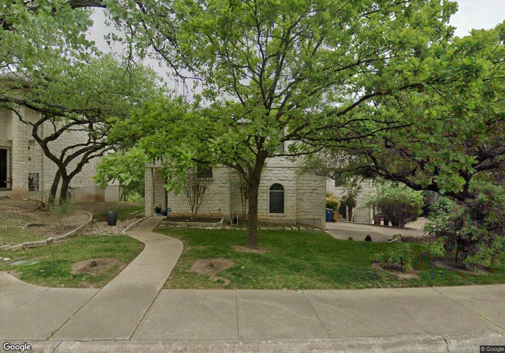
6615 Cat Creek Trail Unit 4 Austin, TX 78731
Cat Mountain NeighborhoodEstimated Value: $552,855 - $645,000
3
Beds
3
Baths
1,959
Sq Ft
$310/Sq Ft
Est. Value
About This Home
This home is located at 6615 Cat Creek Trail Unit 4, Austin, TX 78731 and is currently estimated at $606,714, approximately $309 per square foot. 6615 Cat Creek Trail Unit 4 is a home located in Travis County with nearby schools including Doss Elementary School, Murchison Middle School, and Anderson High School.
Ownership History
Date
Name
Owned For
Owner Type
Purchase Details
Closed on
Mar 17, 2006
Sold by
Woodruff Nicholas C and Woodruff Kari L
Bought by
Milburn Beryl L
Current Estimated Value
Purchase Details
Closed on
Dec 14, 1998
Sold by
Cummings John P and Cummings Kimberly
Bought by
Woodruff Nicholas C
Home Financials for this Owner
Home Financials are based on the most recent Mortgage that was taken out on this home.
Original Mortgage
$185,150
Interest Rate
6.74%
Create a Home Valuation Report for This Property
The Home Valuation Report is an in-depth analysis detailing your home's value as well as a comparison with similar homes in the area
Home Values in the Area
Average Home Value in this Area
Purchase History
| Date | Buyer | Sale Price | Title Company |
|---|---|---|---|
| Milburn Beryl L | -- | None Available | |
| Woodruff Nicholas C | -- | -- |
Source: Public Records
Mortgage History
| Date | Status | Borrower | Loan Amount |
|---|---|---|---|
| Previous Owner | Woodruff Nicholas C | $185,150 |
Source: Public Records
Tax History Compared to Growth
Tax History
| Year | Tax Paid | Tax Assessment Tax Assessment Total Assessment is a certain percentage of the fair market value that is determined by local assessors to be the total taxable value of land and additions on the property. | Land | Improvement |
|---|---|---|---|---|
| 2025 | $3,710 | $474,175 | $67,418 | $406,757 |
| 2023 | $3,385 | $466,455 | $0 | $0 |
| 2022 | $8,375 | $424,050 | $0 | $0 |
| 2021 | $9,395 | $431,640 | $0 | $0 |
| 2020 | $8,416 | $392,400 | $8,746 | $383,654 |
| 2018 | $8,828 | $398,725 | $67,681 | $331,044 |
| 2017 | $9,123 | $409,077 | $67,681 | $341,396 |
| 2016 | $8,483 | $380,384 | $90,000 | $317,012 |
| 2015 | $5,408 | $345,804 | $90,000 | $297,698 |
| 2014 | $5,408 | $314,367 | $0 | $0 |
Source: Public Records
Map
Nearby Homes
- 6602 Cat Creek Trail
- 6706 Fort Davis Cove
- 6706 Fort Davis Cove Unit A
- 6706 Fort Davis Cove Unit B
- 4906 Bob Cat Run
- 6905 Ladera Norte
- 4324 Far Blvd W
- 7108 Las Ventanas Dr
- 7111 Valburn Dr
- 4207 Canyonside Trail
- 6302 Gato Path
- 6321 Lakewood Dr
- 5300 N Scout Island Cir
- 5901 Inter Council Cove
- 6601 N Capital of Texas Hwy
- 4107 N Hills Dr
- 4113 Circletree Loop
- 4217 Greystone Dr
- 7504 Valley Dale Dr
- 6507 Mesa Dr
- 6613 Cat Creek Trail Unit 3
- 6611 Cat Creek Trail Unit 2
- 6701 Cat Creek Trail Unit 5
- 6703 Cat Creek Trail Unit 6
- 6609 Cat Creek Trail Unit 1
- 6605 Cat Creek Trail Unit 1
- 6608 Cat Creek Trail
- 6608 Cat Creek Trail Unit A
- 6610 Cat Creek Trail
- 6604 Cat Creek Trail
- 6612 Cat Creek Trail
- 6606 Cat Creek Trail
- 6606 Cat Creek Trail Unit B
- 6614 Cat Creek Trail
- 6607 Cat Creek Trail Unit 2
- 6702 Cat Creek Trail
- 6805 Cougar Run
- 6700 Cat Creek Trail Unit 2
- 6700 Cat Creek Trail Unit 1
- 6601 Cat Creek Trail