Estimated Value: $306,994 - $315,000
3
Beds
1
Bath
1,028
Sq Ft
$304/Sq Ft
Est. Value
About This Home
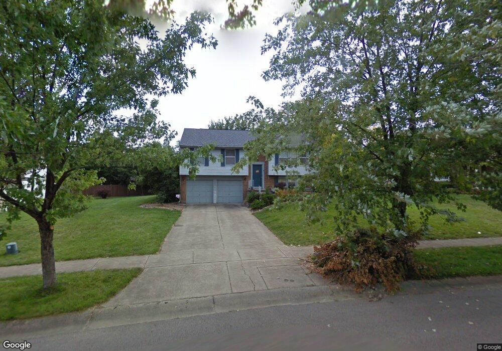
This home is located at 6615 Fernshire Ct, Mason, OH 45040 and is currently estimated at $311,999, approximately $303 per square foot. 6615 Fernshire Ct is a home located in Warren County with nearby schools including Mason Intermediate Elementary School, Mason Middle School, and William Mason High School.
Ownership History
Date
Name
Owned For
Owner Type
Purchase Details
Closed on
Jun 11, 1998
Sold by
Cox Jeri L
Bought by
Tocash Michael J and Tocash Christina R
Current Estimated Value
Home Financials for this Owner
Home Financials are based on the most recent Mortgage that was taken out on this home.
Original Mortgage
$115,593
Outstanding Balance
$23,528
Interest Rate
7.25%
Mortgage Type
VA
Estimated Equity
$288,471
Purchase Details
Closed on
Jan 30, 1984
Sold by
Ryland Group & Inc
Bought by
Cox and Cox James E
Purchase Details
Closed on
Jan 18, 1984
Sold by
P Development Company
Bought by
Ryland Group & Inc.
Purchase Details
Closed on
Jul 20, 1983
Sold by
P Development Company
Bought by
P Development Company
Create a Home Valuation Report for This Property
The Home Valuation Report is an in-depth analysis detailing your home's value as well as a comparison with similar homes in the area
Home Values in the Area
Average Home Value in this Area
Purchase History
| Date | Buyer | Sale Price | Title Company |
|---|---|---|---|
| Tocash Michael J | $115,593 | -- | |
| Cox | $68,000 | -- | |
| Ryland Group & Inc. | $27,600 | -- | |
| P Development Company | -- | -- |
Source: Public Records
Mortgage History
| Date | Status | Borrower | Loan Amount |
|---|---|---|---|
| Open | Tocash Michael J | $115,593 |
Source: Public Records
Tax History Compared to Growth
Tax History
| Year | Tax Paid | Tax Assessment Tax Assessment Total Assessment is a certain percentage of the fair market value that is determined by local assessors to be the total taxable value of land and additions on the property. | Land | Improvement |
|---|---|---|---|---|
| 2024 | $3,088 | $76,090 | $24,500 | $51,590 |
| 2023 | $2,714 | $56,504 | $10,762 | $45,741 |
| 2022 | $2,679 | $56,504 | $10,763 | $45,742 |
| 2021 | $2,538 | $56,504 | $10,763 | $45,742 |
| 2020 | $2,407 | $45,938 | $8,750 | $37,188 |
| 2019 | $2,213 | $45,938 | $8,750 | $37,188 |
| 2018 | $2,220 | $45,938 | $8,750 | $37,188 |
| 2017 | $2,049 | $39,592 | $8,274 | $31,318 |
| 2016 | $2,111 | $39,592 | $8,274 | $31,318 |
| 2015 | $2,115 | $39,592 | $8,274 | $31,318 |
| 2014 | $2,120 | $37,000 | $7,730 | $29,270 |
| 2013 | $2,125 | $41,880 | $8,750 | $33,130 |
Source: Public Records
Map
Nearby Homes
- 6070 Fireside Dr Unit 45
- 6138 Nicholas Way
- 6387 Coverage Ct
- 6369 Coverage Ct
- 6403 Coverage Ct
- 6357 Coverage Ct
- 6383 Coverage Ct
- 6407 Coverage Ct
- 6375 Coverage Ct
- 6365 Coverage Ct
- 6361 Coverage Ct
- 6379 Coverage Ct
- 6411 Coverage Ct
- 6126 Nicholas Way
- 6146 Nicholas Way
- 6150 Nicholas Way
- 6358 Coverage Ct
- 6362 Coverage Ct
- 6134 Nicholas Way
- 6142 Nicholas Way
- 6627 Fernshire Ct
- 6603 Fernshire Ct
- 1336 Firethorn Dr
- 1338 Firethorn Dr
- 6643 Fernshire Ct
- 1334 Firethorne Dr
- 1334 Firethorn Dr
- 1340 Firethorn Dr
- 6614 Fernshire Ct
- 6585 Fernshire Ct
- 6630 Fernshire Ct
- 6655 Fernshire Ct
- 6588 Fernshire Ct
- 1342 Firethorn Dr
- 6173 Fireside Dr
- 6644 Fernshire Ct
- 1344 Firethorn Dr
- 6673 Fernshire Ct
- 1263 Kay Dr
- 1333 Firethorn Dr