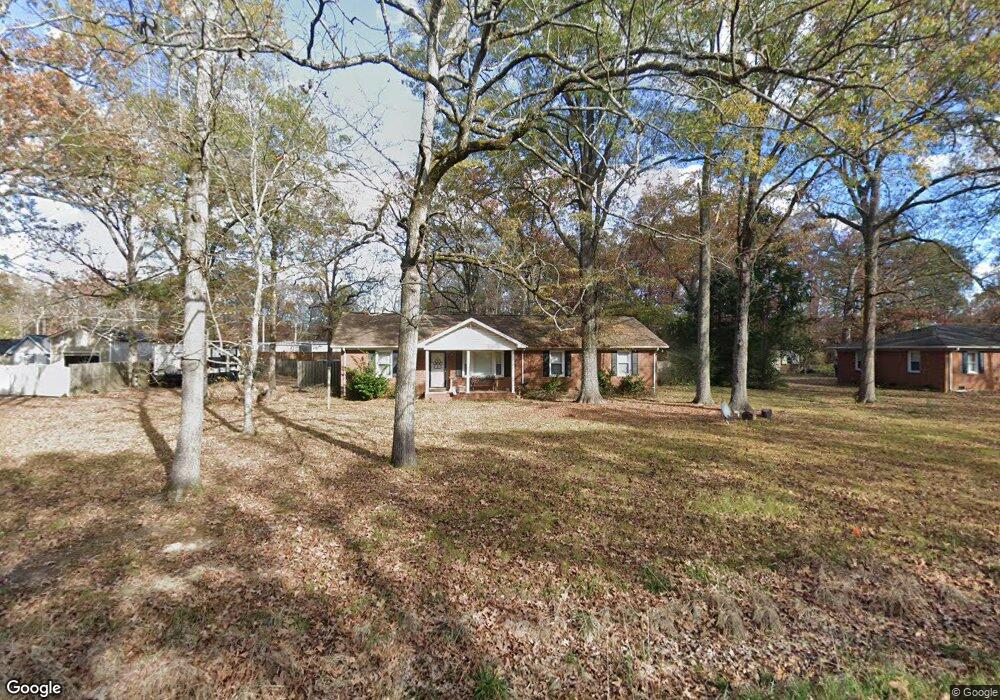
6618 3rd Ave Indian Trail, NC 28079
Estimated Value: $261,000 - $295,049
3
Beds
2
Baths
1,260
Sq Ft
$219/Sq Ft
Est. Value
About This Home
This home is located at 6618 3rd Ave, Indian Trail, NC 28079 and is currently estimated at $276,262, approximately $219 per square foot. 6618 3rd Ave is a home located in Union County with nearby schools including Stallings Elementary School, Porter Ridge Middle School, and Porter Ridge High School.
Ownership History
Date
Name
Owned For
Owner Type
Purchase Details
Closed on
May 22, 2007
Sold by
Fullwood Charles Edward
Bought by
Thomas Jeffrey Scot
Current Estimated Value
Home Financials for this Owner
Home Financials are based on the most recent Mortgage that was taken out on this home.
Original Mortgage
$96,800
Outstanding Balance
$58,302
Interest Rate
6.17%
Mortgage Type
Unknown
Estimated Equity
$217,960
Create a Home Valuation Report for This Property
The Home Valuation Report is an in-depth analysis detailing your home's value as well as a comparison with similar homes in the area
Purchase History
| Date | Buyer | Sale Price | Title Company |
|---|---|---|---|
| Thomas Jeffrey Scot | $121,000 | None Available |
Source: Public Records
Mortgage History
| Date | Status | Borrower | Loan Amount |
|---|---|---|---|
| Open | Thomas Jeffrey Scot | $96,800 |
Source: Public Records
Tax History
| Year | Tax Paid | Tax Assessment Tax Assessment Total Assessment is a certain percentage of the fair market value that is determined by local assessors to be the total taxable value of land and additions on the property. | Land | Improvement |
|---|---|---|---|---|
| 2025 | $2,037 | $305,100 | $0 | $0 |
| 2024 | $1,528 | $179,000 | $31,600 | $147,400 |
| 2023 | $1,459 | $172,100 | $31,600 | $140,500 |
| 2022 | $1,459 | $172,100 | $31,600 | $140,500 |
| 2021 | $1,459 | $172,100 | $31,600 | $140,500 |
| 2020 | $812 | $104,200 | $24,100 | $80,100 |
| 2019 | $1,058 | $104,200 | $24,100 | $80,100 |
| 2018 | $812 | $104,200 | $24,100 | $80,100 |
| 2017 | $1,112 | $104,200 | $24,100 | $80,100 |
| 2016 | $849 | $104,200 | $24,100 | $80,100 |
| 2015 | $862 | $104,200 | $24,100 | $80,100 |
| 2014 | $765 | $107,120 | $34,640 | $72,480 |
Source: Public Records
Map
Nearby Homes
- 6715 3rd Ave
- 3903 Etheredge St
- 6600 Conifer Cir
- 0 Rose Dr Unit CAR4322172
- 0 Rose Dr Unit CAR4322165
- 1010 Mapletree Ln
- 1069 Mapletree Ln
- 1092 Mapletree Ln
- 1073 Mapletree Ln
- 1085 Mapletree Ln
- 1077 Mapletree Ln
- 6706 Woodlawn Ln
- 7215 Conifer Cir
- lot 4, 5 Brown Ln
- 2510 Younts Rd
- 3508 Mayhurst Dr
- 3805 Balsam St Unit 322
- 3805 Balsam St Unit 223
- 3805 Balsam St Unit 321
- 2023 Harlequin Dr
- 6614 3rd Ave
- 6704 3rd Ave
- 6615 3rd Ave
- 6701 3rd Ave
- 6611 3rd Ave
- 6608 3rd Ave
- 6708 3rd Ave
- 5304 Carol Ave
- 3915 Etheredge St
- 3913 Etheredge St
- 3917 Etheredge St
- 6609 3rd Ave
- 6705 3rd Ave
- 6618 2nd Ave
- 6620 2nd Ave
- 3919 Etheredge St
- 3911 Etheredge St
- 3911 Etheredge St
- 3911 Etheredge St Unit 117
- 6704 2nd Ave
Your Personal Tour Guide
Ask me questions while you tour the home.