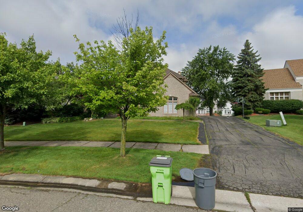
6618 Kings Ct West Bloomfield, MI 48322
Estimated Value: $684,121 - $831,000
4
Beds
3
Baths
3,307
Sq Ft
$224/Sq Ft
Est. Value
About This Home
This home is located at 6618 Kings Ct, West Bloomfield, MI 48322 and is currently estimated at $741,780, approximately $224 per square foot. 6618 Kings Ct is a home located in Oakland County with nearby schools including Meadowbrook Elementary School, James R Geisler Middle School, and Walled Lake Western High School.
Ownership History
Date
Name
Owned For
Owner Type
Purchase Details
Closed on
Nov 13, 2007
Sold by
Mcdonald Charron and Mcdonald Philip
Bought by
Wells Fargo Bank Na and Asset Backed Pass Through Certificates S
Current Estimated Value
Purchase Details
Closed on
Jun 24, 2005
Sold by
Bennett Mark E and Bennett Lauren B
Bought by
Mcdonald Charron
Home Financials for this Owner
Home Financials are based on the most recent Mortgage that was taken out on this home.
Original Mortgage
$490,500
Interest Rate
8.85%
Mortgage Type
Fannie Mae Freddie Mac
Purchase Details
Closed on
May 19, 1994
Sold by
Southwyck Assoc Inc
Bought by
Benivegna Building Co Inc
Create a Home Valuation Report for This Property
The Home Valuation Report is an in-depth analysis detailing your home's value as well as a comparison with similar homes in the area
Home Values in the Area
Average Home Value in this Area
Purchase History
| Date | Buyer | Sale Price | Title Company |
|---|---|---|---|
| Wells Fargo Bank Na | $531,711 | None Available | |
| Mcdonald Charron | $545,000 | Capital Title Ins Agency | |
| Benivegna Building Co Inc | $91,083 | -- |
Source: Public Records
Mortgage History
| Date | Status | Borrower | Loan Amount |
|---|---|---|---|
| Previous Owner | Mcdonald Charron | $490,500 |
Source: Public Records
Tax History Compared to Growth
Tax History
| Year | Tax Paid | Tax Assessment Tax Assessment Total Assessment is a certain percentage of the fair market value that is determined by local assessors to be the total taxable value of land and additions on the property. | Land | Improvement |
|---|---|---|---|---|
| 2024 | $4,301 | $287,270 | $0 | $0 |
| 2022 | $4,055 | $247,400 | $24,300 | $223,100 |
| 2021 | $6,887 | $239,830 | $0 | $0 |
| 2020 | $4,007 | $234,260 | $24,300 | $209,960 |
| 2018 | $6,524 | $228,950 | $24,250 | $204,700 |
| 2015 | -- | $207,590 | $0 | $0 |
| 2014 | -- | $192,450 | $0 | $0 |
| 2011 | -- | $163,670 | $0 | $0 |
Source: Public Records
Map
Nearby Homes
- 6986 Crosswell Dr
- 6642 Carlyle Ct
- 6517 Chelsea Bridge
- 6775 Carlyle Crossing
- 6291 Pheasant Run
- 7453 Pepper Creek
- 7296 Green Farm Rd Unit 133
- 6608 Minnow Pond Dr
- 7276 Somerby
- 7288 Danbrooke Unit 125
- 7156 Sturnbridge Unit 90
- 7156 Sturnbridge
- 6601 Pembridge Hill
- 7990 Little Farm Ln
- 6621 Glenshaw Ct
- 7863 Woodingham
- 7147 Elmhurst Unit 23
- 7647 Larchwood Dr
- Whittaker Plan at Reserve at West Bloomfield
- Drummond Plan at Reserve at West Bloomfield
- 6596 Kings Ct
- 6640 Kings Ct
- 6571 Apple Blossom Trail
- 6549 Apple Blossom Trail
- 6593 Apple Blossom Trail
- 6605 Kings Ct
- 6574 Kings Ct
- 6527 Apple Blossom Trail
- 6583 Kings Ct
- 6552 Kings Ct
- 6505 Apple Blossom Trail
- 7065 Queen Anne Dr
- 7043 Queen Anne Dr
- 6576 Apple Blossom Trail
- 7021 Queen Anne Dr
- 6532 Apple Blossom Trail
- 7097 Queen Anne Dr
- 6598 Apple Blossom Trail
- VL Apple Blossom
- 0 Appleblossom Unit 212072948