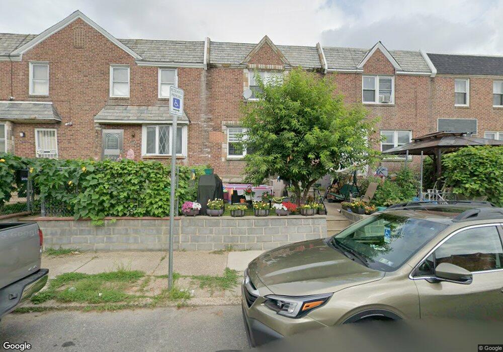
6618 Oakland St Philadelphia, PA 19149
Castor Gardens NeighborhoodEstimated Value: $216,000 - $225,000
3
Beds
1
Bath
1,242
Sq Ft
$178/Sq Ft
Est. Value
About This Home
This home is located at 6618 Oakland St, Philadelphia, PA 19149 and is currently estimated at $220,752, approximately $177 per square foot. 6618 Oakland St is a home located in Philadelphia County with nearby schools including Gilbert Spruance School, Northeast High School, and Gospel of Grace Christian School.
Ownership History
Date
Name
Owned For
Owner Type
Purchase Details
Closed on
Feb 26, 2018
Sold by
Vendeemortgage Trust 1998 3
Bought by
Grascla Arleta
Current Estimated Value
Purchase Details
Closed on
Feb 6, 2018
Sold by
Secretary Of Vetarans Affairs
Bought by
Vendee Mortgage Trust 1998 3 and Deutsche Bank National Trust Company
Purchase Details
Closed on
Jan 26, 1998
Sold by
Gmac Mtg Corp
Bought by
Va
Purchase Details
Closed on
Jan 20, 1995
Sold by
Rosenblatt Martha
Bought by
Mcdonnell Thomas J and Mcdonnell Alice P
Create a Home Valuation Report for This Property
The Home Valuation Report is an in-depth analysis detailing your home's value as well as a comparison with similar homes in the area
Home Values in the Area
Average Home Value in this Area
Purchase History
| Date | Buyer | Sale Price | Title Company |
|---|---|---|---|
| Grascla Arleta | -- | Assurance Abstract Corp | |
| Vendee Mortgage Trust 1998 3 | -- | Assurance Abstract Corp | |
| Va | $6,300 | -- | |
| Mcdonnell Thomas J | $63,000 | -- |
Source: Public Records
Tax History Compared to Growth
Tax History
| Year | Tax Paid | Tax Assessment Tax Assessment Total Assessment is a certain percentage of the fair market value that is determined by local assessors to be the total taxable value of land and additions on the property. | Land | Improvement |
|---|---|---|---|---|
| 2025 | $2,487 | $218,000 | $43,600 | $174,400 |
| 2024 | $2,487 | $218,000 | $43,600 | $174,400 |
| 2023 | $2,487 | $177,700 | $35,540 | $142,160 |
| 2022 | $1,870 | $177,700 | $35,540 | $142,160 |
| 2021 | $1,870 | $0 | $0 | $0 |
| 2020 | $1,870 | $0 | $0 | $0 |
| 2019 | $1,795 | $0 | $0 | $0 |
| 2018 | $1,669 | $0 | $0 | $0 |
| 2017 | $1,669 | $0 | $0 | $0 |
| 2016 | $1,669 | $0 | $0 | $0 |
| 2015 | $1,597 | $0 | $0 | $0 |
| 2014 | -- | $119,200 | $17,583 | $101,617 |
| 2012 | -- | $15,648 | $1,732 | $13,916 |
Source: Public Records
Map
Nearby Homes
- 6621 Sylvester St
- 6627 Oakland St
- 6640 Souder St
- 6725 Eastwood St
- 1535 Hellerman St
- 6826 Sylvester St
- 1500 Hellerman St
- 6626 Lynford St
- 6739 Lynford St
- 6829 Horrocks St
- 2119 Glenview St
- 6834 Large St
- 6827 Lynford St
- 2110 Longshore Ave
- 2169 Knorr St
- 1437 Magee Ave
- 6300 Eastwood St
- 1431 Greeby St
- 1425 Fanshawe St
- 1417 Unruh Ave
- 6616 Oakland St
- 6620 Oakland St
- 6622 Oakland St
- 6614 Oakland St
- 6612 Oakland St
- 6624 Oakland St
- 6610 Oakland St
- 6626 Oakland St
- 6619 Sylvester St
- 6617 Sylvester St
- 6623 Sylvester St
- 6608 Oakland St
- 6628 Oakland St
- 6613 Sylvester St
- 6625 Sylvester St
- 6606 Oakland St
- 6630 Oakland St
- 6611 Sylvester St
- 6625 Oakland St
- 6619 Oakland St