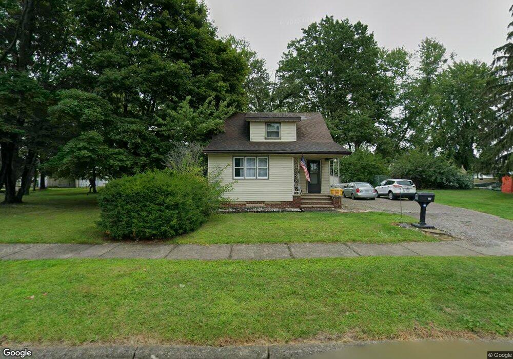
662 Buffalo St Conneaut, OH 44030
Estimated Value: $73,000 - $136,000
3
Beds
2
Baths
1,376
Sq Ft
$76/Sq Ft
Est. Value
About This Home
This home is located at 662 Buffalo St, Conneaut, OH 44030 and is currently estimated at $104,656, approximately $76 per square foot. 662 Buffalo St is a home located in Ashtabula County with nearby schools including Lakeshore Primary Elementary School, Gateway Elementary School, and Conneaut Middle School.
Ownership History
Date
Name
Owned For
Owner Type
Purchase Details
Closed on
Mar 8, 2022
Sold by
Halstead Daniel
Bought by
Halstead Daniel
Current Estimated Value
Purchase Details
Closed on
Dec 13, 2006
Sold by
Nelson Janice E and Ingram Janice E
Bought by
Halstead Daniel and Halstead Kristina J
Purchase Details
Closed on
Dec 1, 2004
Sold by
Ingram David R
Bought by
Ingram Janice E
Create a Home Valuation Report for This Property
The Home Valuation Report is an in-depth analysis detailing your home's value as well as a comparison with similar homes in the area
Home Values in the Area
Average Home Value in this Area
Purchase History
| Date | Buyer | Sale Price | Title Company |
|---|---|---|---|
| Halstead Daniel | $250 | -- | |
| Halstead Daniel | $50,500 | Attorney | |
| Ingram Janice E | -- | -- |
Source: Public Records
Tax History
| Year | Tax Paid | Tax Assessment Tax Assessment Total Assessment is a certain percentage of the fair market value that is determined by local assessors to be the total taxable value of land and additions on the property. | Land | Improvement |
|---|---|---|---|---|
| 2024 | $1,770 | $24,190 | $3,960 | $20,230 |
| 2023 | $1,128 | $24,190 | $3,960 | $20,230 |
| 2022 | $985 | $18,590 | $3,050 | $15,540 |
| 2021 | $1,002 | $18,590 | $3,050 | $15,540 |
| 2020 | $1,002 | $18,590 | $3,050 | $15,540 |
| 2019 | $873 | $15,890 | $1,680 | $14,210 |
| 2018 | $833 | $15,890 | $1,680 | $14,210 |
| 2017 | $831 | $15,890 | $1,680 | $14,210 |
| 2016 | $886 | $18,520 | $1,960 | $16,560 |
| 2015 | $895 | $18,520 | $1,960 | $16,560 |
| 2014 | $789 | $18,520 | $1,960 | $16,560 |
| 2013 | $719 | $17,370 | $2,980 | $14,390 |
Source: Public Records
Map
Nearby Homes
Your Personal Tour Guide
Ask me questions while you tour the home.