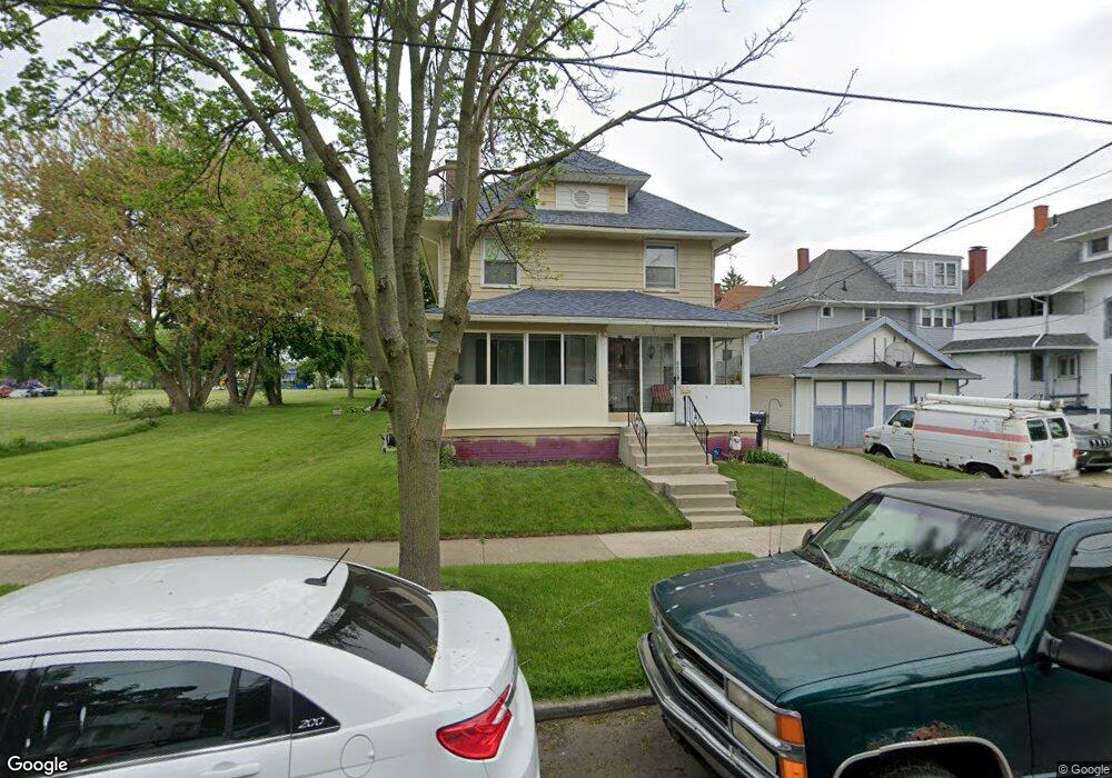
662 Collins St Toledo, OH 43610
Downtown Toledo NeighborhoodEstimated Value: $108,000 - $140,838
4
Beds
1
Bath
1,991
Sq Ft
$62/Sq Ft
Est. Value
About This Home
This home is located at 662 Collins St, Toledo, OH 43610 and is currently estimated at $123,710, approximately $62 per square foot. 662 Collins St is a home located in Lucas County with nearby schools including Glenwood Elementary School, Jesup W. Scott High School, and Rosary Cathedral School.
Ownership History
Date
Name
Owned For
Owner Type
Purchase Details
Closed on
May 8, 2006
Sold by
Singer Richard H and Singer Ella R
Bought by
Singer Anthony Lyndon
Current Estimated Value
Home Financials for this Owner
Home Financials are based on the most recent Mortgage that was taken out on this home.
Original Mortgage
$77,000
Outstanding Balance
$51,202
Interest Rate
9.15%
Mortgage Type
Fannie Mae Freddie Mac
Estimated Equity
$72,508
Create a Home Valuation Report for This Property
The Home Valuation Report is an in-depth analysis detailing your home's value as well as a comparison with similar homes in the area
Home Values in the Area
Average Home Value in this Area
Purchase History
| Date | Buyer | Sale Price | Title Company |
|---|---|---|---|
| Singer Anthony Lyndon | -- | Chicago Title Insurance Comp |
Source: Public Records
Mortgage History
| Date | Status | Borrower | Loan Amount |
|---|---|---|---|
| Open | Singer Anthony Lyndon | $77,000 |
Source: Public Records
Tax History Compared to Growth
Tax History
| Year | Tax Paid | Tax Assessment Tax Assessment Total Assessment is a certain percentage of the fair market value that is determined by local assessors to be the total taxable value of land and additions on the property. | Land | Improvement |
|---|---|---|---|---|
| 2024 | $5,848 | $40,215 | $5,740 | $34,475 |
| 2023 | $1,976 | $30,275 | $5,110 | $25,165 |
| 2022 | $1,974 | $30,275 | $5,110 | $25,165 |
| 2021 | $2,021 | $30,275 | $5,110 | $25,165 |
| 2020 | $1,890 | $24,850 | $4,200 | $20,650 |
| 2019 | $1,844 | $24,850 | $4,200 | $20,650 |
| 2018 | $1,844 | $24,850 | $4,200 | $20,650 |
| 2017 | $1,920 | $24,710 | $4,480 | $20,230 |
| 2016 | $1,920 | $70,600 | $12,800 | $57,800 |
| 2015 | $1,902 | $70,600 | $12,800 | $57,800 |
| 2014 | $1,554 | $24,710 | $4,480 | $20,230 |
| 2013 | $1,554 | $24,710 | $4,480 | $20,230 |
Source: Public Records
Map
Nearby Homes
- 2740 Robinwood Ave
- 2840 Scottwood Ave
- 3024 N Detroit Ave
- 811 Collins St
- 3107 Scottwood Ave
- 2631 Parkwood Ave
- 2535 Parkwood Ave
- 2542 Maplewood Ave
- 2618 Collingwood Blvd
- 922 Islington St
- 433 Islington St
- 928 Islington St
- 3248 N Detroit Ave
- 3214 Maplewood Ave
- 3244 Glenwood Ave
- 952 Post St
- 630 Highland Ave
- 2720 Albion St
- 2434 Lawrence Ave
- 3329 Glenwood Ave
- 2833 Scottwood Ave
- 2839 Scottwood Ave
- 2829 Scottwood Ave
- 2845 Scottwood Ave
- 2847 Scottwood Ave
- 2853 Scottwood Ave
- 2743 Scottwood Ave
- 2857 Scottwood Ave
- 661 Collins St
- 665 Collins St
- 2735 Scottwood Ave
- 2859 Scottwood Ave
- 2736 Robinwood Ave
- 2731 Scottwood Ave
- 2836 Scottwood Ave
- 2844 Scottwood Ave
- 2832 Scottwood Ave
- 2846 Scottwood Ave
- 2732 Robinwood Ave
- 2903 Scottwood Ave