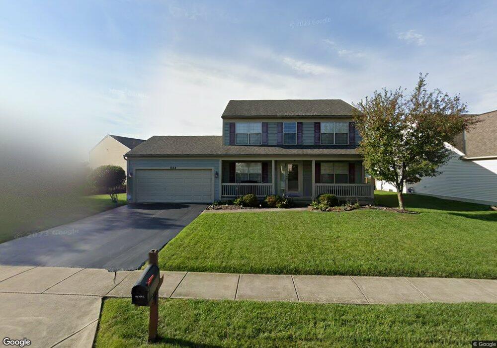
662 Keltonhurst Dr Pataskala, OH 43062
Estimated Value: $378,149 - $395,000
4
Beds
3
Baths
2,055
Sq Ft
$187/Sq Ft
Est. Value
About This Home
This home is located at 662 Keltonhurst Dr, Pataskala, OH 43062 and is currently estimated at $385,037, approximately $187 per square foot. 662 Keltonhurst Dr is a home located in Licking County with nearby schools including North Elementary School, Licking Heights Central, and Licking Heights High School.
Ownership History
Date
Name
Owned For
Owner Type
Purchase Details
Closed on
Jul 28, 2006
Sold by
Va
Bought by
Savage Keith E and Savage Jenny L
Current Estimated Value
Home Financials for this Owner
Home Financials are based on the most recent Mortgage that was taken out on this home.
Original Mortgage
$138,500
Outstanding Balance
$83,244
Interest Rate
6.78%
Mortgage Type
Unknown
Estimated Equity
$301,793
Purchase Details
Closed on
Feb 8, 2006
Sold by
Baker Eric J
Bought by
Va
Purchase Details
Closed on
May 8, 2003
Sold by
Diyanni Brothers Inc
Bought by
Baker Eric J
Home Financials for this Owner
Home Financials are based on the most recent Mortgage that was taken out on this home.
Original Mortgage
$190,513
Interest Rate
5.95%
Mortgage Type
VA
Create a Home Valuation Report for This Property
The Home Valuation Report is an in-depth analysis detailing your home's value as well as a comparison with similar homes in the area
Home Values in the Area
Average Home Value in this Area
Purchase History
| Date | Buyer | Sale Price | Title Company |
|---|---|---|---|
| Savage Keith E | $173,500 | Chicago | |
| Va | -- | Preferre | |
| Baker Eric J | $185,500 | Valmer Land Title Agency |
Source: Public Records
Mortgage History
| Date | Status | Borrower | Loan Amount |
|---|---|---|---|
| Open | Savage Keith E | $138,500 | |
| Previous Owner | Baker Eric J | $190,513 |
Source: Public Records
Tax History Compared to Growth
Tax History
| Year | Tax Paid | Tax Assessment Tax Assessment Total Assessment is a certain percentage of the fair market value that is determined by local assessors to be the total taxable value of land and additions on the property. | Land | Improvement |
|---|---|---|---|---|
| 2024 | $5,573 | $108,750 | $27,720 | $81,030 |
| 2023 | $5,781 | $108,750 | $27,720 | $81,030 |
| 2022 | $4,777 | $77,530 | $19,390 | $58,140 |
| 2021 | $4,869 | $77,530 | $19,390 | $58,140 |
| 2020 | $4,813 | $77,530 | $19,390 | $58,140 |
| 2019 | $4,309 | $64,400 | $13,860 | $50,540 |
| 2018 | $4,353 | $0 | $0 | $0 |
| 2017 | $4,454 | $0 | $0 | $0 |
| 2016 | $4,018 | $0 | $0 | $0 |
| 2015 | $3,831 | $0 | $0 | $0 |
| 2014 | $5,025 | $0 | $0 | $0 |
| 2013 | $4,044 | $0 | $0 | $0 |
Source: Public Records
Map
Nearby Homes
- 705 Woodington Dr
- 5284 Taylor Rd SW
- 213 Kemperwood Dr
- 409 Lockmead Dr
- 101 Barry Knoll Dr
- 8810 Greylag Loop
- 181 Brooksedge Dr
- 1218 Cicada St
- 181 Barry Knoll Dr
- 8022 Narrow Leaf Dr
- 8641 Greylag St
- 823 Bent Oak Dr
- 7989 Aspen Ridge Dr
- 605 Faith Ann Dr
- 6051 Taylor Rd SW
- 1208 Tannic St
- 775 Bent Oak Dr
- 7958 Waggoner Run Dr
- 7913 Birch Creek Dr
- 315 Cottage Grove Cir
- 658 Keltonhurst Dr
- 493 Lockmead Dr
- 495 Lockmead Dr
- 489 Lockmead Dr
- 654 Keltonhurst Dr
- 663 Keltonhurst Dr
- 659 Keltonhurst Dr
- 667 Keltonhurst Dr
- 655 Keltonhurst Dr
- 485 Lockmead Dr
- 935 Keltonhurst Ct
- 650 Keltonhurst Dr
- 671 Keltonhurst Dr
- 939 Keltonhurst Ct
- 481 Lockmead Dr
- 675 Keltonhurst Dr
- 931 Keltonhurst Ct
- 494 Lockmead Dr
- 944 Keltonhurst Ct
- 490 Lockmead Dr