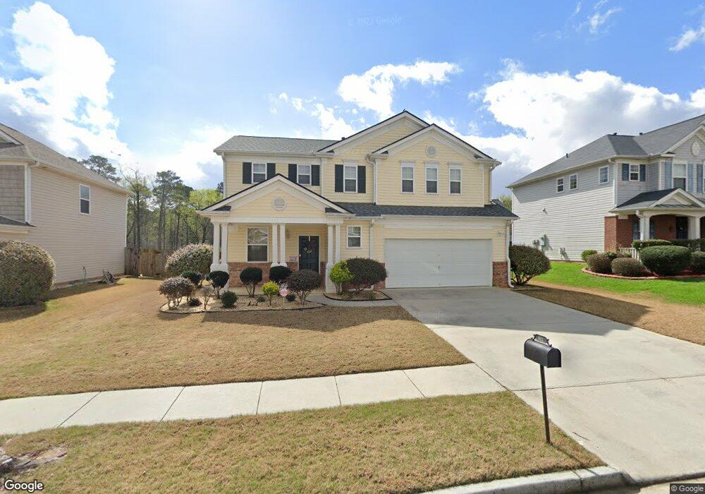
662 Leaflet Ives Trail Lawrenceville, GA 30045
Estimated Value: $362,000 - $394,000
3
Beds
3
Baths
2,250
Sq Ft
$166/Sq Ft
Est. Value
About This Home
This home is located at 662 Leaflet Ives Trail, Lawrenceville, GA 30045 and is currently estimated at $374,358, approximately $166 per square foot. 662 Leaflet Ives Trail is a home located in Gwinnett County with nearby schools including W.J. Cooper Elementary School, McConnell Middle School, and Archer High School.
Ownership History
Date
Name
Owned For
Owner Type
Purchase Details
Closed on
Feb 21, 2008
Sold by
Cartus Financial Corp
Bought by
Min Se S
Current Estimated Value
Home Financials for this Owner
Home Financials are based on the most recent Mortgage that was taken out on this home.
Original Mortgage
$127,760
Outstanding Balance
$79,698
Interest Rate
5.85%
Mortgage Type
New Conventional
Estimated Equity
$294,660
Purchase Details
Closed on
Dec 13, 2004
Sold by
Colony Homes Llc
Bought by
White Karen L
Home Financials for this Owner
Home Financials are based on the most recent Mortgage that was taken out on this home.
Original Mortgage
$149,013
Interest Rate
5.61%
Mortgage Type
New Conventional
Create a Home Valuation Report for This Property
The Home Valuation Report is an in-depth analysis detailing your home's value as well as a comparison with similar homes in the area
Home Values in the Area
Average Home Value in this Area
Purchase History
| Date | Buyer | Sale Price | Title Company |
|---|---|---|---|
| Min Se S | $159,700 | -- | |
| Cartus Financial Corp | $159,700 | -- | |
| White Karen L | $165,700 | -- |
Source: Public Records
Mortgage History
| Date | Status | Borrower | Loan Amount |
|---|---|---|---|
| Open | Cartus Financial Corp | $127,760 | |
| Previous Owner | White Karen L | $149,013 |
Source: Public Records
Tax History Compared to Growth
Tax History
| Year | Tax Paid | Tax Assessment Tax Assessment Total Assessment is a certain percentage of the fair market value that is determined by local assessors to be the total taxable value of land and additions on the property. | Land | Improvement |
|---|---|---|---|---|
| 2024 | $1,399 | $137,600 | $30,000 | $107,600 |
| 2023 | $1,399 | $151,360 | $26,800 | $124,560 |
| 2022 | $3,788 | $124,840 | $26,800 | $98,040 |
| 2021 | $3,079 | $88,880 | $17,600 | $71,280 |
| 2020 | $3,096 | $88,880 | $17,600 | $71,280 |
| 2019 | $3,205 | $82,880 | $17,600 | $65,280 |
| 2018 | $2,722 | $69,080 | $14,800 | $54,280 |
| 2016 | $2,517 | $62,720 | $12,800 | $49,920 |
| 2015 | $2,134 | $51,160 | $11,200 | $39,960 |
| 2014 | -- | $47,560 | $8,800 | $38,760 |
Source: Public Records
Map
Nearby Homes
- 2053 White Top Rd
- 2043 White Top Rd
- 667 Leaflet Ives Trail
- 667 Leaflet Ives Trail
- 642 Leaflet Ives Trail Unit 3
- 2033 White Top Rd
- 657 Leaflet Ives Trail
- 647 Leaflet Ives Trail Unit 3
- 2048 White Top Rd Unit 2
- 2058 White Top Rd
- 1915 Sweet Flag Rd Unit 3
- 2058 White Top Rd SE
- 2023 White Top Rd
- 632 Leaflet Ives Trail
- 2038 White Top Rd Unit 2
- 2068 White Top Rd
- 2038 White Top Rd SE
- 407 Leaflet Ives Trail Unit 2
- 1925 Sweet Flag Rd
- 637 Leaflet Ives Trail