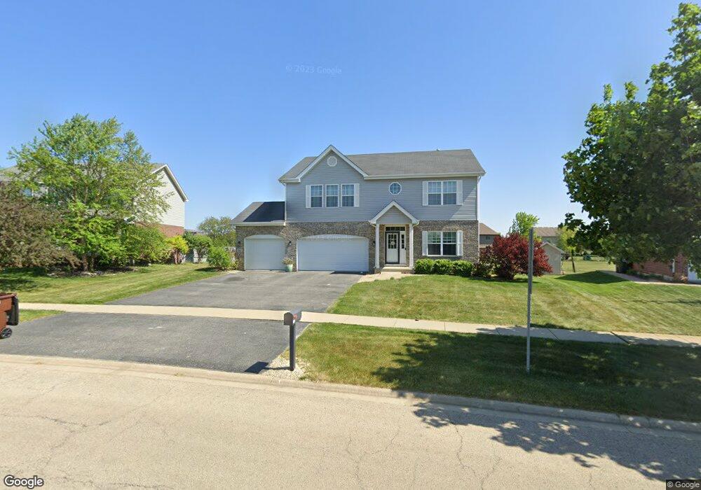
662 Peregrine Dr New Lenox, IL 60451
Estimated Value: $477,327 - $536,000
--
Bed
--
Bath
--
Sq Ft
0.34
Acres
About This Home
This home is located at 662 Peregrine Dr, New Lenox, IL 60451 and is currently estimated at $513,332. 662 Peregrine Dr is a home with nearby schools including Nelson Prairie School, Lincoln Way West, and St. Jude School.
Ownership History
Date
Name
Owned For
Owner Type
Purchase Details
Closed on
Aug 29, 2025
Sold by
Copp Sean J and Copp Jessica L
Bought by
Copp Sean J
Current Estimated Value
Purchase Details
Closed on
Sep 27, 2012
Sold by
Standard Bank And Trust Co
Bought by
Copp Sean S and Copp Jessica H
Home Financials for this Owner
Home Financials are based on the most recent Mortgage that was taken out on this home.
Original Mortgage
$273,102
Interest Rate
3.75%
Mortgage Type
New Conventional
Create a Home Valuation Report for This Property
The Home Valuation Report is an in-depth analysis detailing your home's value as well as a comparison with similar homes in the area
Home Values in the Area
Average Home Value in this Area
Purchase History
| Date | Buyer | Sale Price | Title Company |
|---|---|---|---|
| Copp Sean J | -- | Fidelity National Title | |
| Copp Sean S | $281,566 | Fidelity National Title |
Source: Public Records
Mortgage History
| Date | Status | Borrower | Loan Amount |
|---|---|---|---|
| Previous Owner | Copp Sean S | $273,102 |
Source: Public Records
Tax History Compared to Growth
Tax History
| Year | Tax Paid | Tax Assessment Tax Assessment Total Assessment is a certain percentage of the fair market value that is determined by local assessors to be the total taxable value of land and additions on the property. | Land | Improvement |
|---|---|---|---|---|
| 2024 | $10,674 | $139,525 | $33,360 | $106,165 |
| 2023 | $10,674 | $127,188 | $30,410 | $96,778 |
| 2022 | $9,619 | $117,170 | $28,015 | $89,155 |
| 2021 | $9,132 | $110,194 | $26,347 | $83,847 |
| 2020 | $8,872 | $106,262 | $25,407 | $80,855 |
| 2019 | $8,491 | $102,967 | $24,619 | $78,348 |
| 2018 | $8,295 | $99,417 | $23,770 | $75,647 |
| 2017 | $7,882 | $96,559 | $23,087 | $73,472 |
| 2016 | $7,651 | $93,975 | $22,469 | $71,506 |
| 2015 | $7,407 | $91,017 | $21,762 | $69,255 |
| 2014 | $7,407 | $89,893 | $21,493 | $68,400 |
| 2013 | $7,407 | $91,105 | $21,783 | $69,322 |
Source: Public Records
Map
Nearby Homes
- 2788 Meadow Path
- 2763 Foxwood Dr Unit 2763
- 14620 W Laraway Rd
- 1019 James Pass
- 1108 Yamma Ridge
- 1190 Sierra Ridge
- 1914 Heatherway Ln Unit 27
- 2341 Stone Creek Dr
- 2331 Stone Creek Dr
- 2321 Stone Creek Dr
- 2301 Stone Creek Dr
- 2291 Stone Creek Dr
- 2251 Stone Creek Dr
- 2241 Stone Creek Dr
- 2231 Stone Creek Dr
- 1205 Jennie Dr
- 13255 W Laraway Rd
- 2391 Stone Creek Dr
- 2401 Stone Creek Dr
- Raleigh Plan at Calistoga
- 670 Peregrine Dr
- 656 Peregrine Dr
- 682 Peregrine Dr
- 2422 Cardinal Dr
- 653 Peregrine Dr
- 663 Peregrine Dr
- 690 Peregrine Dr
- 2407 Cardinal Dr
- 2412 Cardinal Dr
- 665 Northern Lights Way
- 621 Northern Lights Way
- 677 Northern Lights Way
- 2388 Kingfisher Ln
- 643 Northern Lights Way
- 2402 Cardinal Dr
- 698 Peregrine Dr
- 2397 Cardinal Dr
- 2399 Kingfisher Ln
- 689 Northern Lights Way
- 2614 Meadow Path