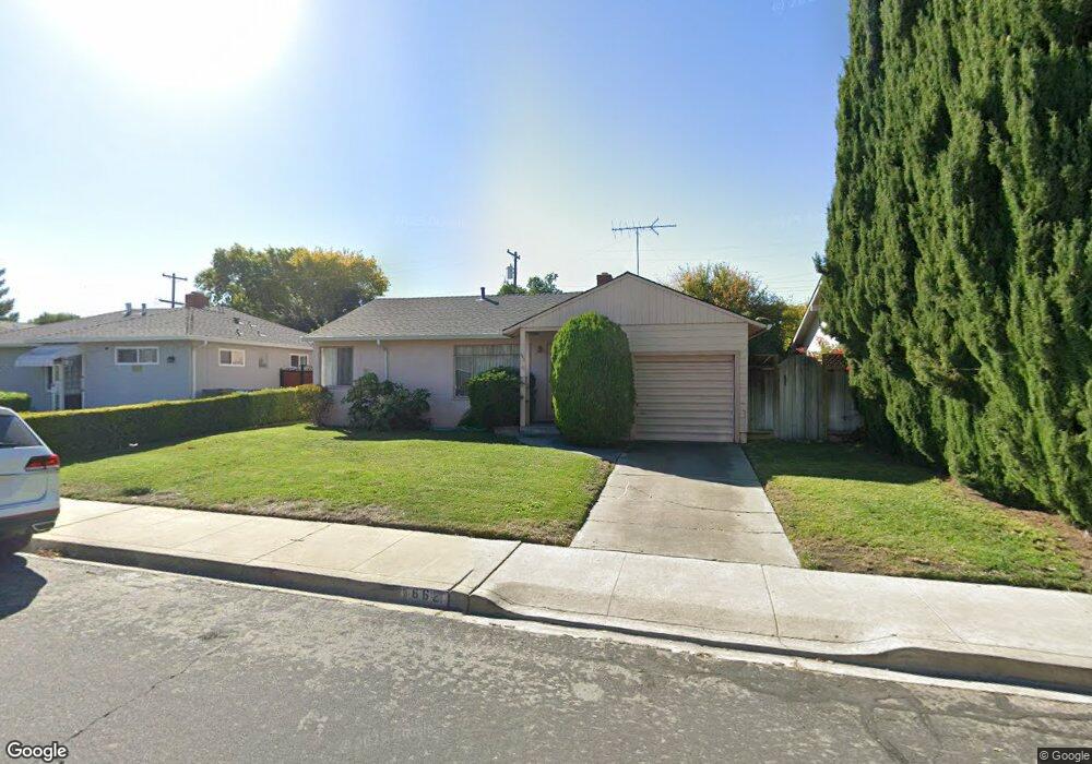
662 Robin Dr Santa Clara, CA 95050
Pruneridge NeighborhoodEstimated Value: $1,375,400 - $1,610,000
About This Home
This home is located at 662 Robin Dr, Santa Clara, CA 95050 and is currently estimated at $1,516,600, approximately $1,775 per square foot. 662 Robin Dr is a home located in Santa Clara County with nearby schools including Westwood Elementary School, Buchser Middle School, and Santa Clara High School.
Ownership History
We collect this data history from publicly available records. To have your information removed, we recommend requesting removal directly through your county’s website.
Purchase Details
Purchase Details
Purchase Details
Purchase Details
Home Values in the Area
Average Home Value in this Area
Purchase History
We collect this data history from publicly available records. To have your information removed, we recommend requesting removal directly through your county’s website.
| Date | Buyer | Sale Price | Title Company |
|---|---|---|---|
| -- | None Available | ||
| -- | -- | ||
| -- | -- | ||
| -- | -- | ||
| -- | -- |
Tax History
We collect this data history from publicly available records. To have your information removed, we recommend requesting removal directly through your county’s website.
| Year | Tax Paid | Tax Assessment Tax Assessment Total Assessment is a certain percentage of the fair market value that is determined by local assessors to be the total taxable value of land and additions on the property. | Land | Improvement |
|---|---|---|---|---|
| 2025 | $844 | $58,846 | $31,850 | $26,996 |
| 2024 | $815 | $57,693 | $31,226 | $26,467 |
| 2023 | $807 | $56,563 | $30,614 | $25,949 |
| 2022 | $799 | $55,455 | $30,014 | $25,441 |
| 2021 | $793 | $54,369 | $29,426 | $24,943 |
| 2020 | $779 | $53,813 | $29,125 | $24,688 |
| 2019 | $779 | $52,758 | $28,554 | $24,204 |
| 2018 | $735 | $51,725 | $27,995 | $23,730 |
| 2017 | $730 | $50,712 | $27,447 | $23,265 |
| 2016 | $783 | $49,718 | $26,909 | $22,809 |
| 2015 | $779 | $48,972 | $26,505 | $22,467 |
| 2014 | $727 | $48,013 | $25,986 | $22,027 |
Map
- 690 Catala Ct
- 738 Los Olivos Dr
- 2421 Michele Jean Way
- 853 Sunset Dr
- 2473 Brannan Place
- 2488 Hart Ave
- 988 Sunset Dr
- 951 Fairfield Ave
- 582 Valeri Ruth Ct
- 584 Valeri Ruth Ct
- 628 Frederick Ave
- 968 Madeline Ln
- 643 Bucher Ave
- 2293 Pruneridge Ave
- 1701 Market St Unit 1
- 880 N Winchester Blvd Unit 206
- 880 N Winchester Blvd Unit 205
- 1274 Carmel Way
- 944 White Dr
- 1183 Blackfield Dr
Ask me questions while you tour the home.