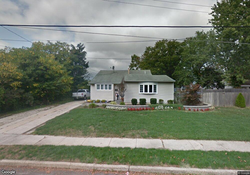
662 Topeka Ave Mantua, NJ 08051
Mantua Township NeighborhoodEstimated Value: $334,000 - $374,000
--
Bed
--
Bath
1,480
Sq Ft
$240/Sq Ft
Est. Value
About This Home
This home is located at 662 Topeka Ave, Mantua, NJ 08051 and is currently estimated at $355,429, approximately $240 per square foot. 662 Topeka Ave is a home located in Gloucester County with nearby schools including Centre City School, Clearview Regional Middle School, and Clearview Regional High School.
Ownership History
Date
Name
Owned For
Owner Type
Purchase Details
Closed on
Dec 22, 2003
Sold by
Giacomucci Michael A and Giacomucci Cheryl A
Bought by
Falabella Nicolas
Current Estimated Value
Home Financials for this Owner
Home Financials are based on the most recent Mortgage that was taken out on this home.
Original Mortgage
$150,636
Interest Rate
5.88%
Mortgage Type
FHA
Purchase Details
Closed on
Nov 29, 1999
Sold by
Giacomucci Michael A
Bought by
Giacomucci Michael A and Giacomucci Cheryl A
Home Financials for this Owner
Home Financials are based on the most recent Mortgage that was taken out on this home.
Original Mortgage
$102,301
Interest Rate
7.9%
Mortgage Type
FHA
Purchase Details
Closed on
Mar 20, 1995
Sold by
Eshelman Robert O and Giacomucci Michael
Bought by
Giacomucci Michael A and Giacomucci Phyllis E
Create a Home Valuation Report for This Property
The Home Valuation Report is an in-depth analysis detailing your home's value as well as a comparison with similar homes in the area
Home Values in the Area
Average Home Value in this Area
Purchase History
| Date | Buyer | Sale Price | Title Company |
|---|---|---|---|
| Falabella Nicolas | $149,900 | Group 21 Title Agency | |
| Giacomucci Michael A | -- | Continental Title Abstract C | |
| Giacomucci Michael A | $4,000 | Continental Title Abstract C | |
| Giacomucci Michael A | -- | -- |
Source: Public Records
Mortgage History
| Date | Status | Borrower | Loan Amount |
|---|---|---|---|
| Previous Owner | Falabella Nicolas | $150,636 | |
| Previous Owner | Giacomucci Michael A | $102,301 |
Source: Public Records
Tax History Compared to Growth
Tax History
| Year | Tax Paid | Tax Assessment Tax Assessment Total Assessment is a certain percentage of the fair market value that is determined by local assessors to be the total taxable value of land and additions on the property. | Land | Improvement |
|---|---|---|---|---|
| 2025 | $7,612 | $295,600 | $85,800 | $209,800 |
| 2024 | $7,532 | $295,600 | $85,800 | $209,800 |
| 2023 | $7,532 | $295,600 | $85,800 | $209,800 |
| 2022 | $6,485 | $185,400 | $58,200 | $127,200 |
| 2021 | $6,266 | $185,400 | $58,200 | $127,200 |
| 2020 | $6,482 | $185,400 | $58,200 | $127,200 |
| 2019 | $6,372 | $185,400 | $58,200 | $127,200 |
| 2018 | $6,281 | $185,400 | $58,200 | $127,200 |
| 2017 | $6,187 | $185,400 | $58,200 | $127,200 |
| 2016 | $6,116 | $185,400 | $58,200 | $127,200 |
| 2015 | $5,966 | $185,400 | $58,200 | $127,200 |
| 2014 | $5,766 | $185,400 | $58,200 | $127,200 |
Source: Public Records
Map
Nearby Homes
- 290 Montgomery Dr
- 380 Heritage Rd
- 284 Columbus Dr
- 333 Jackson Rd
- 17 Oakton Dr
- 590 Bridgeton Pike
- 41 Woodbrook Dr Unit C041
- 26 Woodstream Ct
- 0 Bridgeton Pike Unit NJGL2059468
- L13 N Bridgeton Pike
- 485 Harrison Ave
- 36 Bluebird Rd
- 119 Monroe Ave
- 204 W Landing Rd
- 190 Mockingbird Ln
- 155 Whippoorwill Way
- 580 Mount Royal Rd
- 608 Main St
- 325 Bridgeton Pike
- 261 Tony Cir
- 298 Montgomery Dr
- 299 Madison Rd
- 295 Madison Rd
- 294 Montgomery Dr
- 291 Madison Rd
- 300 Montgomery Dr
- 301 Madison Rd
- 287 Madison Rd
- 286 Montgomery Dr
- 298 Madison Rd
- 306 Montgomery Dr
- 307 Madison Rd
- 295 Montgomery Dr
- 299 Montgomery Dr
- 291 Montgomery Dr
- 303 Montgomery Dr
- 300 Madison Rd
- 290 Madison Rd
- 282 Montgomery Dr
- 283 Madison Rd