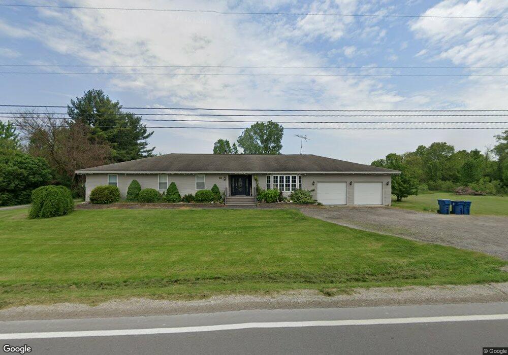
662 W Bemis Rd Saline, MI 48176
Estimated Value: $581,993 - $736,000
3
Beds
1
Bath
3,350
Sq Ft
$190/Sq Ft
Est. Value
About This Home
This home is located at 662 W Bemis Rd, Saline, MI 48176 and is currently estimated at $635,248, approximately $189 per square foot. 662 W Bemis Rd is a home located in Washtenaw County with nearby schools including Harvest Elementary School, Heritage School, and Saline Middle School.
Ownership History
Date
Name
Owned For
Owner Type
Purchase Details
Closed on
Jun 26, 2021
Sold by
Peatee Robert J
Bought by
Peatee Robert J and Peatee Connie S
Current Estimated Value
Home Financials for this Owner
Home Financials are based on the most recent Mortgage that was taken out on this home.
Original Mortgage
$229,950
Interest Rate
2.9%
Mortgage Type
New Conventional
Create a Home Valuation Report for This Property
The Home Valuation Report is an in-depth analysis detailing your home's value as well as a comparison with similar homes in the area
Home Values in the Area
Average Home Value in this Area
Purchase History
| Date | Buyer | Sale Price | Title Company |
|---|---|---|---|
| Peatee Robert J | -- | None Available |
Source: Public Records
Mortgage History
| Date | Status | Borrower | Loan Amount |
|---|---|---|---|
| Closed | Peatee Robert J | $229,950 |
Source: Public Records
Tax History
| Year | Tax Paid | Tax Assessment Tax Assessment Total Assessment is a certain percentage of the fair market value that is determined by local assessors to be the total taxable value of land and additions on the property. | Land | Improvement |
|---|---|---|---|---|
| 2025 | $5,090 | $248,228 | $0 | $0 |
| 2024 | $4,946 | $222,197 | $0 | $0 |
| 2023 | $4,719 | $210,000 | $0 | $0 |
| 2022 | $6,415 | $208,400 | $0 | $0 |
| 2021 | $6,237 | $207,800 | $0 | $0 |
| 2020 | $5,978 | $199,500 | $0 | $0 |
| 2019 | $6,127 | $194,100 | $194,100 | $0 |
| 2018 | $5,991 | $187,300 | $0 | $0 |
| 2017 | $5,526 | $184,100 | $0 | $0 |
| 2016 | $4,089 | $143,287 | $0 | $0 |
| 2015 | -- | $142,859 | $0 | $0 |
| 2014 | -- | $138,396 | $0 | $0 |
| 2013 | -- | $138,396 | $0 | $0 |
Source: Public Records
Map
Nearby Homes
- 4846 Burton Ln Unit 22
- 5064 Rutland Dr
- 5048 Rutland Dr
- 5092 Rutland Dr Unit 71
- 5035 Rutland Dr
- 5043 Rutland Dr
- Alma Plan at Fosdick Glen of Saline - Toll Brothers at Fosdick Glen
- Decker Plan at Fosdick Glen of Saline - Toll Brothers at Fosdick Glen
- Delton Plan at Fosdick Glen of Saline - Toll Brothers at Fosdick Glen
- Frankfort Plan at Fosdick Glen of Saline - Toll Brothers at Fosdick Glen
- Whittaker Plan at Fosdick Glen of Saline - Toll Brothers at Fosdick Glen
- Brant Plan at Fosdick Glen of Saline - Toll Brothers at Fosdick Glen
- 5052 Rutland Dr
- 5071 Rutland Dr
- 838 Real Quiet Ct Unit 65
- 6081 Lincolnshire Dr
- 754 Sutton Ct
- 834 Meghan Ct
- 290 Shelby Ct Unit 6
- 294 Shelby Ct
- 705 W Bemis Rd
- 4849 Burton Ln Unit 3
- 4842 Burton Ln
- 7864 Secretariat Dr Unit 37
- 7848 Secretariat Dr Unit 36
- 560 W Bemis Rd
- 4853 Burton Ln
- 4857 Burton Ln Unit 5
- 7832 Secretariat Dr Unit 35
- 7914 Fosdick Rd
- 7850 Fosdick Rd
- 564 Lincolnshire Ct
- 7882 Secretariat Dr
- 7828 Fosdick Rd
- 5027 Rutland Dr
- 507 W Bemis Rd
- 7816 Secretariat Dr Unit 34
- 568 Lincolnshire Ct Unit 8
- 7859 Secretariat Dr
- 7800 Secretariat Dr Unit 33
Your Personal Tour Guide
Ask me questions while you tour the home.