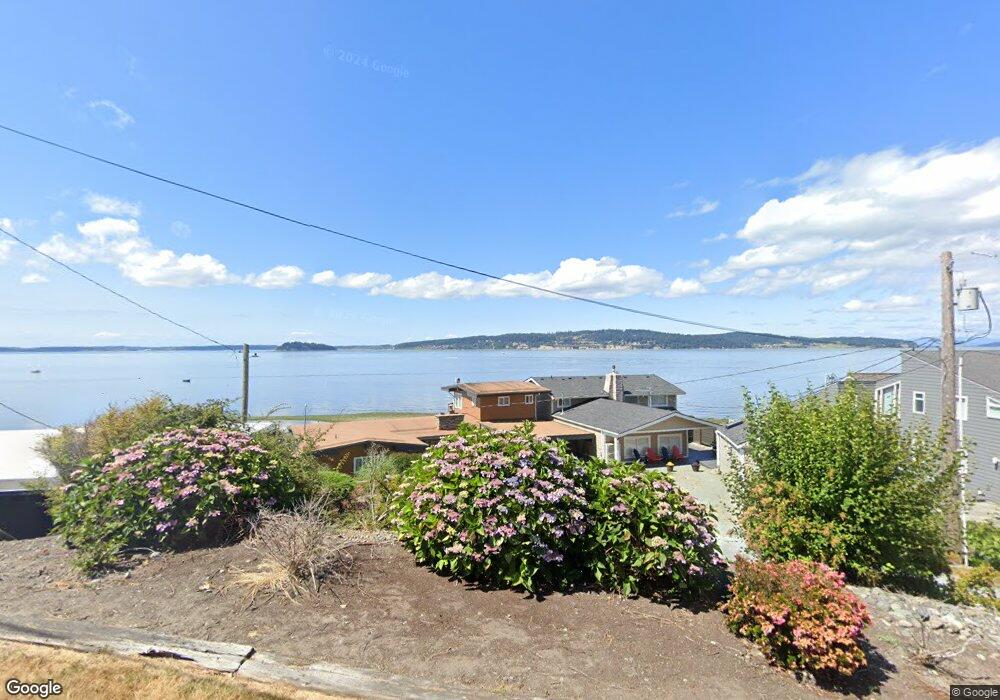
662 W Doeskin Ct Camano, WA 98282
Estimated Value: $830,000 - $1,844,000
3
Beds
3
Baths
1,640
Sq Ft
$812/Sq Ft
Est. Value
About This Home
This home is located at 662 W Doeskin Ct, Camano, WA 98282 and is currently estimated at $1,331,739, approximately $812 per square foot. 662 W Doeskin Ct is a home located in Island County with nearby schools including Utsalady Elementary School, Port Susan Middle School, and Stanwood High School.
Ownership History
Date
Name
Owned For
Owner Type
Purchase Details
Closed on
Dec 20, 2023
Sold by
Steck Thomas H
Bought by
Steck Parker T
Current Estimated Value
Purchase Details
Closed on
Sep 8, 2022
Sold by
Lynn Steck Debra
Bought by
Steck Thomas H
Purchase Details
Closed on
Aug 23, 2004
Sold by
Eade David E and Eade Monica G
Bought by
Steck Thomas H and Steck Debbie L
Home Financials for this Owner
Home Financials are based on the most recent Mortgage that was taken out on this home.
Original Mortgage
$522,500
Interest Rate
4.75%
Mortgage Type
Purchase Money Mortgage
Create a Home Valuation Report for This Property
The Home Valuation Report is an in-depth analysis detailing your home's value as well as a comparison with similar homes in the area
Home Values in the Area
Average Home Value in this Area
Purchase History
| Date | Buyer | Sale Price | Title Company |
|---|---|---|---|
| Steck Parker T | $313 | None Listed On Document | |
| Steck Thomas H | -- | -- | |
| Steck Thomas H | $830,000 | -- |
Source: Public Records
Mortgage History
| Date | Status | Borrower | Loan Amount |
|---|---|---|---|
| Previous Owner | Steck Thomas H | $522,500 |
Source: Public Records
Tax History Compared to Growth
Tax History
| Year | Tax Paid | Tax Assessment Tax Assessment Total Assessment is a certain percentage of the fair market value that is determined by local assessors to be the total taxable value of land and additions on the property. | Land | Improvement |
|---|---|---|---|---|
| 2025 | $9,471 | $1,321,991 | $925,380 | $396,611 |
| 2024 | $9,345 | $1,246,935 | $850,380 | $396,555 |
| 2023 | $9,345 | $1,227,424 | $825,380 | $402,044 |
| 2022 | $7,295 | $1,069,473 | $710,380 | $359,093 |
| 2021 | $6,982 | $791,939 | $475,380 | $316,559 |
| 2020 | $6,287 | $733,904 | $425,380 | $308,524 |
| 2019 | $5,799 | $652,287 | $425,380 | $226,907 |
| 2018 | $6,013 | $603,041 | $375,380 | $227,661 |
| 2017 | $4,860 | $579,547 | $350,380 | $229,167 |
| 2016 | $5,080 | $520,501 | $300,380 | $220,121 |
| 2015 | $5,227 | $523,516 | $300,380 | $223,136 |
| 2013 | -- | $529,547 | $300,380 | $229,167 |
Source: Public Records
Map
Nearby Homes
- 0 Maple Grove Rd Unit NWM2455478
- 1048 Malvern Hills Dr
- 688 Gladstone Dr
- 1042 Shorecrest Place
- 366 Samanthia Ln
- 1048 Cassius Ct
- 941 Cambell Dr
- 0 Cambell Dr Unit NWM2331086
- 628 N Sunset Dr
- 980 Marshall Dr
- 25 Anadar Place
- 1 S Camano Dr
- 900 N Sunset Dr
- 78 Vista Del Mar St
- 97 Utsalady Rd
- 92 Utsalady Rd
- 441 Windsun Way
- 1015 Aqua Vista Ln
- 1107 Puesta Del Sol Ave
- 345 Seaview Ct
- 662 Doeskin Ct
- 668 Doeskin Ct
- 660 Doeskin Ct
- 663 W Doeskin Ct
- 672 Doeskin Ct
- 656 Maple Grove Rd
- 672 W Doeskin Ct
- 633 Maple Grove Rd
- 674 Doeskin Ct
- 654 Maple Grove Rd
- 663 Maple Grove Rd
- 659 Maple Grove Rd
- 676 Doeskin Ct
- 657 Maple Grove Rd
- 651 Maple Grove Rd
- 647 Maple Grove Rd
- 678 Maple Grove Rd
- 641 Maple Grove Rd
- 0 LOT97 Maple Grove Rd
- 0 Maple Grove Rd Unit NWM1883844