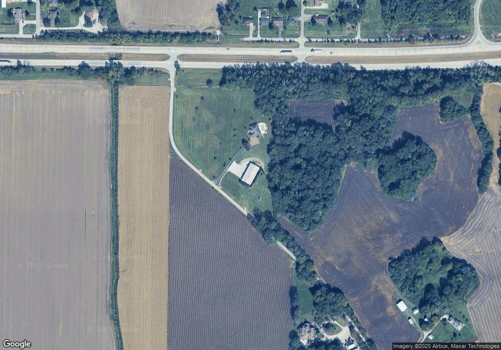
6620 Carson School Rd Mount Vernon, IN 47620
Estimated Value: $383,000 - $653,387
3
Beds
3
Baths
2,706
Sq Ft
$178/Sq Ft
Est. Value
About This Home
This home is located at 6620 Carson School Rd, Mount Vernon, IN 47620 and is currently estimated at $481,597, approximately $177 per square foot. 6620 Carson School Rd is a home located in Posey County with nearby schools including Mount Vernon Junior High School and Mount Vernon High School.
Ownership History
Date
Name
Owned For
Owner Type
Purchase Details
Closed on
Aug 25, 2025
Sold by
Moore Rebecca L
Bought by
Droste Aaron and Droste Kameron
Current Estimated Value
Home Financials for this Owner
Home Financials are based on the most recent Mortgage that was taken out on this home.
Original Mortgage
$400,000
Outstanding Balance
$400,000
Interest Rate
6.74%
Mortgage Type
New Conventional
Estimated Equity
$81,597
Create a Home Valuation Report for This Property
The Home Valuation Report is an in-depth analysis detailing your home's value as well as a comparison with similar homes in the area
Home Values in the Area
Average Home Value in this Area
Purchase History
| Date | Buyer | Sale Price | Title Company |
|---|---|---|---|
| Droste Aaron | -- | First American Title |
Source: Public Records
Mortgage History
| Date | Status | Borrower | Loan Amount |
|---|---|---|---|
| Open | Droste Aaron | $400,000 |
Source: Public Records
Tax History Compared to Growth
Tax History
| Year | Tax Paid | Tax Assessment Tax Assessment Total Assessment is a certain percentage of the fair market value that is determined by local assessors to be the total taxable value of land and additions on the property. | Land | Improvement |
|---|---|---|---|---|
| 2024 | $4,647 | $492,900 | $47,300 | $445,600 |
| 2023 | $4,126 | $450,600 | $44,100 | $406,500 |
| 2022 | $4,738 | $461,700 | $41,700 | $420,000 |
| 2021 | $4,154 | $396,800 | $39,900 | $356,900 |
| 2020 | $4,171 | $389,100 | $39,000 | $350,100 |
| 2019 | $4,001 | $377,500 | $37,500 | $340,000 |
| 2018 | $3,864 | $373,100 | $37,500 | $335,600 |
| 2017 | $3,629 | $370,200 | $37,500 | $332,700 |
| 2016 | $3,329 | $353,900 | $37,500 | $316,400 |
| 2014 | $3,024 | $332,500 | $38,600 | $293,900 |
| 2013 | $3,024 | $342,200 | $38,600 | $303,600 |
Source: Public Records
Map
Nearby Homes
- 10311 Eastgate Dr S
- 10413 Hidden Valley Ln E
- 5900 Serenity Dr
- 5712 Hausman Rd
- 0 Fox Ridge Rd
- 5225 Star Dr
- 11314 Vixen Dr
- 10900 Woodside Dr S
- 9051 Middle Mount Vernon Rd
- 7417 Norfield Dr E
- 4031 Saint Phillips Rd S
- 2734 Marycrest Dr
- 2646 Marycrest Dr
- Little Rock Craftsman Plan at Westridge Commons
- Revolution Craftsman Plan at Westridge Commons
- Revolution Farmhouse Plan at Westridge Commons
- Walnut Craftsman Plan at Westridge Commons
- Patriot Modern Plan at Westridge Commons
- National Farmhouse Plan at Westridge Commons
- Cumberland Farmhouse 3-Car Plan at Westridge Commons
- 9520 Old Highway 62 E
- 9600 Old Highway 62 E
- 9606 Old Highway 62 E
- 9610 Old Highway 62 E
- 9650 Old Highway 62 E
- 6458 Marrs Manor Rd
- 6471 Powers Dr
- 6451 Marrs Manor Rd
- 6450 Marrs Manor Rd
- 9609 Manor Ln
- 9615 Manor Ln
- 6425 Marrs Manor Rd
- 9600 Manor Ln
- 6420 Powers Dr
- 6419 Marrs Manor Rd
- 9606 Manor Ln
- 9612 Manor Ln
- 6411 Marrs Manor Rd
- 9700 Manor Ln
- 9706 Manor Ln