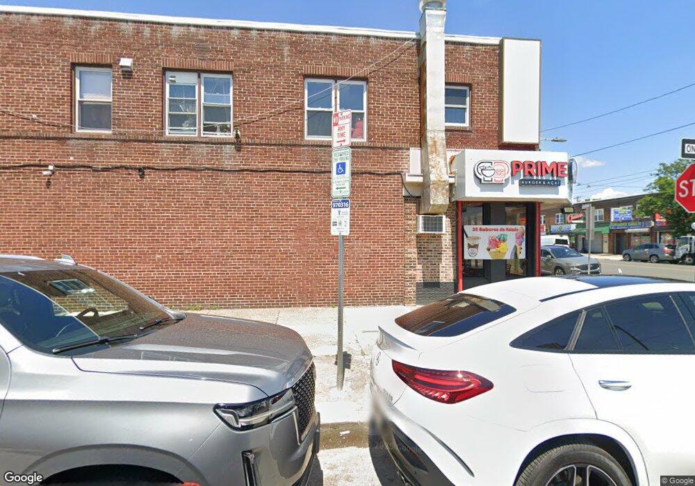
6620 Castor Ave Philadelphia, PA 19149
Castor Gardens NeighborhoodEstimated Value: $971,547
--
Bed
2
Baths
3,120
Sq Ft
$311/Sq Ft
Est. Value
About This Home
This home is located at 6620 Castor Ave, Philadelphia, PA 19149 and is currently estimated at $971,547, approximately $311 per square foot. 6620 Castor Ave is a home located in Philadelphia County with nearby schools including J. Hampton Moore School, Castor Gardens Middle School, and Northeast High School.
Ownership History
Date
Name
Owned For
Owner Type
Purchase Details
Closed on
Nov 3, 2011
Sold by
Lim Sam
Bought by
Chen Shi Tao
Current Estimated Value
Home Financials for this Owner
Home Financials are based on the most recent Mortgage that was taken out on this home.
Original Mortgage
$249,500
Outstanding Balance
$170,053
Interest Rate
4.01%
Mortgage Type
Future Advance Clause Open End Mortgage
Estimated Equity
$801,494
Create a Home Valuation Report for This Property
The Home Valuation Report is an in-depth analysis detailing your home's value as well as a comparison with similar homes in the area
Home Values in the Area
Average Home Value in this Area
Purchase History
| Date | Buyer | Sale Price | Title Company |
|---|---|---|---|
| Chen Shi Tao | $410,000 | None Available |
Source: Public Records
Mortgage History
| Date | Status | Borrower | Loan Amount |
|---|---|---|---|
| Open | Chen Shi Tao | $249,500 |
Source: Public Records
Tax History Compared to Growth
Tax History
| Year | Tax Paid | Tax Assessment Tax Assessment Total Assessment is a certain percentage of the fair market value that is determined by local assessors to be the total taxable value of land and additions on the property. | Land | Improvement |
|---|---|---|---|---|
| 2025 | $4,198 | $370,500 | $74,100 | $296,400 |
| 2024 | $4,198 | $370,500 | $74,100 | $296,400 |
| 2023 | $4,198 | $299,900 | $59,980 | $239,920 |
| 2022 | $4,775 | $299,900 | $59,980 | $239,920 |
| 2021 | $4,775 | $0 | $0 | $0 |
| 2020 | $4,775 | $0 | $0 | $0 |
| 2019 | $4,729 | $0 | $0 | $0 |
| 2018 | $4,461 | $0 | $0 | $0 |
| 2017 | $4,075 | $0 | $0 | $0 |
| 2016 | $4,075 | $0 | $0 | $0 |
| 2015 | $3,901 | $0 | $0 | $0 |
| 2014 | -- | $291,100 | $39,600 | $251,500 |
| 2012 | -- | $54,080 | $13,520 | $40,560 |
Source: Public Records
Map
Nearby Homes
- 1425 Fanshawe St
- 1437 Magee Ave
- 1417 Unruh Ave
- 1353 Fanshawe St
- 1353 Wells St
- 1412 Magee Ave
- 1324 Unruh Ave
- 1431 Greeby St
- 1409 Greeby St
- 6626 Lynford St
- 1343 Greeby St
- 1304 Fanshawe St
- 1344 Greeby St
- 1314 Gilham St
- 1328 Greeby St
- 1326 Greeby St
- 6739 Lynford St
- 1227 Fanshawe St
- 1238 Gilham St
- 1300 Glenview St
- 6624 Castor Ave
- 1441 Fanshawe St
- 6616 Castor Ave
- 1439 Fanshawe St
- 1437 Fanshawe St
- 6614 Castor Ave
- 1435 Fanshawe St
- 1440 Fanshawe St
- 1433 Fanshawe St
- 1438 Fanshawe St
- 1436 Fanshawe St
- 1431 Fanshawe St
- 6610 Castor Ave
- 1438 Unruh Ave
- 1432 Fanshawe St
- 1429 Fanshawe St
- 1436 Unruh Ave
- 6627 Castor Ave
- 1434 Unruh Ave
- 1432 Unruh Ave