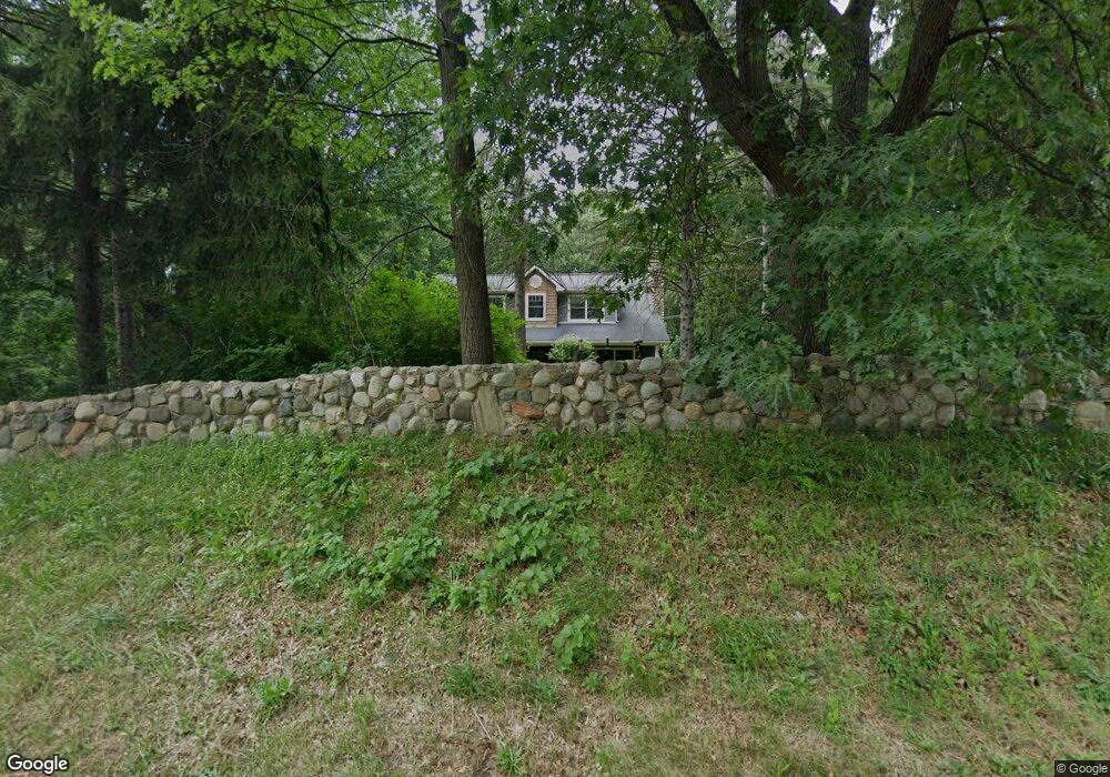
6620 Pontiac Trail West Bloomfield, MI 48323
Estimated Value: $573,000 - $692,763
3
Beds
4
Baths
2,758
Sq Ft
$223/Sq Ft
Est. Value
About This Home
This home is located at 6620 Pontiac Trail, West Bloomfield, MI 48323 and is currently estimated at $613,941, approximately $222 per square foot. 6620 Pontiac Trail is a home located in Oakland County with nearby schools including Walled Lake Central High School, The Susan And Rabbi Harold Loss Ecc, and Brookfield Academy - West Bloomfield.
Ownership History
Date
Name
Owned For
Owner Type
Purchase Details
Closed on
May 6, 2006
Sold by
Eagle International Investments Inc
Bought by
Scobie Bruce and Scobie Carmen M
Current Estimated Value
Purchase Details
Closed on
Aug 19, 2004
Sold by
Scobie Carmen M and Dimech Carmen M
Bought by
Scobie Bruce E and Scobie Carmen M
Purchase Details
Closed on
Nov 27, 2001
Sold by
Scobie Bruce E
Bought by
Oakland County Board Of Road
Purchase Details
Closed on
Jun 16, 1995
Sold by
Eagle Invest Inc
Bought by
Dimech Carmen M
Home Financials for this Owner
Home Financials are based on the most recent Mortgage that was taken out on this home.
Original Mortgage
$60,000
Interest Rate
7.43%
Mortgage Type
New Conventional
Create a Home Valuation Report for This Property
The Home Valuation Report is an in-depth analysis detailing your home's value as well as a comparison with similar homes in the area
Home Values in the Area
Average Home Value in this Area
Purchase History
| Date | Buyer | Sale Price | Title Company |
|---|---|---|---|
| Scobie Bruce | $100,000 | Trans | |
| Scobie Bruce E | -- | Stewart Title Guaranty Co | |
| Oakland County Board Of Road | $8,505 | -- | |
| Dimech Carmen M | $140,000 | -- |
Source: Public Records
Mortgage History
| Date | Status | Borrower | Loan Amount |
|---|---|---|---|
| Previous Owner | Dimech Carmen M | $60,000 |
Source: Public Records
Tax History Compared to Growth
Tax History
| Year | Tax Paid | Tax Assessment Tax Assessment Total Assessment is a certain percentage of the fair market value that is determined by local assessors to be the total taxable value of land and additions on the property. | Land | Improvement |
|---|---|---|---|---|
| 2024 | $4,579 | $281,770 | $0 | $0 |
| 2022 | $4,222 | $269,000 | $112,950 | $156,050 |
| 2021 | $6,943 | $261,490 | $0 | $0 |
| 2020 | $4,172 | $247,340 | $112,950 | $134,390 |
| 2018 | $6,758 | $241,180 | $112,950 | $128,230 |
| 2015 | -- | $243,520 | $0 | $0 |
| 2014 | -- | $229,960 | $0 | $0 |
| 2011 | -- | $235,040 | $0 | $0 |
Source: Public Records
Map
Nearby Homes
- 4540 Rolling Pine Ct
- 4442 Borland St
- 6980 Hambro St
- 6675 Langtoft St
- 0000 Langtoft
- 4066 Green Lake Rd
- 4335 Crestdale Ave
- 6978 Colony Dr
- 3991 Fieldview Ave
- 4245 Bunker Ave
- 3965 Carrick Ave
- 3950 Bradmore Ave
- 5994 Glen Eagles Dr
- 7545/7585 Pontiac Trail
- 7585/7548 Pontiac Trail
- 6140 Pontiac Trail
- 000 Pontiac Trail
- 6100 Pontiac Trail
- 6903 Dandison Blvd
- 4212 Greendale Ave
- 4356 Rolling Pine Dr
- 4528 Rolling Pine Ct
- 4534 Rolling Pine Ct
- 4396 Rolling Pine Dr
- 4350 Rolling Pine Dr
- 4369 Rolling Pine Dr
- 4379 Rolling Pine Dr
- 6700 Pontiac Trail
- 4400 Rolling Pine Dr
- 6585 Heron Point
- 4357 Rolling Pine Dr
- 4385 Rolling Pine Dr
- 4522 Rolling Pine Ct
- 6595 Heron Point
- 6575 Heron Point
- 6550 Heron Point
- 4569 Borland St
- 4575 Borland St
- 4557 Borland St
- 6605 Heron Point Unit 79