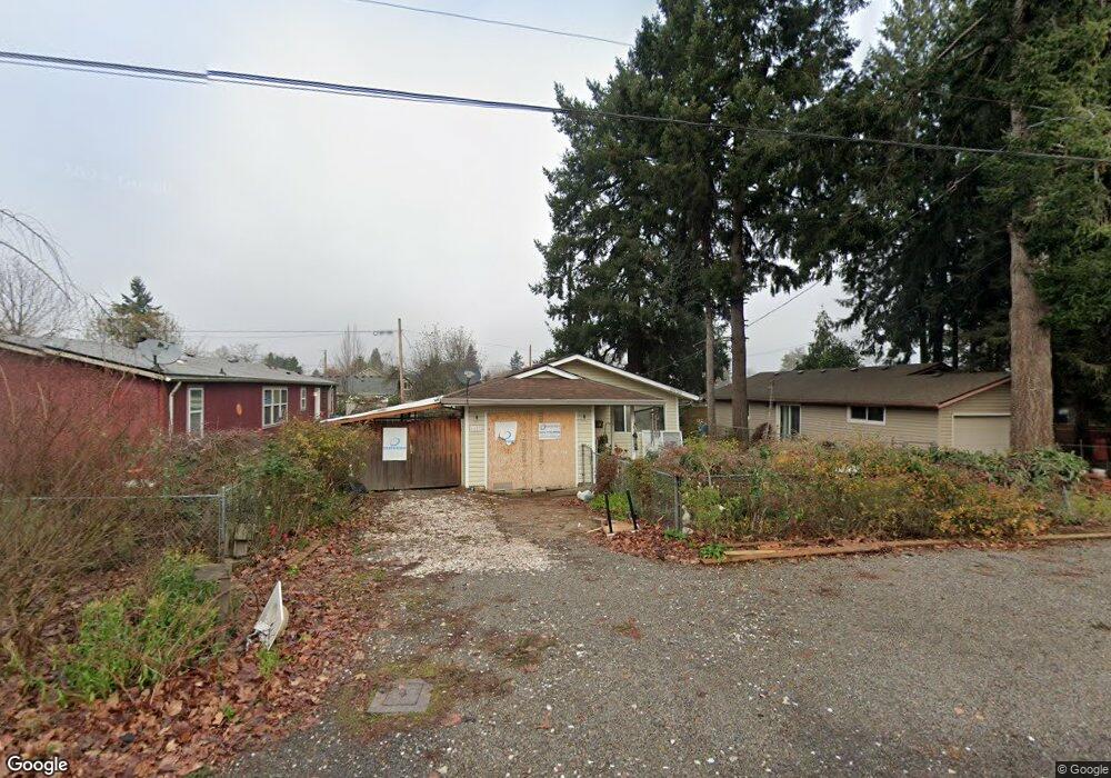
6623 N Powers St Portland, OR 97203
Saint Johns NeighborhoodEstimated Value: $386,000 - $411,000
3
Beds
1
Bath
980
Sq Ft
$408/Sq Ft
Est. Value
About This Home
This home is located at 6623 N Powers St, Portland, OR 97203 and is currently estimated at $399,837, approximately $407 per square foot. 6623 N Powers St is a home located in Multnomah County with nearby schools including James John Elementary School, George Middle School, and Roosevelt High School.
Ownership History
Date
Name
Owned For
Owner Type
Purchase Details
Closed on
Jul 29, 2003
Sold by
Hernandez Justina Damazo
Bought by
Hernandez Justina Damazo
Current Estimated Value
Purchase Details
Closed on
May 25, 2000
Sold by
Vidan Robert
Bought by
Tejada Justina
Home Financials for this Owner
Home Financials are based on the most recent Mortgage that was taken out on this home.
Original Mortgage
$104,704
Outstanding Balance
$36,016
Interest Rate
8.08%
Mortgage Type
FHA
Estimated Equity
$363,821
Purchase Details
Closed on
Nov 24, 1996
Sold by
Griffin Belva J
Bought by
Rogers William and Rogers Traci
Create a Home Valuation Report for This Property
The Home Valuation Report is an in-depth analysis detailing your home's value as well as a comparison with similar homes in the area
Home Values in the Area
Average Home Value in this Area
Purchase History
| Date | Buyer | Sale Price | Title Company |
|---|---|---|---|
| Hernandez Justina Damazo | -- | Multiple | |
| Tejada Justina | $104,900 | First American Title Co | |
| Rogers William | $12,000 | -- |
Source: Public Records
Mortgage History
| Date | Status | Borrower | Loan Amount |
|---|---|---|---|
| Open | Tejada Justina | $104,704 |
Source: Public Records
Tax History Compared to Growth
Tax History
| Year | Tax Paid | Tax Assessment Tax Assessment Total Assessment is a certain percentage of the fair market value that is determined by local assessors to be the total taxable value of land and additions on the property. | Land | Improvement |
|---|---|---|---|---|
| 2024 | $3,285 | $122,780 | -- | -- |
| 2023 | $3,159 | $119,210 | $0 | $0 |
| 2022 | $3,091 | $115,740 | $0 | $0 |
| 2021 | $3,038 | $112,370 | $0 | $0 |
| 2020 | $2,787 | $109,100 | $0 | $0 |
| 2019 | $2,685 | $105,930 | $0 | $0 |
| 2018 | $2,606 | $102,850 | $0 | $0 |
| 2017 | $2,498 | $99,860 | $0 | $0 |
| 2016 | $2,286 | $96,960 | $0 | $0 |
| 2015 | $2,226 | $94,140 | $0 | $0 |
| 2014 | $2,193 | $91,400 | $0 | $0 |
Source: Public Records
Map
Nearby Homes
- 6640 N Columbia Blvd
- 6244 N Columbia Way
- 6669 N Fessenden St Unit 25
- 6675 N Fessenden St Unit 14
- 6649 N Fessenden St Unit 11
- 6838 N Columbia Blvd
- 10112 N Oregonian Ave
- 10227 N MacRum Ave
- 6905 N Bank St
- 6909 N Bank St
- 6913 N Bank St
- 6915 N Bank St
- 7045 N Mears St
- 6914 N Swift St
- 6916 N Swift St
- 9449 N Geneva Ave
- 6926 N Armour St
- 6815 N Smith St
- 9832 N Clarendon Ave Unit 9836
- 7129 N Sedro St
- 6615 N Powers St
- 6631 N Powers St
- 6605 N Powers St
- 6645 N Powers St
- 6624 N Mears St
- 6616 N Mears St
- 6632 N Mears St
- 6644 N Mears St
- 6621 N Columbia Way
- 6621 N Columbia Way Unit 2
- 6621 N Columbia Way Unit 7
- 6621 N Columbia Way Unit 6
- 6621 N Columbia Way Unit 5
- 6621 N Columbia Way Unit 4
- 6621 N Columbia Way Unit 3
- 6621 N Columbia Way Unit 1
- 9825 N MacRum Ave
- 6650 N Mears St
- 6656 N Mears St
- 6675 N Powers St