Estimated Value: $1,075,000 - $1,596,000
3
Beds
2
Baths
2,021
Sq Ft
$659/Sq Ft
Est. Value
About This Home
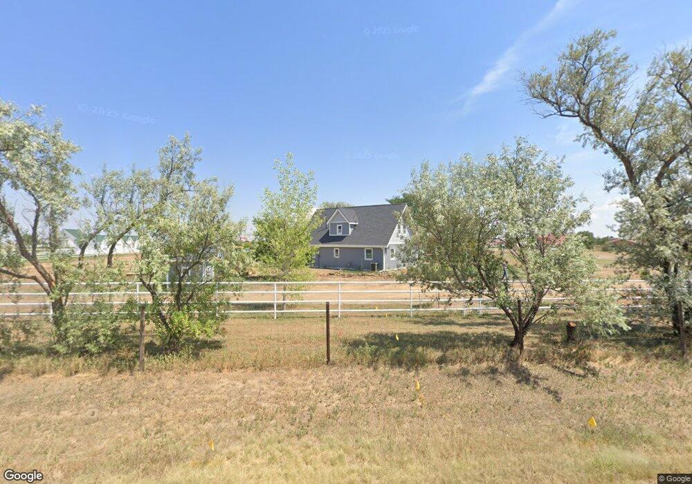
This home is located at 6624 Aggregate Blvd, Erie, CO 80516 and is currently estimated at $1,332,216, approximately $659 per square foot. 6624 Aggregate Blvd is a home located in Weld County with nearby schools including Legacy Elementary School, Erie Middle School, and Erie High School.
Ownership History
Date
Name
Owned For
Owner Type
Purchase Details
Closed on
Jan 3, 2025
Sold by
Demple Matthew O and Demple Patricia A
Bought by
Lenick Organic Farms Llc
Current Estimated Value
Purchase Details
Closed on
Mar 24, 2006
Sold by
Hopp Howard A and Hopp Linda L
Bought by
Demple Matthew O and Demple Patricia A
Home Financials for this Owner
Home Financials are based on the most recent Mortgage that was taken out on this home.
Original Mortgage
$425,000
Interest Rate
10.12%
Mortgage Type
Fannie Mae Freddie Mac
Create a Home Valuation Report for This Property
The Home Valuation Report is an in-depth analysis detailing your home's value as well as a comparison with similar homes in the area
Home Values in the Area
Average Home Value in this Area
Purchase History
| Date | Buyer | Sale Price | Title Company |
|---|---|---|---|
| Lenick Organic Farms Llc | $1,500,000 | Fidelity National Title | |
| Lenick Organic Farms Llc | $1,500,000 | Fidelity National Title | |
| Demple Matthew O | $425,000 | Land Title Guarantee Company |
Source: Public Records
Mortgage History
| Date | Status | Borrower | Loan Amount |
|---|---|---|---|
| Previous Owner | Demple Matthew O | $425,000 |
Source: Public Records
Tax History Compared to Growth
Tax History
| Year | Tax Paid | Tax Assessment Tax Assessment Total Assessment is a certain percentage of the fair market value that is determined by local assessors to be the total taxable value of land and additions on the property. | Land | Improvement |
|---|---|---|---|---|
| 2025 | $4,519 | $55,470 | $20,860 | $34,610 |
| 2024 | $4,519 | $55,470 | $20,860 | $34,610 |
| 2023 | $4,312 | $52,870 | $24,220 | $28,650 |
| 2022 | $3,855 | $41,450 | $21,890 | $19,560 |
| 2021 | $3,879 | $42,640 | $22,520 | $20,120 |
| 2020 | $3,484 | $38,650 | $19,920 | $18,730 |
| 2019 | $3,541 | $38,650 | $19,920 | $18,730 |
| 2018 | $2,726 | $31,110 | $14,830 | $16,280 |
| 2017 | $2,753 | $31,110 | $14,830 | $16,280 |
| 2016 | $1,786 | $20,050 | $6,810 | $13,240 |
| 2015 | $1,727 | $20,050 | $6,810 | $13,240 |
| 2014 | $2,260 | $26,590 | $12,180 | $14,410 |
Source: Public Records
Map
Nearby Homes
- 3319 Eagle Butte Ave
- 3310 Quicksilver Rd
- 3309 Quicksilver Rd
- 2623 Steeple Rock Dr
- 6320 Walnut Grove Way
- 6520 Empire Ave
- 6516 Empire Ave
- 6324 Saratoga Trail
- 6325 Saratoga Trail
- 3516 Little Bell Dr
- 6499 Empire Ave
- 2913 Saratoga Trail
- 3452 Tipple Pkwy
- 6244 Waterman Way
- 6101 Summit Peak Ct Unit 105
- 6325 Copper Dr
- 6109 Black Mesa Rd
- 6045 Sandstone Cir
- 6021 Lynx Creek Cir
- 3080 S Buttercup Cir
- 6624 County Road 7
- 3057 County Road 14 1/2
- 3117 County Road 14 1/2
- 0 Holly St Unit 655737
- 0 Holly St Unit 381175
- 0 Holly St Unit 337200
- 0 Holly St Unit 520284
- 0 Holly St Unit 569083
- 0 Holly St Unit 600323
- 3052 Cherokee Ct Unit 16
- 3177 County Road 14 1/2
- 3022 Eagle Butte Ave
- 3108 Eagle Butte Ave
- 3018 Eagle Butte Ave
- 3112 Eagle Butte Ave
- 3115 Holly St
- 3120 Eagle Butte Ave
- 6821 Aggregate Blvd Unit WELD
- 3174 Holly St
- 3124 Eagle Butte Ave