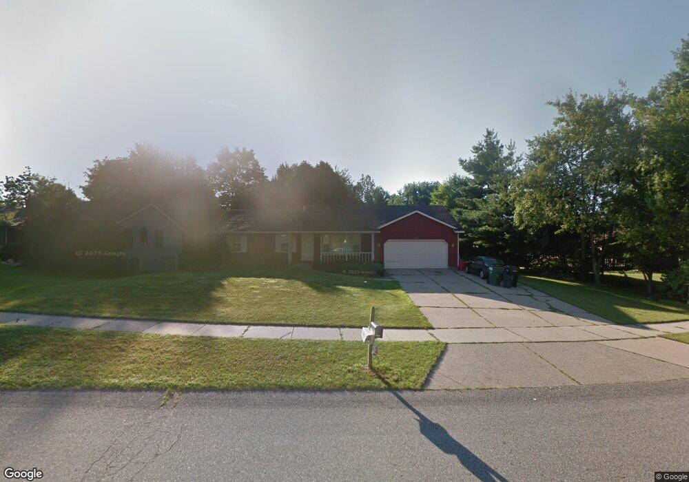
6626 Crownpointe Dr SW Byron Center, MI 49315
Estimated Value: $331,000 - $403,000
3
Beds
2
Baths
1,250
Sq Ft
$301/Sq Ft
Est. Value
About This Home
This home is located at 6626 Crownpointe Dr SW, Byron Center, MI 49315 and is currently estimated at $375,760, approximately $300 per square foot. 6626 Crownpointe Dr SW is a home located in Kent County with nearby schools including Marshall Elementary School, Robert L. Nickels Intermediate School, and Byron Center West Middle School.
Ownership History
Date
Name
Owned For
Owner Type
Purchase Details
Closed on
May 27, 2010
Sold by
Schurr Robert P
Bought by
Sheets Jennifer L and Sheets Tedd A
Current Estimated Value
Home Financials for this Owner
Home Financials are based on the most recent Mortgage that was taken out on this home.
Original Mortgage
$118,405
Outstanding Balance
$78,965
Interest Rate
4.87%
Mortgage Type
FHA
Estimated Equity
$296,795
Purchase Details
Closed on
Nov 4, 2003
Sold by
Meyerink Roger and Meyerink Mary
Bought by
Schurr Robert P
Home Financials for this Owner
Home Financials are based on the most recent Mortgage that was taken out on this home.
Original Mortgage
$164,900
Interest Rate
6.02%
Mortgage Type
Purchase Money Mortgage
Create a Home Valuation Report for This Property
The Home Valuation Report is an in-depth analysis detailing your home's value as well as a comparison with similar homes in the area
Home Values in the Area
Average Home Value in this Area
Purchase History
| Date | Buyer | Sale Price | Title Company |
|---|---|---|---|
| Sheets Jennifer L | $120,000 | Trans | |
| Schurr Robert P | $164,900 | Chicago Title |
Source: Public Records
Mortgage History
| Date | Status | Borrower | Loan Amount |
|---|---|---|---|
| Open | Sheets Jennifer L | $118,405 | |
| Previous Owner | Schurr Robert P | $164,900 |
Source: Public Records
Tax History Compared to Growth
Tax History
| Year | Tax Paid | Tax Assessment Tax Assessment Total Assessment is a certain percentage of the fair market value that is determined by local assessors to be the total taxable value of land and additions on the property. | Land | Improvement |
|---|---|---|---|---|
| 2025 | $1,817 | $163,000 | $0 | $0 |
| 2024 | $1,817 | $145,500 | $0 | $0 |
| 2023 | $1,738 | $129,500 | $0 | $0 |
| 2022 | $2,422 | $114,400 | $0 | $0 |
| 2021 | $2,358 | $105,600 | $0 | $0 |
| 2020 | $1,600 | $95,700 | $0 | $0 |
| 2019 | $2,301 | $92,400 | $0 | $0 |
| 2018 | $2,253 | $88,400 | $18,800 | $69,600 |
| 2017 | $2,193 | $79,700 | $0 | $0 |
| 2016 | $2,114 | $75,800 | $0 | $0 |
| 2015 | $2,078 | $75,800 | $0 | $0 |
| 2013 | -- | $67,400 | $0 | $0 |
Source: Public Records
Map
Nearby Homes
- 6540 Kingtree Dr SW
- 6696 Highmeadow Dr SW
- 1010 Bellview Meadow Dr SW Unit 68
- 1012 Bellview Meadow Dr SW
- 1171 Runway Place SW
- 907 Amber View Dr SW
- 825 Amber Ridge Dr SW
- 6787 Sunfield Dr SW
- 6455 Silverton Dr
- 1058 Amberwood West Dr SW
- 924 Amberwood West Dr SW
- 6450 Estate Dr SW
- 6471 Estate Dr SW
- 6455 Estate Dr SW
- 323 Scabbard St SW
- 906 60th St SW
- 1493 Dexter Dr SW Unit 34
- 1501 Dexter St SW Unit 35
- 1531 Dexter Dr SW Unit 37
- 7074 Nantucket Dr SW
- 6610 Crownpointe Dr SW
- 909 Woodspointe Dr SW
- 895 Woodspointe Dr SW
- 860 E Crownpointe Ct SW
- 874 E Crownpointe Ct SW
- 850 E Crownpointe Ct SW
- 6615 Kingtree Dr SW
- 935 Woodspointe Dr SW
- 883 Woodspointe Dr SW
- 836 E Crownpointe Ct SW
- 899 E Crownpointe Ct SW
- 914 Woodspointe Dr SW
- 6593 Crownpointe Dr SW
- 900 Woodspointe Dr SW
- 928 Woodspointe Dr SW
- 871 Woodspointe Dr SW
- 6572 Kingtree Dr SW
- 6577 Kingtree Dr SW
- 951 Woodspointe Dr SW
- 875 E Crownpointe Ct SW