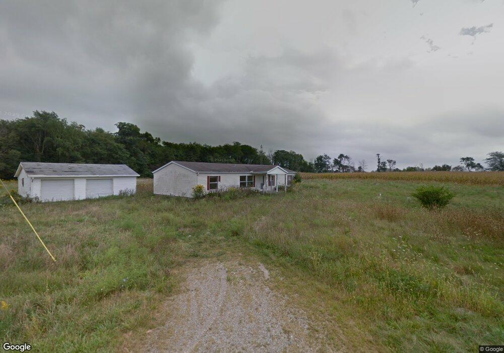
6629 Cr 202 de Graff, OH 43318
Estimated Value: $164,000 - $294,000
3
Beds
2
Baths
1,560
Sq Ft
$143/Sq Ft
Est. Value
About This Home
This home is located at 6629 Cr 202, de Graff, OH 43318 and is currently estimated at $223,333, approximately $143 per square foot. 6629 Cr 202 is a home located in Logan County with nearby schools including Riverside Elementary School and Riverside High School.
Ownership History
Date
Name
Owned For
Owner Type
Purchase Details
Closed on
Jul 8, 2021
Sold by
Hoylman Brandon R
Bought by
Woods Skyler R and Woods Addie L
Current Estimated Value
Home Financials for this Owner
Home Financials are based on the most recent Mortgage that was taken out on this home.
Original Mortgage
$147,283
Outstanding Balance
$133,636
Interest Rate
2.9%
Mortgage Type
FHA
Estimated Equity
$89,697
Purchase Details
Closed on
Jun 3, 2011
Sold by
Snyder Shelby D
Bought by
Government National Mortgage Assoc
Create a Home Valuation Report for This Property
The Home Valuation Report is an in-depth analysis detailing your home's value as well as a comparison with similar homes in the area
Home Values in the Area
Average Home Value in this Area
Purchase History
| Date | Buyer | Sale Price | Title Company |
|---|---|---|---|
| Woods Skyler R | $150,000 | None Available | |
| Government National Mortgage Assoc | -- | -- |
Source: Public Records
Mortgage History
| Date | Status | Borrower | Loan Amount |
|---|---|---|---|
| Open | Woods Skyler R | $147,283 |
Source: Public Records
Tax History Compared to Growth
Tax History
| Year | Tax Paid | Tax Assessment Tax Assessment Total Assessment is a certain percentage of the fair market value that is determined by local assessors to be the total taxable value of land and additions on the property. | Land | Improvement |
|---|---|---|---|---|
| 2024 | $1,990 | $57,070 | $10,640 | $46,430 |
| 2023 | $1,990 | $57,070 | $10,640 | $46,430 |
| 2022 | $1,992 | $42,030 | $7,710 | $34,320 |
| 2021 | $1,460 | $42,030 | $7,710 | $34,320 |
| 2020 | $1,501 | $43,850 | $8,040 | $35,810 |
| 2019 | $1,496 | $43,850 | $8,040 | $35,810 |
| 2018 | $1,551 | $43,850 | $8,040 | $35,810 |
| 2016 | $1,527 | $39,860 | $7,310 | $32,550 |
| 2014 | $1,414 | $39,860 | $7,310 | $32,550 |
| 2013 | $1,407 | $39,860 | $7,310 | $32,550 |
| 2012 | $1,535 | $41,950 | $6,460 | $35,490 |
Source: Public Records
Map
Nearby Homes
- 6629 County Road 202
- 6629 Cr202
- 6539 County Road 202
- 6467 County Road 202
- 6431 County Road 202
- 6377 County Road 202
- 5101 Ohio 508
- 4627 Ohio 508
- 4627 State Route 508
- 5249 Township Road 7
- 5191 Township Road 7
- 3271 State Route 508
- 3723 State Route 508
- 4143 State Route 508
- 5129 Township Road 7
- 4409 State Route 508
- 5101 State Route 508
- 9973 Carlisle Pike
- 4323 Ohio 508