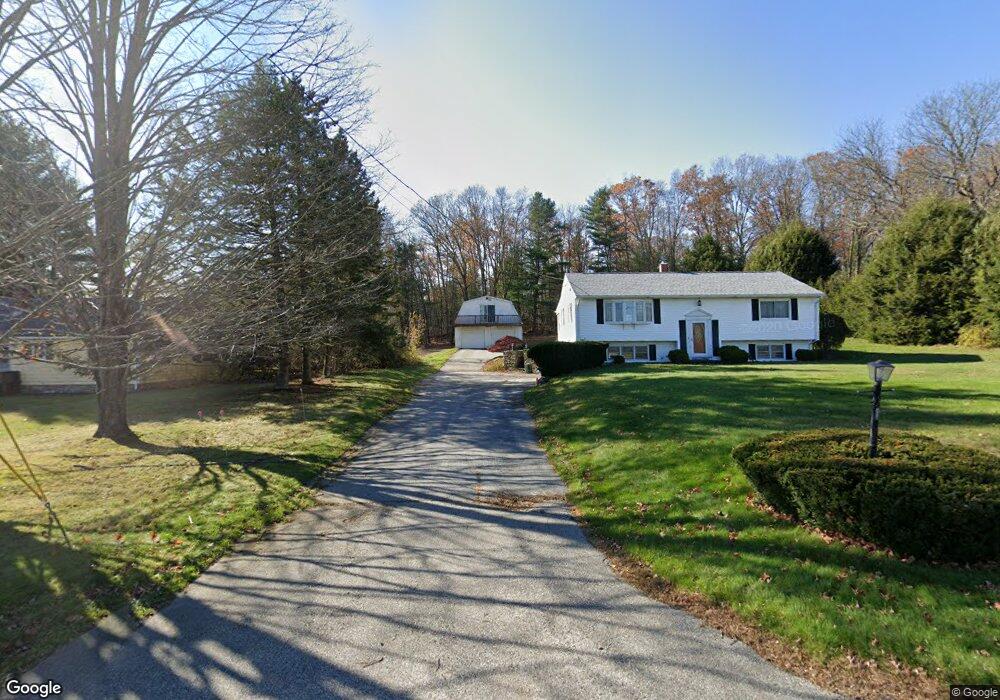
663 N Woodstock Rd Southbridge, MA 01550
Estimated Value: $370,000 - $391,000
2
Beds
1
Bath
1,544
Sq Ft
$246/Sq Ft
Est. Value
About This Home
This home is located at 663 N Woodstock Rd, Southbridge, MA 01550 and is currently estimated at $379,341, approximately $245 per square foot. 663 N Woodstock Rd is a home located in Worcester County with nearby schools including Trinity Catholic Academy.
Ownership History
Date
Name
Owned For
Owner Type
Purchase Details
Closed on
Sep 1, 2023
Sold by
Rondeau Armand O and Pnc Bank Na
Bought by
Daou Properties Llc
Current Estimated Value
Purchase Details
Closed on
Nov 4, 1985
Bought by
Rondeau Armand O and Rondeau Patricia
Create a Home Valuation Report for This Property
The Home Valuation Report is an in-depth analysis detailing your home's value as well as a comparison with similar homes in the area
Home Values in the Area
Average Home Value in this Area
Purchase History
| Date | Buyer | Sale Price | Title Company |
|---|---|---|---|
| Daou Properties Llc | $242,000 | None Available | |
| Daou Properties Llc | $242,000 | None Available | |
| Rondeau Armand O | -- | -- |
Source: Public Records
Mortgage History
| Date | Status | Borrower | Loan Amount |
|---|---|---|---|
| Previous Owner | Rondeau Armand O | $168,000 | |
| Previous Owner | Rondeau Armand O | $134,300 | |
| Previous Owner | Rondeau Armand O | $16,996 | |
| Previous Owner | Rondeau Armand O | $91,500 |
Source: Public Records
Tax History Compared to Growth
Tax History
| Year | Tax Paid | Tax Assessment Tax Assessment Total Assessment is a certain percentage of the fair market value that is determined by local assessors to be the total taxable value of land and additions on the property. | Land | Improvement |
|---|---|---|---|---|
| 2025 | $4,974 | $339,300 | $53,300 | $286,000 |
| 2024 | $4,631 | $303,500 | $44,500 | $259,000 |
| 2023 | $4,793 | $302,600 | $44,500 | $258,100 |
| 2022 | $4,899 | $273,700 | $38,100 | $235,600 |
| 2021 | $4,549 | $234,000 | $38,100 | $195,900 |
| 2020 | $4,404 | $226,100 | $38,100 | $188,000 |
| 2018 | $3,976 | $191,600 | $38,100 | $153,500 |
| 2017 | $4,213 | $204,800 | $38,100 | $166,700 |
| 2016 | $4,064 | $201,100 | $38,100 | $163,000 |
| 2015 | $4,094 | $201,100 | $38,100 | $163,000 |
| 2014 | $3,879 | $197,500 | $38,100 | $159,400 |
Source: Public Records
Map
Nearby Homes
- 717 Tipton Rock Rd
- 104 Hilltop Dr Unit 2
- 1023 N Woodstock Rd
- 366 Lebanon Hill Rd
- 325 Ashland Ave Unit 10
- 325 Ashland Ave Unit 2
- 325 Ashland Ave Unit 12
- 0 Alpine Dr
- 768 Ashland Ave
- 29 Arland Dr
- 0 Brentwood Dr
- 0 Old North Woodstock Rd
- 99 Lebanon Hill Rd
- 504 Alpine Dr
- 4 W Dudley Rd
- 0 Lebanon Hill Rd
- 1669 Route 169
- 38 Meadowbrook Rd
- 51 Warren St
- 320 Elm St
- 653 N Woodstock Rd
- 687 N Woodstock Rd
- 615 N Woodstock Rd
- 606 N Woodstock Rd
- 697 N Woodstock Rd
- 601 N Woodstock Rd
- 601 N Woodstock Rd
- 22 Upland Ave
- 30 Upland Ave
- 5 Upland Ave
- 17 Upland Ave
- 3 Grandview Dr
- 600 N Woodstock Rd
- 589 N Woodstock Rd
- 590 N Woodstock Rd
- 003A N Woodstock Rd
- 3 N Woodstock Rd
- 0. N Woodstock Rd
- 584 N Woodstock Rd
- 564 N Woodstock Rd