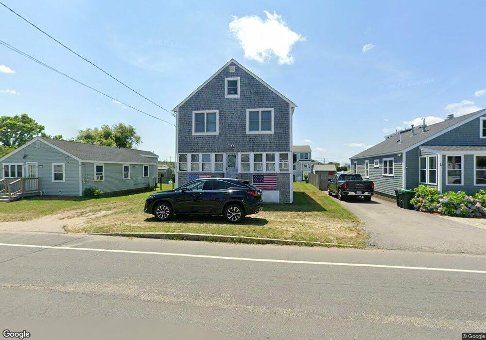
663 Ocean St Marshfield, MA 02050
Ocean Bluff-Brant Rock NeighborhoodEstimated Value: $704,680 - $838,000
5
Beds
2
Baths
1,632
Sq Ft
$471/Sq Ft
Est. Value
About This Home
This home is located at 663 Ocean St, Marshfield, MA 02050 and is currently estimated at $768,920, approximately $471 per square foot. 663 Ocean St is a home with nearby schools including Daniel Webster, Furnace Brook Middle School, and Marshfield High School.
Create a Home Valuation Report for This Property
The Home Valuation Report is an in-depth analysis detailing your home's value as well as a comparison with similar homes in the area
Home Values in the Area
Average Home Value in this Area
Tax History
| Year | Tax Paid | Tax Assessment Tax Assessment Total Assessment is a certain percentage of the fair market value that is determined by local assessors to be the total taxable value of land and additions on the property. | Land | Improvement |
|---|---|---|---|---|
| 2025 | $5,845 | $590,400 | $292,200 | $298,200 |
| 2024 | $6,235 | $600,100 | $278,300 | $321,800 |
| 2023 | $5,794 | $537,800 | $258,400 | $279,400 |
| 2022 | $5,794 | $447,400 | $208,700 | $238,700 |
| 2021 | $5,571 | $422,400 | $206,800 | $215,600 |
| 2020 | $5,315 | $398,700 | $188,900 | $209,800 |
| 2019 | $5,179 | $387,100 | $188,900 | $198,200 |
| 2018 | $5,123 | $383,200 | $188,900 | $194,300 |
| 2017 | $4,849 | $353,400 | $178,900 | $174,500 |
| 2016 | $4,607 | $331,900 | $169,000 | $162,900 |
| 2015 | $4,359 | $328,000 | $169,000 | $159,000 |
| 2014 | $4,023 | $302,700 | $155,100 | $147,600 |
Source: Public Records
Map
Nearby Homes
Your Personal Tour Guide
Ask me questions while you tour the home.