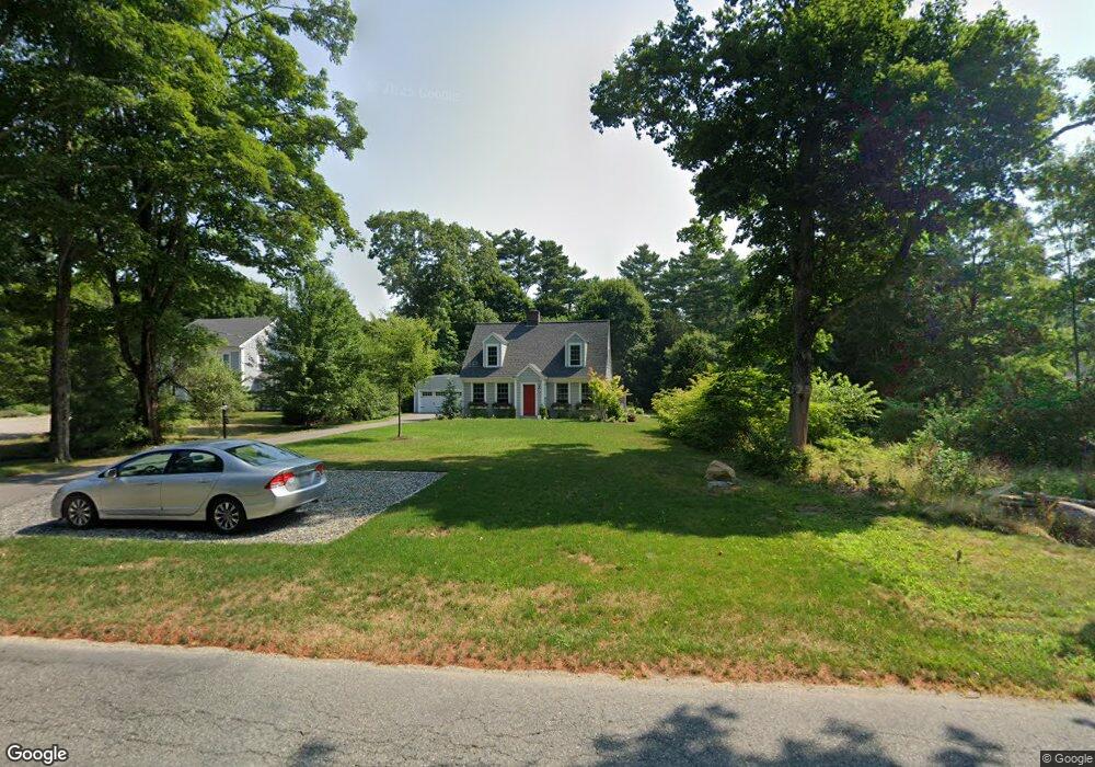
663 Point Rd Marion, MA 02738
Estimated Value: $639,000 - $772,000
3
Beds
2
Baths
1,858
Sq Ft
$365/Sq Ft
Est. Value
About This Home
This home is located at 663 Point Rd, Marion, MA 02738 and is currently estimated at $678,858, approximately $365 per square foot. 663 Point Rd is a home located in Plymouth County with nearby schools including Old Rochester Regional High School and Tabor Academy.
Ownership History
Date
Name
Owned For
Owner Type
Purchase Details
Closed on
May 19, 2008
Sold by
Dennehy Patrick T and Dennehy Carole R
Bought by
Sughrue Oliver Stevens and Sughrue Helene Collins
Current Estimated Value
Home Financials for this Owner
Home Financials are based on the most recent Mortgage that was taken out on this home.
Original Mortgage
$268,000
Interest Rate
5.91%
Mortgage Type
Purchase Money Mortgage
Purchase Details
Closed on
Apr 15, 1994
Sold by
Dennehy Nominee Rt and Dennehy
Bought by
Dennehy Carole R and Dennehy Norman C
Create a Home Valuation Report for This Property
The Home Valuation Report is an in-depth analysis detailing your home's value as well as a comparison with similar homes in the area
Purchase History
| Date | Buyer | Sale Price | Title Company |
|---|---|---|---|
| Sughrue Oliver Stevens | $335,000 | -- | |
| Dennehy Carole R | $75,000 | -- |
Source: Public Records
Mortgage History
| Date | Status | Borrower | Loan Amount |
|---|---|---|---|
| Open | Dennehy Carole R | $284,000 | |
| Closed | Dennehy Carole R | $268,000 | |
| Previous Owner | Dennehy Carole R | $100,000 | |
| Previous Owner | Dennehy Carole R | $25,000 |
Source: Public Records
Tax History
| Year | Tax Paid | Tax Assessment Tax Assessment Total Assessment is a certain percentage of the fair market value that is determined by local assessors to be the total taxable value of land and additions on the property. | Land | Improvement |
|---|---|---|---|---|
| 2025 | $5,310 | $569,700 | $251,200 | $318,500 |
| 2024 | $5,184 | $559,800 | $251,200 | $308,600 |
| 2023 | $4,132 | $437,700 | $222,800 | $214,900 |
| 2022 | $4,164 | $383,800 | $168,000 | $215,800 |
| 2021 | $3,924 | $346,600 | $144,500 | $202,100 |
| 2020 | $4,129 | $352,900 | $160,600 | $192,300 |
| 2019 | $3,892 | $352,900 | $160,600 | $192,300 |
| 2018 | $3,717 | $324,600 | $166,900 | $157,700 |
| 2017 | $3,617 | $317,000 | $166,900 | $150,100 |
| 2016 | $3,585 | $317,000 | $166,900 | $150,100 |
| 2015 | $3,553 | $319,800 | $154,500 | $165,300 |
Source: Public Records
Map
Nearby Homes
- 143 Cross Neck Rd
- 0 Cross Neck Rd Unit 73420524
- 0 Cross Neck Rd Unit 73466177
- 0 Cross Neck Rd Unit 73420525
- 0 Register Rd
- 4 Blackhall Ct
- 5 Hermitage Rd
- 25 Main St Unit 3
- 245 Wareham Rd
- 44 Register Rd
- 13 Cottage St
- 414 Point Rd
- 16 Vine St
- 929 Point Rd
- 45 Front St
- 25 West Ave
- 0 Rd Unit 73474504
- 2 Quelle Ln
- 13 Fieldstone Ln
- 0 Cromesett Rd (Off) Unit 73385395
Your Personal Tour Guide
Ask me questions while you tour the home.