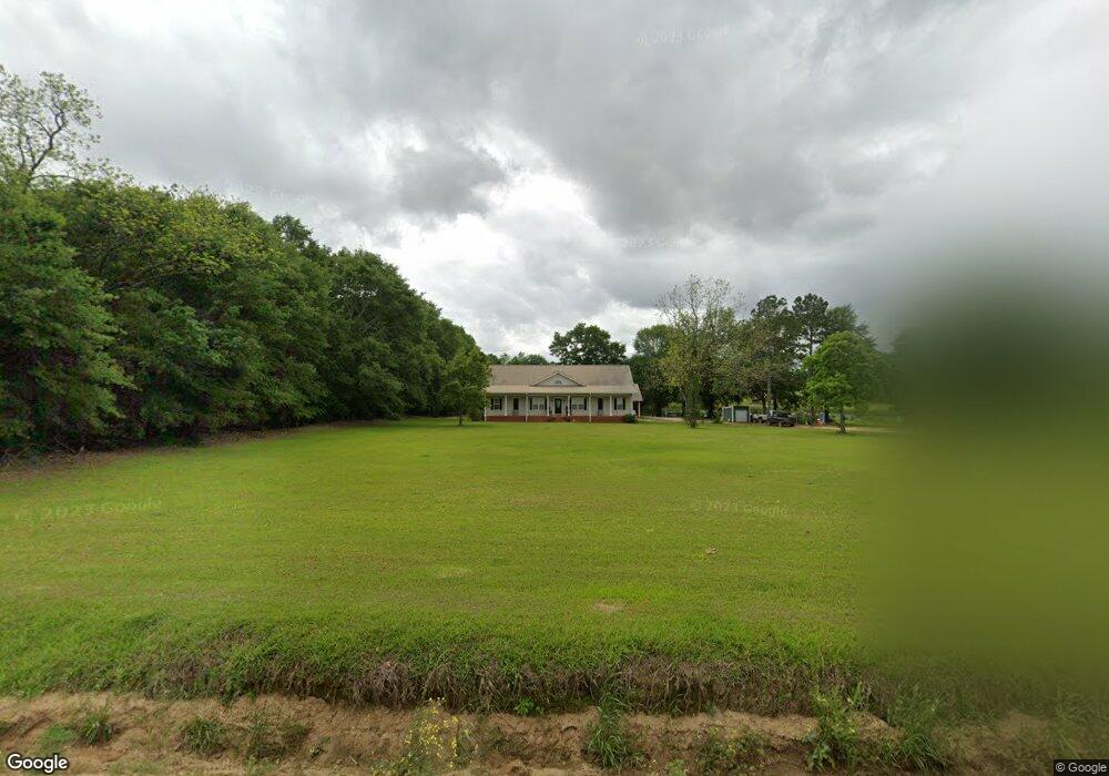
663 Whitfield Rd Moultrie, GA 31768
Estimated Value: $316,000 - $336,000
Studio
2
Baths
2,122
Sq Ft
$154/Sq Ft
Est. Value
About This Home
This home is located at 663 Whitfield Rd, Moultrie, GA 31768 and is currently estimated at $327,473, approximately $154 per square foot. 663 Whitfield Rd is a home located in Colquitt County with nearby schools including Doerun Elementary School, C.A. Gray Junior High School, and Willie J. Williams Middle School.
Ownership History
Date
Name
Owned For
Owner Type
Purchase Details
Closed on
Oct 11, 2000
Sold by
Massey Michael K
Bought by
Smith James Russell
Current Estimated Value
Purchase Details
Closed on
Feb 1, 2000
Bought by
Massey Michael K
Purchase Details
Closed on
Jul 8, 1999
Bought by
Massey Lee M
Purchase Details
Closed on
Apr 15, 1999
Bought by
Massey Lee M
Create a Home Valuation Report for This Property
The Home Valuation Report is an in-depth analysis detailing your home's value as well as a comparison with similar homes in the area
Purchase History
| Date | Buyer | Sale Price | Title Company |
|---|---|---|---|
| Smith James Russell | $45,000 | -- | |
| Massey Michael K | $30,000 | -- | |
| Massey Lee M | $32,100 | -- | |
| Massey Lee M | $10,000 | -- |
Source: Public Records
Tax History
| Year | Tax Paid | Tax Assessment Tax Assessment Total Assessment is a certain percentage of the fair market value that is determined by local assessors to be the total taxable value of land and additions on the property. | Land | Improvement |
|---|---|---|---|---|
| 2025 | $2,388 | $122,081 | $26,085 | $95,996 |
| 2024 | $2,388 | $124,215 | $19,565 | $104,650 |
| 2023 | $2,577 | $96,590 | $19,565 | $77,025 |
| 2022 | $1,998 | $85,921 | $17,390 | $68,531 |
| 2021 | $1,865 | $78,821 | $17,390 | $61,431 |
| 2020 | $1,899 | $78,821 | $17,390 | $61,431 |
| 2019 | $1,821 | $68,239 | $17,390 | $50,849 |
| 2018 | $1,745 | $68,239 | $17,390 | $50,849 |
| 2017 | $1,776 | $67,246 | $16,397 | $50,849 |
| 2016 | $1,799 | $67,246 | $16,397 | $50,849 |
| 2015 | $1,939 | $67,246 | $16,397 | $50,849 |
| 2014 | $1,903 | $71,655 | $16,397 | $55,258 |
| 2013 | -- | $71,655 | $16,397 | $55,258 |
Source: Public Records
Map
Nearby Homes
- 512 Hagin Still Rd
- 4043 Old Doerun Rd
- 1485 Bay Rd
- 318 E Culpepper Ave
- 827 Bonnie Tuk Rd
- 417 W Bay Ave
- 1440 Faison Rd
- 323 N Broad St
- Sardis Schley Church Rd
- 00 Rossman Dairy Rd
- 378 Old S R 33
- LOT 29 Merganser Ln
- LOT 32 Merganser Ln
- LOT 28 Merganser Ln
- LOT 26 Merganser Ln
- LOT 30 Merganser Ln
- Lot 45 Fox Trot Dr
- LOT 52 Fox Trot Dr
- LOT 58 Fox Trot Dr
- LOT 56 Fox Trot Dr
- 886 Dona Turner Rd
- 852 Dona Turner Rd
- 969 Dona Turner Rd
- 1186 Sam Sells Rd
- 1119 Dona Turner Rd
- 420 Whitfield Rd
- 1152 Dona Turner Rd
- 284 Whitfield Rd
- 1294 Sam Sells Rd
- 572 Dona Turner Rd
- TBD Sam Sells Rd
- 1444 Sam Sells Rd
- 1023 Sam Sells Rd
- 1403 Sam Sells Rd
- 1427 Sam Sells Rd
- 407 Mike Horne Rd
- 1331 Sam Sells Rd
- 1465 Sam Sells Rd
- 506 Dona Turner Rd
- 889 Sam Sells Rd
Your Personal Tour Guide
Ask me questions while you tour the home.