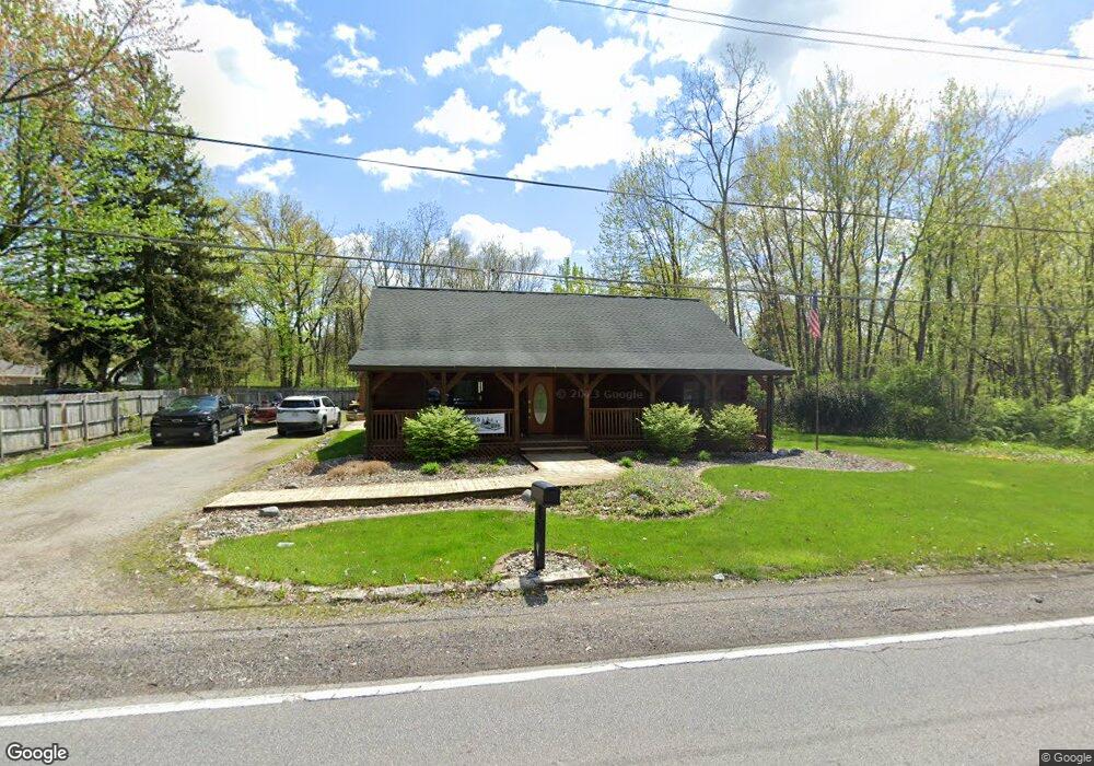
6630 Reed Rd Fort Wayne, IN 46835
Brookside-Parkerdale NeighborhoodEstimated Value: $246,000 - $288,062
2
Beds
2
Baths
1,984
Sq Ft
$135/Sq Ft
Est. Value
About This Home
This home is located at 6630 Reed Rd, Fort Wayne, IN 46835 and is currently estimated at $268,516, approximately $135 per square foot. 6630 Reed Rd is a home located in Allen County with nearby schools including Saint Joseph Central School, Jefferson Middle School, and Northrop High School.
Ownership History
Date
Name
Owned For
Owner Type
Purchase Details
Closed on
May 12, 2022
Sold by
Lauer Kenneth A and Lauer Constance J
Bought by
Hart Kyle Logan and Hart Zoya
Current Estimated Value
Home Financials for this Owner
Home Financials are based on the most recent Mortgage that was taken out on this home.
Original Mortgage
$218,500
Outstanding Balance
$206,452
Interest Rate
4.67%
Mortgage Type
New Conventional
Estimated Equity
$62,064
Purchase Details
Closed on
Oct 9, 2003
Sold by
Lauer Kenneth A and Lauer Constance J
Bought by
Lauer Kenneth A and Lauer Constance J
Home Financials for this Owner
Home Financials are based on the most recent Mortgage that was taken out on this home.
Original Mortgage
$35,000
Interest Rate
6.23%
Mortgage Type
Credit Line Revolving
Create a Home Valuation Report for This Property
The Home Valuation Report is an in-depth analysis detailing your home's value as well as a comparison with similar homes in the area
Home Values in the Area
Average Home Value in this Area
Purchase History
| Date | Buyer | Sale Price | Title Company |
|---|---|---|---|
| Lauer Kenneth A | -- | -- | |
| Hart Kyle Logan | $250,000 | Centurion Land Title |
Source: Public Records
Mortgage History
| Date | Status | Borrower | Loan Amount |
|---|---|---|---|
| Open | Hart Kyle Logan | $218,500 | |
| Previous Owner | Lauer Kenneth A | $35,000 |
Source: Public Records
Tax History Compared to Growth
Tax History
| Year | Tax Paid | Tax Assessment Tax Assessment Total Assessment is a certain percentage of the fair market value that is determined by local assessors to be the total taxable value of land and additions on the property. | Land | Improvement |
|---|---|---|---|---|
| 2024 | $3,003 | $274,200 | $26,600 | $247,600 |
| 2022 | $2,482 | $220,700 | $20,000 | $200,700 |
| 2021 | $2,280 | $203,300 | $19,200 | $184,100 |
| 2020 | $2,026 | $184,600 | $19,200 | $165,400 |
| 2019 | $1,882 | $172,500 | $19,200 | $153,300 |
| 2018 | $1,747 | $159,500 | $19,200 | $140,300 |
| 2017 | $1,654 | $150,800 | $19,200 | $131,600 |
| 2016 | $1,666 | $153,900 | $19,200 | $134,700 |
| 2014 | $1,437 | $139,300 | $19,200 | $120,100 |
| 2013 | $1,406 | $136,500 | $22,600 | $113,900 |
Source: Public Records
Map
Nearby Homes
- 4834 Starwood Dr
- 4731 Evard Rd
- 6914 Bradford Dr
- 6318 Sawmill Woods Dr
- 6219 Sawmill Woods Dr
- 6108 Crofton Dr
- 5937 Sawmill Woods Ct
- 5625 Mirando Dr
- 5948 Sawmill Woods Dr
- 5614 Kipling Ct
- 7028 Salge Dr
- 4734 Willow Brook Dr
- 4321 Foxknoll Cove
- 5615 Graber Dr
- 6309 Becker Dr
- 5032 Rothman Rd
- 5622 Sawmill Woods Blvd
- 5510 Pine Oak Ct
- 5729 Saint Joe Center Rd
- 6007 Cheshire Ct