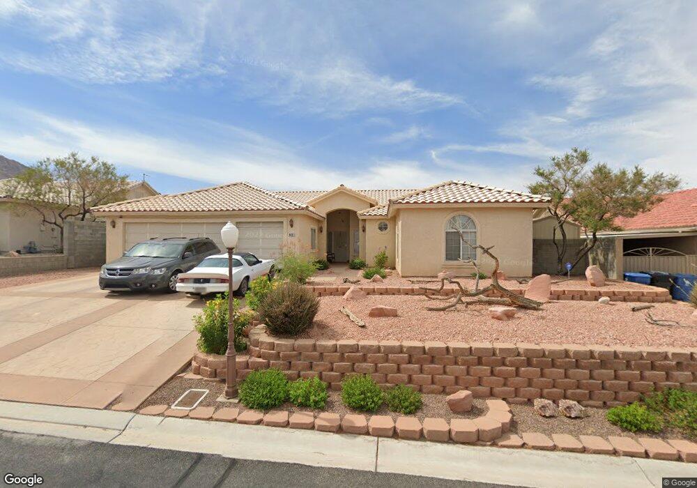
6631 Network Cir Las Vegas, NV 89156
Estimated Value: $509,165 - $602,000
4
Beds
3
Baths
2,318
Sq Ft
$238/Sq Ft
Est. Value
About This Home
This home is located at 6631 Network Cir, Las Vegas, NV 89156 and is currently estimated at $551,041, approximately $237 per square foot. 6631 Network Cir is a home located in Clark County with nearby schools including Mountain View Elementary School, Dr. William H. Bailey Middle School, and Sunrise Mountain High School.
Ownership History
Date
Name
Owned For
Owner Type
Purchase Details
Closed on
Aug 10, 2000
Sold by
Kelly William W
Bought by
Portwood Terry A and Portwood Judy L
Current Estimated Value
Home Financials for this Owner
Home Financials are based on the most recent Mortgage that was taken out on this home.
Original Mortgage
$201,900
Outstanding Balance
$73,052
Interest Rate
8.19%
Estimated Equity
$477,989
Purchase Details
Closed on
Jun 28, 1999
Sold by
Kelly William W
Bought by
Kelly William W and The William W Kelly Separate Property Tr
Purchase Details
Closed on
Jun 9, 1999
Sold by
Duke Dwayne and Duke Robin
Bought by
Kelly William W
Create a Home Valuation Report for This Property
The Home Valuation Report is an in-depth analysis detailing your home's value as well as a comparison with similar homes in the area
Home Values in the Area
Average Home Value in this Area
Purchase History
| Date | Buyer | Sale Price | Title Company |
|---|---|---|---|
| Portwood Terry A | $229,900 | Ati Title | |
| Kelly William W | -- | -- | |
| Kelly William W | $207,000 | Fidelity National Title Agen |
Source: Public Records
Mortgage History
| Date | Status | Borrower | Loan Amount |
|---|---|---|---|
| Open | Portwood Terry A | $201,900 |
Source: Public Records
Tax History Compared to Growth
Tax History
| Year | Tax Paid | Tax Assessment Tax Assessment Total Assessment is a certain percentage of the fair market value that is determined by local assessors to be the total taxable value of land and additions on the property. | Land | Improvement |
|---|---|---|---|---|
| 2025 | $2,239 | $130,055 | $33,250 | $96,805 |
| 2024 | $2,175 | $130,055 | $33,250 | $96,805 |
| 2023 | $2,175 | $125,232 | $33,250 | $91,982 |
| 2022 | $2,112 | $108,631 | $24,500 | $84,131 |
| 2021 | $2,050 | $102,892 | $22,750 | $80,142 |
| 2020 | $1,987 | $105,501 | $26,250 | $79,251 |
| 2019 | $1,930 | $100,175 | $22,050 | $78,125 |
| 2018 | $1,873 | $91,166 | $21,718 | $69,448 |
| 2017 | $2,433 | $82,957 | $20,825 | $62,132 |
| 2016 | $1,774 | $78,920 | $14,578 | $64,342 |
| 2015 | $1,771 | $64,065 | $10,413 | $53,652 |
| 2014 | $1,719 | $56,859 | $10,413 | $46,446 |
Source: Public Records
Map
Nearby Homes
- 2085 N Hollywood Blvd
- 6435 Heatherton Ave
- 6755 Warthog Ave
- 1330 Honey Lake St
- 6958 Lazy Sunset Ct
- 1345 Morning Sun Way
- 6271 Brynhurst Dr
- 1905 Eskam St
- 6800 E Lake Mead Blvd Unit 1034
- 6800 E Lake Mead Blvd Unit 2011
- 6800 E Lake Mead Blvd Unit 2083
- 6800 E Lake Mead Blvd Unit 2028
- 6800 E Lake Mead Blvd Unit 2072
- 6800 E Lake Mead Blvd Unit 2024
- 6800 E Lake Mead Blvd Unit 2076
- 1239 N Hollywood Blvd
- 6741 Solaron Ave
- 1932 Spindrift Ct
- 2093 Scanlon Ferry Ct Unit 103
- 1250 Bobrich Cir
- 6617 Network Cir
- 6645 Network Cir
- 6630 Network Cir
- 6603 Network Cir
- 6659 Network Cir
- 6644 Network Cir
- 6616 Network Cir
- 6630 E Owens Ave
- 6658 Network Cir
- 6610 E Owens Ave
- 6602 Network Cir
- 6673 Network Cir
- 6670 E Owens Ave
- 6637 Chapel Bells Ct
- 6651 Chapel Bells Ct
- 6581 Monterey Vista Ct
- 6623 Chapel Bells Ct
- 6671 Chapel Bells Ct
- 6588 Mount Palmer Ct
- 6680 E Owens Ave