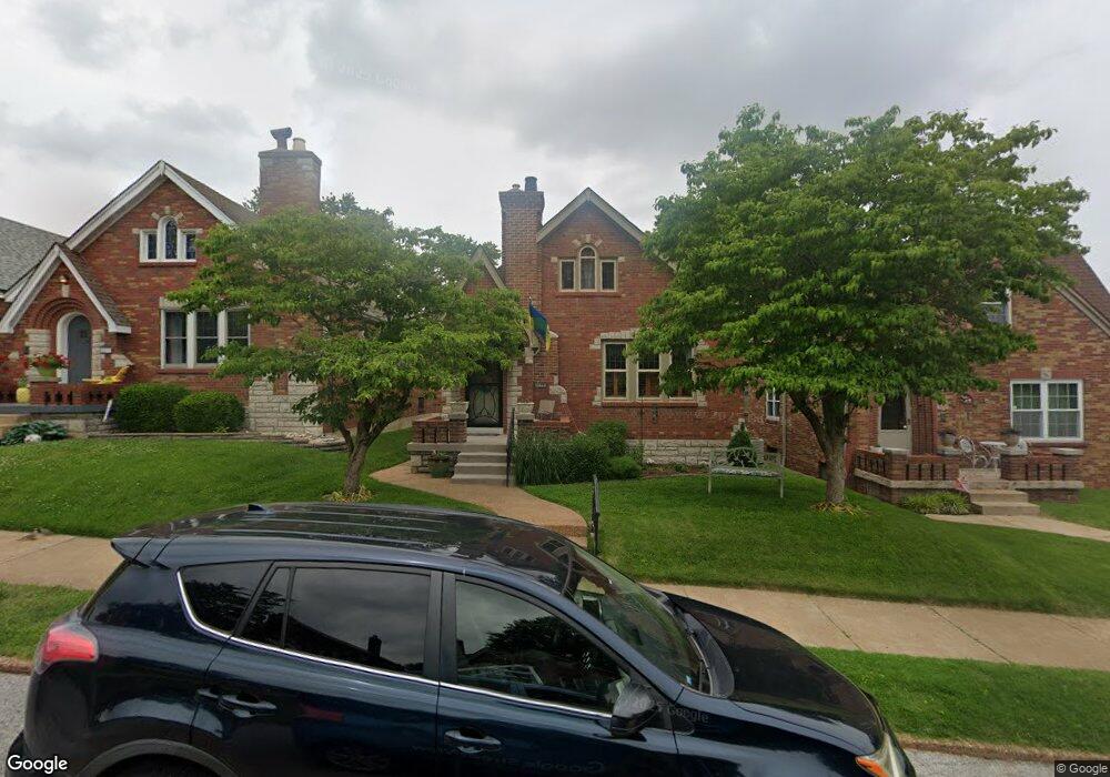
6633 Winnebago St Saint Louis, MO 63109
Lindenwood Park NeighborhoodEstimated Value: $348,000 - $401,000
4
Beds
2
Baths
2,350
Sq Ft
$155/Sq Ft
Est. Value
About This Home
This home is located at 6633 Winnebago St, Saint Louis, MO 63109 and is currently estimated at $364,355, approximately $155 per square foot. 6633 Winnebago St is a home located in St. Louis City with nearby schools including Mason Elementary School, Long International Middle School, and Roosevelt High School.
Ownership History
Date
Name
Owned For
Owner Type
Purchase Details
Closed on
Dec 21, 2012
Sold by
Misursca Paula
Bought by
Unnerstall Jay B and Unnerstall Patricia A
Current Estimated Value
Purchase Details
Closed on
Aug 24, 2000
Sold by
Thompson Jeanne L
Bought by
Misuraca Paula
Home Financials for this Owner
Home Financials are based on the most recent Mortgage that was taken out on this home.
Original Mortgage
$50,000
Interest Rate
8.21%
Mortgage Type
Purchase Money Mortgage
Create a Home Valuation Report for This Property
The Home Valuation Report is an in-depth analysis detailing your home's value as well as a comparison with similar homes in the area
Home Values in the Area
Average Home Value in this Area
Purchase History
| Date | Buyer | Sale Price | Title Company |
|---|---|---|---|
| Unnerstall Jay B | -- | Ust | |
| Misuraca Paula | -- | -- |
Source: Public Records
Mortgage History
| Date | Status | Borrower | Loan Amount |
|---|---|---|---|
| Previous Owner | Misuraca Paula | $50,000 |
Source: Public Records
Tax History Compared to Growth
Tax History
| Year | Tax Paid | Tax Assessment Tax Assessment Total Assessment is a certain percentage of the fair market value that is determined by local assessors to be the total taxable value of land and additions on the property. | Land | Improvement |
|---|---|---|---|---|
| 2025 | $4,005 | $56,590 | $3,330 | $53,260 |
| 2024 | $3,825 | $47,710 | $3,330 | $44,380 |
| 2023 | $3,825 | $47,710 | $3,330 | $44,380 |
| 2022 | $3,639 | $43,680 | $3,330 | $40,350 |
| 2021 | $3,633 | $43,680 | $3,330 | $40,350 |
| 2020 | $3,305 | $40,010 | $3,330 | $36,680 |
| 2019 | $3,294 | $40,020 | $3,330 | $36,690 |
| 2018 | $3,188 | $37,520 | $3,000 | $34,520 |
| 2017 | $3,134 | $37,530 | $3,000 | $34,520 |
| 2016 | $2,791 | $32,970 | $3,000 | $29,960 |
| 2015 | $2,530 | $32,960 | $3,000 | $29,960 |
| 2014 | $2,400 | $32,960 | $3,000 | $29,960 |
| 2013 | -- | $31,270 | $3,000 | $28,270 |
Source: Public Records
Map
Nearby Homes
- 6565 Winnebago St
- 6659 Tholozan Ave
- 6621 Tholozan Ave
- 6541 Lindenwood Place
- 6561 Bancroft Ave
- 6631 Pernod Ave
- 6611 Pernod Ave
- 6656 Oleatha Ave
- 6709 Lansdowne Ave
- 6973 Winona Ave
- 6517 Tholozan Ave
- 3815 Mccausland Ave Unit 4
- 6962 Sutherland Ave
- 6811 Marquette Ave
- 6439 Mardel Ave
- 6637 Devonshire Ave Unit 2
- 6409 Sutherland Ave
- 6600 Devonshire Ave Unit 5
- 6968 Lansdowne Ave
- 7038 Pernod Ave
- 6637 Winnebago St
- 6629 Winnebago St
- 6639 Winnebago St
- 6625 Winnebago St
- 6623 Winnebago St
- 6643 Winnebago St
- 6630 Lindenwood Place
- 6647 Winnebago St
- 6636 Lindenwood Place
- 6619 Winnebago St
- 6626 Lindenwood Place
- 6640 Lindenwood Place
- 6622 Lindenwood Place
- 6632 Winnebago St
- 6644 Lindenwood Place
- 6636 Winnebago St
- 6651 Winnebago St
- 6615 Winnebago St
- 6628 Winnebago St
- 6640 Winnebago St