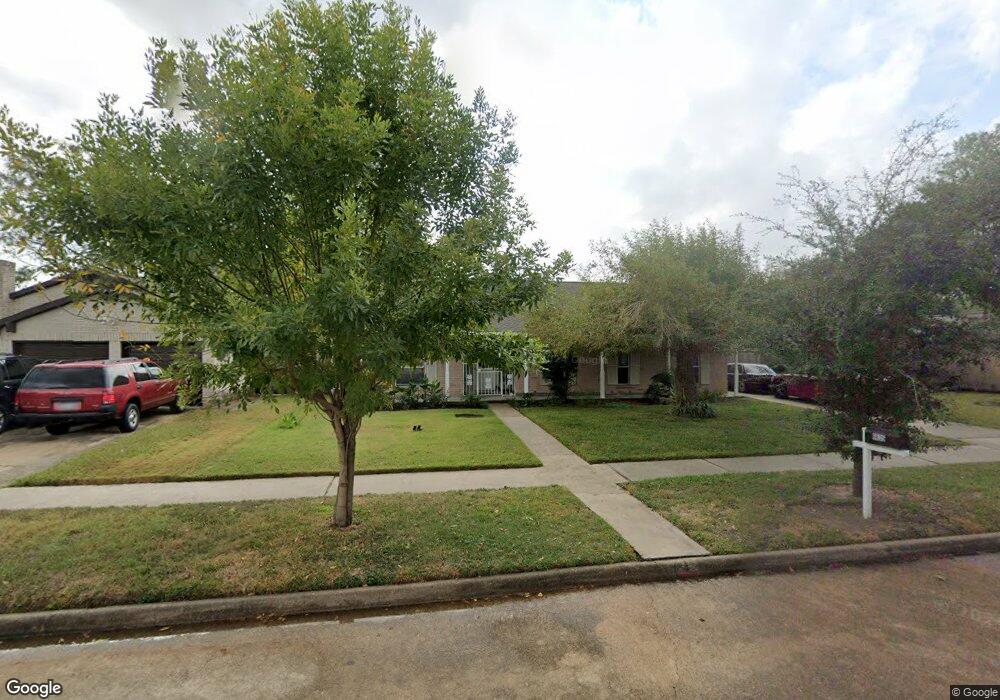
6635 Brownie Campbell Rd Houston, TX 77086
Estimated Value: $240,851 - $263,000
4
Beds
2
Baths
2,262
Sq Ft
$111/Sq Ft
Est. Value
About This Home
This home is located at 6635 Brownie Campbell Rd, Houston, TX 77086 and is currently estimated at $250,963, approximately $110 per square foot. 6635 Brownie Campbell Rd is a home located in Harris County with nearby schools including Kujawa EC/Pre-K/K School, Carmichael Elementary School, and Shotwell Middle School.
Ownership History
Date
Name
Owned For
Owner Type
Purchase Details
Closed on
Dec 8, 2017
Sold by
Brett Michael D
Bought by
Ochoa Rivera Arturo Yanez and Ochoa Becerra Carmen
Current Estimated Value
Purchase Details
Closed on
May 11, 2007
Sold by
Thexton Kevin
Bought by
Brett Michael D
Home Financials for this Owner
Home Financials are based on the most recent Mortgage that was taken out on this home.
Original Mortgage
$127,775
Interest Rate
10.5%
Mortgage Type
Purchase Money Mortgage
Purchase Details
Closed on
Oct 2, 2005
Sold by
Sykes Ruth
Bought by
Thexton Kevin
Create a Home Valuation Report for This Property
The Home Valuation Report is an in-depth analysis detailing your home's value as well as a comparison with similar homes in the area
Home Values in the Area
Average Home Value in this Area
Purchase History
| Date | Buyer | Sale Price | Title Company |
|---|---|---|---|
| Ochoa Rivera Arturo Yanez | -- | Metropolitan Escrow & Title | |
| Brett Michael D | -- | Startex Title Company | |
| Thexton Kevin | -- | -- |
Source: Public Records
Mortgage History
| Date | Status | Borrower | Loan Amount |
|---|---|---|---|
| Previous Owner | Brett Michael D | $127,775 |
Source: Public Records
Tax History Compared to Growth
Tax History
| Year | Tax Paid | Tax Assessment Tax Assessment Total Assessment is a certain percentage of the fair market value that is determined by local assessors to be the total taxable value of land and additions on the property. | Land | Improvement |
|---|---|---|---|---|
| 2025 | $5,881 | $250,476 | $40,067 | $210,409 |
| 2024 | $5,881 | $254,301 | $40,067 | $214,234 |
| 2023 | $5,881 | $259,198 | $40,067 | $219,131 |
| 2022 | $5,302 | $217,805 | $33,955 | $183,850 |
| 2021 | $4,380 | $180,364 | $33,955 | $146,409 |
| 2020 | $4,287 | $158,803 | $33,955 | $124,848 |
| 2019 | $4,356 | $155,205 | $17,299 | $137,906 |
| 2018 | $2,077 | $144,638 | $17,299 | $127,339 |
| 2017 | $3,964 | $146,470 | $15,534 | $130,936 |
| 2016 | $3,585 | $132,464 | $15,534 | $116,930 |
| 2015 | $2,492 | $122,958 | $15,534 | $107,424 |
| 2014 | $2,492 | $91,961 | $15,534 | $76,427 |
Source: Public Records
Map
Nearby Homes
- 6630 Brownie Campbell Rd
- 6654 Brownie Campbell Rd
- 6615 Winding Trace Dr
- 6722 Winding Trace Dr
- 6610 Northleaf Dr
- 10522 Northview Dr
- 11009 Panicum Ct
- 11006 Crinkleawn Dr
- 6502 Trail Valley Way
- 11021 Crenchrus Ct
- 11007 Tobasa Ct
- 7023 Sandswept Ln
- 6911 Silver Star Dr
- 10306 Jillana Kaye Dr
- 13610 Kaltenbrun Rd
- 13518 Kaltenbrun Rd
- 6822 Dusty Dawn Dr
- 7218 Winding Trace Dr
- 10214 Trade Winds Dr
- 6703 Deer Ridge Ln
- 6639 Brownie Campbell Rd
- 6631 Brownie Campbell Rd
- 6642 Canyon Way Dr
- 6643 Brownie Campbell Rd
- 6627 Brownie Campbell Rd
- 6646 Canyon Way Dr
- 6638 Canyon Way Dr
- 6650 Canyon Way Dr
- 6634 Canyon Way Dr
- 6634 Brownie Campbell Rd
- 6647 Brownie Campbell Rd
- 6638 Brownie Campbell Rd
- 6623 Brownie Campbell Rd
- 6626 Brownie Campbell Rd
- 6642 Brownie Campbell Rd
- 6654 Canyon Way Dr
- 6630 Canyon Way Dr
- 6651 Brownie Campbell Rd
- 6619 Brownie Campbell Rd
- 6646 Brownie Campbell Rd