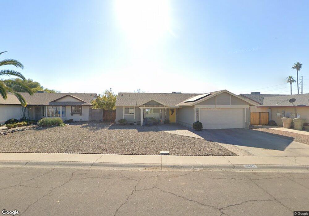
6635 W Mescal St Glendale, AZ 85304
Estimated Value: $294,349 - $382,000
--
Bed
2
Baths
1,221
Sq Ft
$285/Sq Ft
Est. Value
About This Home
This home is located at 6635 W Mescal St, Glendale, AZ 85304 and is currently estimated at $348,337, approximately $285 per square foot. 6635 W Mescal St is a home located in Maricopa County with nearby schools including Copperwood School, Ironwood High School, and Legacy Traditional School - Glendale.
Ownership History
Date
Name
Owned For
Owner Type
Purchase Details
Closed on
Feb 20, 2018
Sold by
Oso Deborah
Bought by
Oso Deborah Alice
Current Estimated Value
Home Financials for this Owner
Home Financials are based on the most recent Mortgage that was taken out on this home.
Original Mortgage
$138,750
Outstanding Balance
$117,509
Interest Rate
3.99%
Mortgage Type
New Conventional
Estimated Equity
$230,828
Purchase Details
Closed on
Sep 16, 2005
Sold by
Oso Olumayokun
Bought by
Oso Deborah
Purchase Details
Closed on
Jul 21, 2005
Sold by
Harris Deborah A
Bought by
Oso Deborah and Oso Olumayokin O
Create a Home Valuation Report for This Property
The Home Valuation Report is an in-depth analysis detailing your home's value as well as a comparison with similar homes in the area
Home Values in the Area
Average Home Value in this Area
Purchase History
| Date | Buyer | Sale Price | Title Company |
|---|---|---|---|
| Oso Deborah Alice | -- | Driggs Title Agency Inc | |
| Oso Deborah | -- | -- | |
| Oso Deborah | -- | -- |
Source: Public Records
Mortgage History
| Date | Status | Borrower | Loan Amount |
|---|---|---|---|
| Open | Oso Deborah Alice | $138,750 |
Source: Public Records
Tax History Compared to Growth
Tax History
| Year | Tax Paid | Tax Assessment Tax Assessment Total Assessment is a certain percentage of the fair market value that is determined by local assessors to be the total taxable value of land and additions on the property. | Land | Improvement |
|---|---|---|---|---|
| 2025 | $781 | $10,254 | -- | -- |
| 2024 | $798 | $9,765 | -- | -- |
| 2023 | $798 | $24,560 | $4,910 | $19,650 |
| 2022 | $790 | $18,720 | $3,740 | $14,980 |
| 2021 | $848 | $17,080 | $3,410 | $13,670 |
| 2020 | $861 | $15,660 | $3,130 | $12,530 |
| 2019 | $837 | $14,030 | $2,800 | $11,230 |
| 2018 | $817 | $12,800 | $2,560 | $10,240 |
| 2017 | $823 | $11,230 | $2,240 | $8,990 |
| 2016 | $818 | $11,110 | $2,220 | $8,890 |
| 2015 | $767 | $9,880 | $1,970 | $7,910 |
Source: Public Records
Map
Nearby Homes
- 10637 N 65th Ave
- 10960 N 67th Ave Unit 118
- 10960 N 67th Ave Unit 235
- 10960 N 67th Ave Unit 105
- 10960 N 67th Ave Unit 56
- 10960 N 67th Ave Unit 201
- 10960 N 67th Ave Unit 74
- 10960 N 67th Ave Unit 133
- 10960 N 67th Ave Unit 211
- 10960 N 67th Ave Unit 231
- 10960 N 67th Ave Unit 167
- 6319 W Mercer Ln
- 6534 W North Ln
- 6960 W Peoria Ave Unit 225
- 6960 W Peoria Ave Unit 2
- 6960 W Peoria Ave Unit 201
- 6960 W Peoria Ave Unit 67
- 6960 W Peoria Ave Unit 59
- 6960 W Peoria Ave Unit 210
- 6960 W Peoria Ave Unit 181
- 6629 W Mescal St
- 6641 W Mescal St Unit 3
- 6626 W Desert Cove Ave
- 6623 W Mescal St
- 6620 W Desert Cove Ave
- 6632 W Desert Cove Ave
- 11015 N 66th Dr
- 11021 N 66th Dr
- 11009 N 66th Dr
- 6634 W Mescal St
- 6614 W Desert Cove Ave
- 6640 W Mescal St Unit 3
- 6617 W Mescal St
- 6628 W Mescal St
- 6646 W Mescal St
- 11003 N 66th Dr
- 6652 W Mescal St
- 6622 W Mescal St
- 6608 W Desert Cove Ave
- 6611 W Mescal St