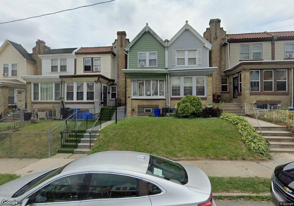
6638 Cornelius St Philadelphia, PA 19138
West Oak Lane NeighborhoodEstimated Value: $214,000 - $261,000
3
Beds
1
Bath
1,352
Sq Ft
$174/Sq Ft
Est. Value
About This Home
This home is located at 6638 Cornelius St, Philadelphia, PA 19138 and is currently estimated at $235,005, approximately $173 per square foot. 6638 Cornelius St is a home located in Philadelphia County with nearby schools including Anna B. Day School, Martin Luther King High School, and West Oak Lane Charter School.
Ownership History
Date
Name
Owned For
Owner Type
Purchase Details
Closed on
Oct 16, 2018
Sold by
Graham Shyree A
Bought by
Graham Benita A
Current Estimated Value
Purchase Details
Closed on
Jun 20, 2014
Sold by
Travis Raymond
Bought by
Travis Raymond and Graham Shyree A
Purchase Details
Closed on
Jun 23, 1965
Bought by
Raymond Travis and Raymond Ophelia
Create a Home Valuation Report for This Property
The Home Valuation Report is an in-depth analysis detailing your home's value as well as a comparison with similar homes in the area
Home Values in the Area
Average Home Value in this Area
Purchase History
| Date | Buyer | Sale Price | Title Company |
|---|---|---|---|
| Graham Benita A | -- | None Available | |
| Travis Raymond | -- | None Available | |
| Raymond Travis | -- | -- |
Source: Public Records
Tax History Compared to Growth
Tax History
| Year | Tax Paid | Tax Assessment Tax Assessment Total Assessment is a certain percentage of the fair market value that is determined by local assessors to be the total taxable value of land and additions on the property. | Land | Improvement |
|---|---|---|---|---|
| 2025 | $2,382 | $206,400 | $41,280 | $165,120 |
| 2024 | $2,382 | $206,400 | $41,280 | $165,120 |
| 2023 | $2,382 | $170,200 | $34,040 | $136,160 |
| 2022 | $1,811 | $170,200 | $34,040 | $136,160 |
| 2021 | $1,811 | $0 | $0 | $0 |
| 2020 | $1,811 | $0 | $0 | $0 |
| 2019 | $1,891 | $0 | $0 | $0 |
| 2018 | $1,110 | $0 | $0 | $0 |
| 2017 | $1,641 | $0 | $0 | $0 |
| 2016 | $1,221 | $0 | $0 | $0 |
| 2015 | -- | $0 | $0 | $0 |
| 2014 | -- | $117,200 | $10,080 | $107,120 |
| 2012 | -- | $12,128 | $1,881 | $10,247 |
Source: Public Records
Map
Nearby Homes
- 6661 Cornelius St
- 6635 Hollis St
- 6620 Cornelius St
- 1521 E Walnut Ln
- 1505 Beverly Rd
- 6332 E Wister St
- 1537 Beverly Rd
- 1544 Beverly Rd
- 6824 Rodney St
- 7243 Mansfield Ave
- 1559 E Pastorius St
- 1344 Narragansett St
- 7258 Mansfield Ave
- 1416-20 E Tulpehocken St
- 1544 E Tulpehocken St
- 2152 Stenton Ave
- 5843 Crittenden St
- 5839 Crittenden St
- 5831 Crittenden St
- 5829 Crittenden St
- 6640 Cornelius St
- 6636 Cornelius St
- 6642 Cornelius St
- 6634 Cornelius St
- 6644 Cornelius St
- 6632 Cornelius St
- 6646 Cornelius St
- 6630 Cornelius St
- 6648 Cornelius St
- 6628 Cornelius St
- 6626 Cornelius St
- 6650 Cornelius St
- 6939 Stenton Ave
- 6935 Stenton Ave
- 6941 Stenton Ave
- 6652 Cornelius St
- 6933 Stenton Ave
- 6624 Cornelius St
- 6931 Stenton Ave
- 6943 Stenton Ave