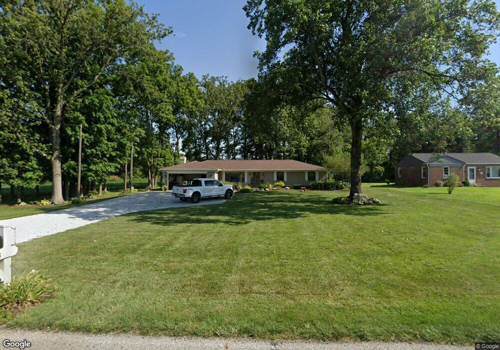
6638 W 300 S New Palestine, IN 46163
Estimated Value: $283,527 - $332,000
3
Beds
2
Baths
1,521
Sq Ft
$200/Sq Ft
Est. Value
About This Home
This home is located at 6638 W 300 S, New Palestine, IN 46163 and is currently estimated at $304,882, approximately $200 per square foot. 6638 W 300 S is a home located in Hancock County with nearby schools including Sugar Creek Elementary School, New Palestine Jr High School, and New Palestine High School.
Ownership History
Date
Name
Owned For
Owner Type
Purchase Details
Closed on
Jan 29, 2018
Sold by
Roseman Keith Allen
Bought by
Roseman Keith and Roseman Kim
Current Estimated Value
Purchase Details
Closed on
Dec 16, 2011
Sold by
Kleiman Merriam L
Bought by
Roseman Keith
Home Financials for this Owner
Home Financials are based on the most recent Mortgage that was taken out on this home.
Original Mortgage
$104,000
Outstanding Balance
$71,143
Interest Rate
4.01%
Mortgage Type
Future Advance Clause Open End Mortgage
Estimated Equity
$233,739
Create a Home Valuation Report for This Property
The Home Valuation Report is an in-depth analysis detailing your home's value as well as a comparison with similar homes in the area
Home Values in the Area
Average Home Value in this Area
Purchase History
| Date | Buyer | Sale Price | Title Company |
|---|---|---|---|
| Roseman Keith | -- | None Available | |
| Roseman Keith | -- | None Available |
Source: Public Records
Mortgage History
| Date | Status | Borrower | Loan Amount |
|---|---|---|---|
| Open | Roseman Keith | $104,000 |
Source: Public Records
Tax History Compared to Growth
Tax History
| Year | Tax Paid | Tax Assessment Tax Assessment Total Assessment is a certain percentage of the fair market value that is determined by local assessors to be the total taxable value of land and additions on the property. | Land | Improvement |
|---|---|---|---|---|
| 2024 | $1,509 | $202,400 | $47,500 | $154,900 |
| 2023 | $1,524 | $182,900 | $47,500 | $135,400 |
| 2022 | $1,171 | $156,400 | $32,100 | $124,300 |
| 2021 | $1,040 | $133,000 | $32,100 | $100,900 |
| 2020 | $880 | $124,900 | $29,900 | $95,000 |
| 2019 | $826 | $117,100 | $29,900 | $87,200 |
| 2018 | $736 | $117,100 | $29,900 | $87,200 |
| 2017 | $799 | $120,500 | $29,900 | $90,600 |
| 2016 | $809 | $116,400 | $28,800 | $87,600 |
| 2014 | $853 | $113,900 | $27,700 | $86,200 |
| 2013 | -- | $114,400 | $27,700 | $86,700 |
Source: Public Records
Map
Nearby Homes
- 2974 S Kings Way
- 6589 S Kings Way
- 2639 S Kings Way
- 6127 W David Wayne Dr
- 2460 S Wildflower Ln
- 2419 S Wildflower Ln
- 0 W 600 S Unit MBR22040612
- 6922 W Briarwood Blvd
- 6084 W Deer Run Dr
- 4980 S Canton Cir
- 2433 S Copperstone Dr
- 3756 S Fallow Trail
- 5976 W Countryside Dr
- 7264 W Beyers Ct
- 6238 W Us Highway 52
- 2775 High Acres East St
- 6357 W U S 52
- 7204 W Christian Dr
- 3948 S Woodfield Dr
- 7888 Magnolia St
- 6620 W 300 S
- 6620 W 300 S Np
- 6596 W 300 S
- 6513 W 300 S
- 2928 S Kings Way
- 6837 W 300 S
- 3113 S 700 W
- 6392 W 300 S
- 6392 W 300 S
- 6899 W 300 S
- 6362 W 300 S
- 6349 W Buckskin Ct
- 6340 W 300 S
- 6644 W Cross Trail
- 6620 W Cross Trail
- 6594 W Cross Trail
- 6718 W Willow Grove Dr
- 6349 W Prairie Ct
- 6570 W Cross Trail
- 3263 S Rosewind Dr