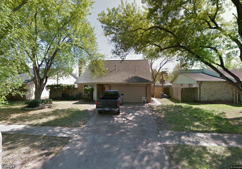
6639 Sandswept Ln Houston, TX 77086
North Houston NeighborhoodEstimated Value: $221,719 - $248,000
4
Beds
2
Baths
1,840
Sq Ft
$126/Sq Ft
Est. Value
About This Home
This home is located at 6639 Sandswept Ln, Houston, TX 77086 and is currently estimated at $231,180, approximately $125 per square foot. 6639 Sandswept Ln is a home located in Harris County with nearby schools including Kujawa EC/Pre-K/K School, Carmichael Elementary School, and Shotwell Middle School.
Ownership History
Date
Name
Owned For
Owner Type
Purchase Details
Closed on
Dec 20, 2001
Sold by
Mcdermott Christopher R
Bought by
Mcdermott Christopher R and Mcdermott Wendy M
Current Estimated Value
Home Financials for this Owner
Home Financials are based on the most recent Mortgage that was taken out on this home.
Original Mortgage
$40,764
Interest Rate
7.15%
Mortgage Type
FHA
Create a Home Valuation Report for This Property
The Home Valuation Report is an in-depth analysis detailing your home's value as well as a comparison with similar homes in the area
Home Values in the Area
Average Home Value in this Area
Purchase History
| Date | Buyer | Sale Price | Title Company |
|---|---|---|---|
| Mcdermott Christopher R | -- | Fidelity National Title |
Source: Public Records
Mortgage History
| Date | Status | Borrower | Loan Amount |
|---|---|---|---|
| Closed | Mcdermott Christopher R | $40,764 |
Source: Public Records
Tax History Compared to Growth
Tax History
| Year | Tax Paid | Tax Assessment Tax Assessment Total Assessment is a certain percentage of the fair market value that is determined by local assessors to be the total taxable value of land and additions on the property. | Land | Improvement |
|---|---|---|---|---|
| 2025 | $883 | $210,483 | $39,200 | $171,283 |
| 2024 | $883 | $213,655 | $39,200 | $174,455 |
| 2023 | $883 | $220,893 | $39,200 | $181,693 |
| 2022 | $3,662 | $183,302 | $33,220 | $150,082 |
| 2021 | $3,321 | $152,876 | $33,220 | $119,656 |
| 2020 | $3,356 | $143,141 | $33,220 | $109,921 |
| 2019 | $3,173 | $138,202 | $16,939 | $121,263 |
| 2018 | $1,116 | $129,026 | $16,939 | $112,087 |
| 2017 | $2,528 | $120,891 | $15,211 | $105,680 |
| 2016 | $2,298 | $109,607 | $15,211 | $94,396 |
| 2015 | $1,614 | $103,352 | $15,211 | $88,141 |
| 2014 | $1,614 | $76,989 | $15,211 | $61,778 |
Source: Public Records
Map
Nearby Homes
- 6615 Winding Trace Dr
- 6722 Winding Trace Dr
- 10522 Northview Dr
- 6502 Trail Valley Way
- 6630 Brownie Campbell Rd
- 6654 Brownie Campbell Rd
- 10306 Jillana Kaye Dr
- 6911 Silver Star Dr
- 6610 Northleaf Dr
- 7002 Sandswept Ln
- 6822 Dusty Dawn Dr
- 6606 Dusty Dawn Dr
- 7023 Sandswept Ln
- 11009 Panicum Ct
- 11006 Crinkleawn Dr
- 6703 Deer Ridge Ln
- 10214 Trade Winds Dr
- 11021 Crenchrus Ct
- 11007 Tobasa Ct
- 13610 Kaltenbrun Rd
- 6635 Sandswept Ln
- 6643 Sandswept Ln
- 6706 Trail Valley Way
- 6631 Sandswept Ln
- 6702 Trail Valley Way
- 6710 Trail Valley Way
- 6647 Sandswept Ln
- 6638 Sandswept Ln
- 6714 Trail Valley Way
- 6642 Sandswept Ln
- 6634 Sandswept Ln
- 6627 Sandswept Ln
- 6646 Sandswept Ln
- 6630 Sandswept Ln
- 6626 Trail Valley Way
- 6623 Sandswept Ln
- 6703 Sandswept Ln
- 6626 Sandswept Ln
- 10335 Mountain Park Dr
- 6622 Trail Valley Way