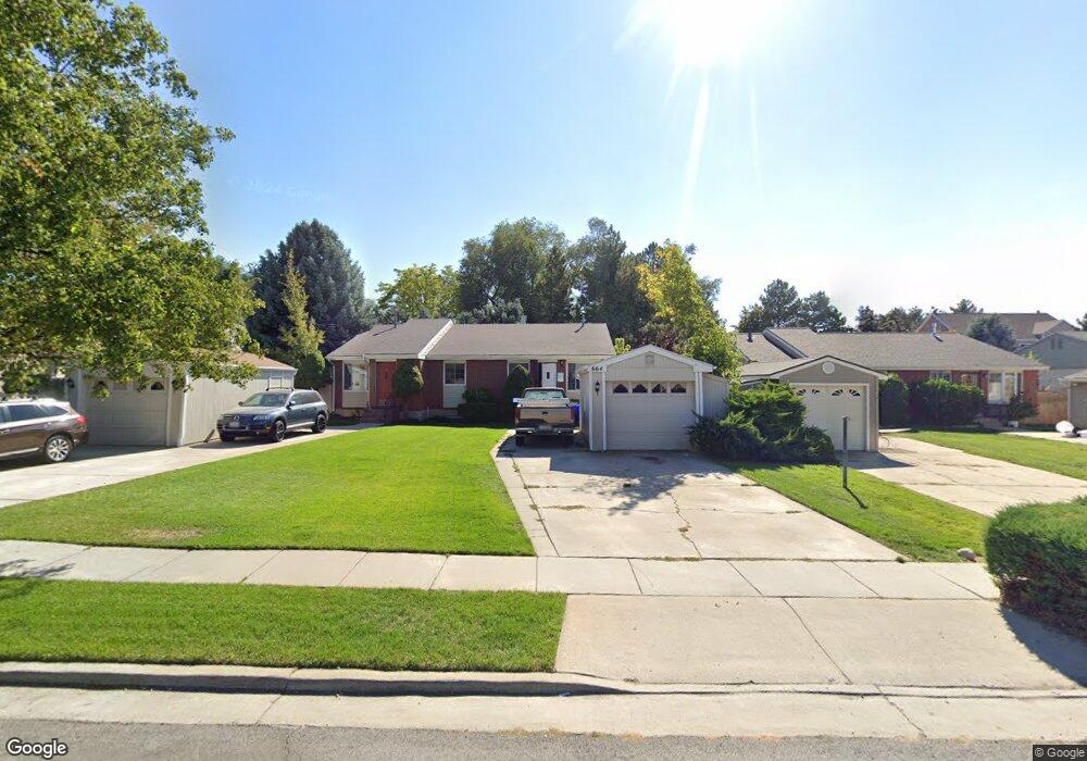
664 Angie Cir Unit 670 Midvale, UT 84047
Estimated Value: $694,000 - $838,000
5
Beds
4
Baths
2,196
Sq Ft
$356/Sq Ft
Est. Value
About This Home
This home is located at 664 Angie Cir Unit 670, Midvale, UT 84047 and is currently estimated at $781,354, approximately $355 per square foot. 664 Angie Cir Unit 670 is a home located in Salt Lake County with nearby schools including East Midvale Elementary School, Hillcrest High School, and Midvale Middle School.
Ownership History
Date
Name
Owned For
Owner Type
Purchase Details
Closed on
Oct 5, 2020
Sold by
Heward James C and Heward Jessica L
Bought by
664 & 670 E Angie Circle Llc
Current Estimated Value
Home Financials for this Owner
Home Financials are based on the most recent Mortgage that was taken out on this home.
Original Mortgage
$313,000
Outstanding Balance
$278,397
Interest Rate
2.9%
Mortgage Type
New Conventional
Estimated Equity
$502,957
Purchase Details
Closed on
Feb 27, 2017
Sold by
Heward James C and Heward Jessica J
Bought by
664 & 670 E Angie Circle Llc
Home Financials for this Owner
Home Financials are based on the most recent Mortgage that was taken out on this home.
Original Mortgage
$262,000
Interest Rate
4.12%
Mortgage Type
New Conventional
Purchase Details
Closed on
Apr 2, 2014
Sold by
Heward James C
Bought by
664 & 670 Angie Circle Llc
Home Financials for this Owner
Home Financials are based on the most recent Mortgage that was taken out on this home.
Original Mortgage
$220,500
Interest Rate
4.38%
Mortgage Type
New Conventional
Purchase Details
Closed on
Feb 25, 2014
Sold by
Robbins Donaldson Brent
Bought by
Heward James C
Home Financials for this Owner
Home Financials are based on the most recent Mortgage that was taken out on this home.
Original Mortgage
$220,500
Interest Rate
4.38%
Mortgage Type
New Conventional
Purchase Details
Closed on
Feb 24, 2014
Sold by
Heward James C
Bought by
Hewco Llc
Home Financials for this Owner
Home Financials are based on the most recent Mortgage that was taken out on this home.
Original Mortgage
$220,500
Interest Rate
4.38%
Mortgage Type
New Conventional
Purchase Details
Closed on
Dec 16, 2004
Sold by
Robbins Don B and Robbins Bette J
Bought by
Robbins Donaldson B and Robbins Elizabeth J
Home Financials for this Owner
Home Financials are based on the most recent Mortgage that was taken out on this home.
Original Mortgage
$100,000
Interest Rate
5.7%
Mortgage Type
New Conventional
Create a Home Valuation Report for This Property
The Home Valuation Report is an in-depth analysis detailing your home's value as well as a comparison with similar homes in the area
Home Values in the Area
Average Home Value in this Area
Purchase History
| Date | Buyer | Sale Price | Title Company |
|---|---|---|---|
| 664 & 670 E Angie Circle Llc | -- | Integrated Ttl Ins Svcs Llc | |
| Heward James C | -- | Integrated Ttl Ins Svcs Llc | |
| 664 & 670 E Angie Circle Llc | -- | Monument Title Ins Co | |
| Heward James C | -- | Moument Title Ins Co | |
| 664 & 670 Angie Circle Llc | -- | None Available | |
| Heward James C | -- | Preferred Title & Escrow Ins | |
| Hewco Llc | -- | Accommodation | |
| Robbins Donaldson B | -- | Meridian Title | |
| Robbins Don B | -- | Meridian Title |
Source: Public Records
Mortgage History
| Date | Status | Borrower | Loan Amount |
|---|---|---|---|
| Open | Heward James C | $313,000 | |
| Previous Owner | Heward James C | $262,000 | |
| Previous Owner | Heward James C | $220,500 | |
| Previous Owner | Robbins Don B | $100,000 |
Source: Public Records
Tax History Compared to Growth
Tax History
| Year | Tax Paid | Tax Assessment Tax Assessment Total Assessment is a certain percentage of the fair market value that is determined by local assessors to be the total taxable value of land and additions on the property. | Land | Improvement |
|---|---|---|---|---|
| 2025 | $4,309 | $741,700 | $173,900 | $567,800 |
| 2024 | $4,309 | $707,500 | $164,100 | $543,400 |
| 2023 | $4,046 | $658,200 | $156,000 | $502,200 |
| 2022 | $4,249 | $675,200 | $130,000 | $545,200 |
| 2021 | $3,817 | $518,600 | $120,000 | $398,600 |
| 2020 | $3,696 | $475,200 | $98,600 | $376,600 |
| 2019 | $3,622 | $453,700 | $93,000 | $360,700 |
| 2018 | $3,218 | $407,700 | $93,000 | $314,700 |
| 2017 | $3,254 | $396,200 | $93,000 | $303,200 |
| 2016 | $3,037 | $358,600 | $93,000 | $265,600 |
| 2015 | $2,393 | $277,700 | $91,100 | $186,600 |
| 2014 | $2,436 | $276,100 | $92,100 | $184,000 |
Source: Public Records
Map
Nearby Homes
- 6886 S 670 E
- 6874 S 595 E Unit 66
- 6890 S 725 E Unit A
- 618 E Cobblestone Ln
- 668 E Cobblestone Ln
- 512 E Larchwood Dr
- 6969 S Free Land Ave
- 6934 S 745 E Unit C
- 6936 S 775 E Unit B
- 6907 S 800 E
- 734 E Bogart Ln Unit 108
- 550 E Villager Ln
- 7083 Village Place
- 761 E Gables Ln
- 6948 S 855 E
- 375 E 6815 S
- 6969 S 855 E
- 888 E 6895 S Unit 3
- 326 E 6815 S
- 841 E Newbold Cir
- 676 Angie Cir Unit 678
- 654 Angie Cir Unit 656
- 6848 S 700 E Unit 6850
- 644 Angie Cir Unit 646
- 6880 S 700 E
- 659 Angie Cir Unit 661
- 659 E Angie Cir
- 673 Angie Cir
- 6876 S 700 E
- 675 E 6910 S Unit 8
- 675 Countryside Ct Unit 675
- 679 E 6910 S
- 679 Countryside Ct Unit 7
- 679 Countryside Ct Unit 679
- 634 Angie Cir Unit 636
- 683 E 6910 S
- 6824 S 700 E
- 683 E Countryside Ct
- 6872 S 700 E Unit 3
- 687 Countryside Ct Unit 5