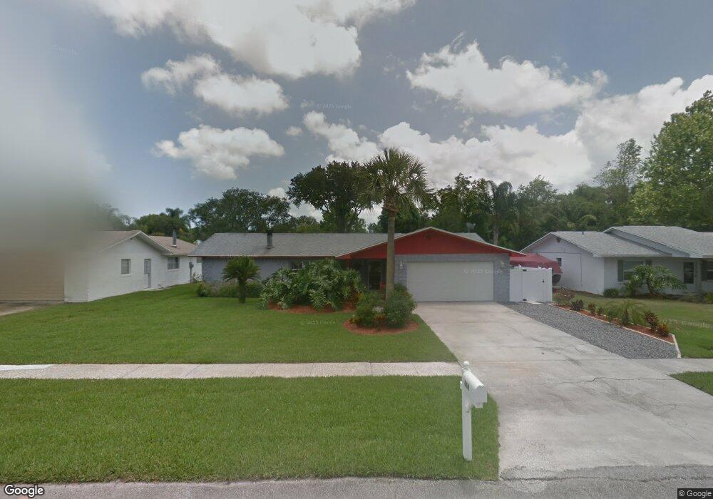
664 Branch Dr Port Orange, FL 32127
Port Orange West NeighborhoodEstimated Value: $318,000 - $413,000
3
Beds
2
Baths
1,503
Sq Ft
$247/Sq Ft
Est. Value
About This Home
This home is located at 664 Branch Dr, Port Orange, FL 32127 and is currently estimated at $370,766, approximately $246 per square foot. 664 Branch Dr is a home located in Volusia County with nearby schools including Sweetwater Elementary School, Creekside Middle School, and Spruce Creek High School.
Ownership History
Date
Name
Owned For
Owner Type
Purchase Details
Closed on
Sep 29, 2023
Sold by
Laporte Paul Adalard and Laporte Ann Marie
Bought by
Laporte Paul Adalard and Laporte Paul Adalard
Current Estimated Value
Purchase Details
Closed on
Sep 27, 2023
Sold by
Laporte Ann Marie and Laporte Paul Adalard
Bought by
Laporte Paul Adalard and Laporte Ann Marie
Purchase Details
Closed on
Mar 15, 1991
Bought by
Laporte Ann Marie
Purchase Details
Closed on
Sep 15, 1979
Bought by
Laporte Ann Marie
Create a Home Valuation Report for This Property
The Home Valuation Report is an in-depth analysis detailing your home's value as well as a comparison with similar homes in the area
Home Values in the Area
Average Home Value in this Area
Purchase History
| Date | Buyer | Sale Price | Title Company |
|---|---|---|---|
| Laporte Paul Adalard | $100 | None Listed On Document | |
| Laporte Paul Adalard | $100 | None Listed On Document | |
| Laporte Ann Marie | $100 | -- | |
| Laporte Ann Marie | $46,900 | -- |
Source: Public Records
Tax History Compared to Growth
Tax History
| Year | Tax Paid | Tax Assessment Tax Assessment Total Assessment is a certain percentage of the fair market value that is determined by local assessors to be the total taxable value of land and additions on the property. | Land | Improvement |
|---|---|---|---|---|
| 2025 | $1,461 | $125,395 | -- | -- |
| 2024 | $1,461 | $121,862 | -- | -- |
| 2023 | $1,461 | $118,313 | $0 | $0 |
| 2022 | $1,394 | $114,867 | $0 | $0 |
| 2021 | $1,411 | $111,521 | $0 | $0 |
| 2020 | $1,372 | $109,981 | $0 | $0 |
| 2019 | $1,321 | $107,508 | $0 | $0 |
| 2018 | $1,314 | $105,503 | $0 | $0 |
| 2017 | $1,310 | $103,333 | $0 | $0 |
| 2016 | $1,298 | $101,208 | $0 | $0 |
| 2015 | $1,333 | $100,504 | $0 | $0 |
| 2014 | $1,334 | $99,706 | $0 | $0 |
Source: Public Records
Map
Nearby Homes
- 653 Sweetwood Dr
- 771 Tumblebrook Dr
- 714 Hawks Ridge Rd
- 769 Osprey Dr
- 761 Tumblebrook Dr
- 749 Tumblebrook Dr
- 5836 Spruce Creek Woods Dr
- 823 Bayridge Ln
- 5949 Kendrew Dr
- 5994 Seminole Woods Dr
- 740 English Oaks Dr
- 5822 Spruce Creek Woods Dr
- 739 English Oaks Dr
- 5936 Boggs Ford Rd
- 5953 Boggs Ford Rd
- 783 Highgarden Dr
- 732 English Oaks Dr
- 725 English Oaks Dr
- 722 English Oaks Dr
- 720 English Oaks Dr
- 662 Branch Dr
- 666 Branch Dr
- 667 George Miller Cir
- 665 George Miller Cir
- 668 Branch Dr
- 669 George Miller Cir
- 663 Branch Dr
- 662 Tumblebrook Dr
- 654 Tumblebrook Dr
- 670 Branch Dr
- 669 Branch Dr
- 670 George Miller Cir
- 652 Tumblebrook Dr
- 657 Tumblebrook Dr
- 664 George Miller Cir
- 659 Tumblebrook Dr
- 673 Branch Dr
- 672 Branch Dr
- 649 Sweetwood Dr
- 654 Sweetwood Dr