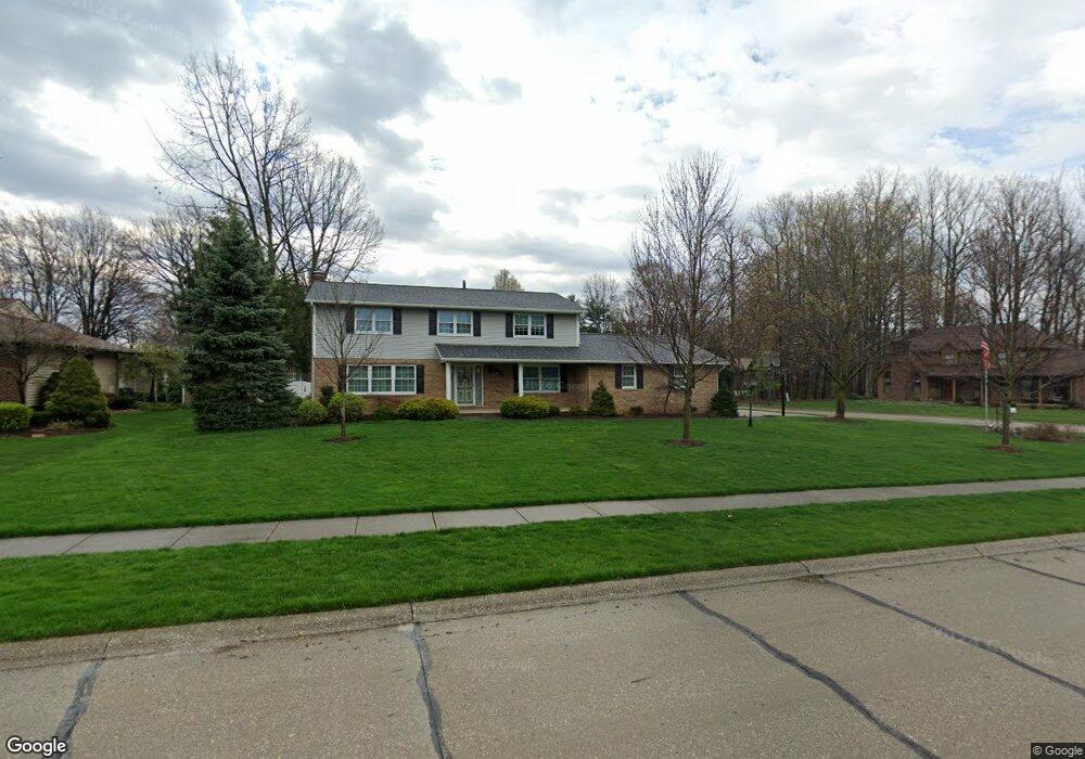
664 Clark Dr Tallmadge, OH 44278
Estimated Value: $378,815 - $432,000
4
Beds
2
Baths
2,412
Sq Ft
$167/Sq Ft
Est. Value
About This Home
This home is located at 664 Clark Dr, Tallmadge, OH 44278 and is currently estimated at $402,454, approximately $166 per square foot. 664 Clark Dr is a home located in Summit County with nearby schools including Tallmadge Middle School, Tallmadge High School, and Middlebury Academy.
Ownership History
Date
Name
Owned For
Owner Type
Purchase Details
Closed on
May 23, 2024
Sold by
Looman Ernest Wilford and Looman Judith A
Bought by
Looman Family Fortress Trust and Looman
Current Estimated Value
Purchase Details
Closed on
May 7, 2024
Sold by
Looman Ernest Wilford and Looman Judith A
Bought by
Looman Family Fortress Trust and Looman
Create a Home Valuation Report for This Property
The Home Valuation Report is an in-depth analysis detailing your home's value as well as a comparison with similar homes in the area
Home Values in the Area
Average Home Value in this Area
Purchase History
| Date | Buyer | Sale Price | Title Company |
|---|---|---|---|
| Looman Family Fortress Trust | -- | None Listed On Document | |
| Looman Family Fortress Trust | -- | None Listed On Document |
Source: Public Records
Tax History Compared to Growth
Tax History
| Year | Tax Paid | Tax Assessment Tax Assessment Total Assessment is a certain percentage of the fair market value that is determined by local assessors to be the total taxable value of land and additions on the property. | Land | Improvement |
|---|---|---|---|---|
| 2025 | $4,545 | $100,272 | $28,910 | $71,362 |
| 2024 | $4,545 | $100,272 | $28,910 | $71,362 |
| 2023 | $4,545 | $100,272 | $28,910 | $71,362 |
| 2022 | $4,710 | $85,929 | $24,710 | $61,219 |
| 2021 | $4,731 | $85,929 | $24,710 | $61,219 |
| 2020 | $4,694 | $85,930 | $24,710 | $61,220 |
| 2019 | $4,724 | $78,180 | $12,930 | $65,250 |
| 2018 | $4,161 | $78,180 | $12,930 | $65,250 |
| 2017 | $3,452 | $78,180 | $12,930 | $65,250 |
| 2016 | $3,723 | $65,830 | $12,930 | $52,900 |
| 2015 | $3,452 | $65,830 | $12,930 | $52,900 |
| 2014 | $3,429 | $65,890 | $12,930 | $52,960 |
| 2013 | $3,393 | $66,330 | $12,930 | $53,400 |
Source: Public Records
Map
Nearby Homes
- 617 Northeast Ave
- 557 Wring Dr
- 0 Northeast Ave Unit 5114314
- 313 Whittlesey Dr
- 185 Reserve Dr
- 0 East Ave
- 1072 Carol Ln
- 532 Beverly Dr
- 213 Green Hill Dr
- 368 Knollwood Ave
- 0 North Ave Unit 5116540
- 243 S Munroe Rd
- 617 North Ave
- 206 Fawnwood Dr
- 779 Atwood Dr
- 288 S Munroe Rd
- 528 Fernwood Ave
- 1029 Maple St
- 313 Southeast Ave
- 98 Benjamin Way
- 676 Clark Dr
- 390 Regency Park Dr
- 369 Regency Park Dr
- 379 Regency Park Dr
- 688 Clark Dr
- 667 Clark Dr
- 657 Clark Dr
- 677 Clark Dr
- 400 Regency Park Dr
- 638 Clark Dr
- 647 Clark Dr
- 395 Regency Park Dr
- 687 Clark Dr
- 637 Clark Dr
- 403 Regency Park Dr
- 702 Clark Dr
- 410 Regency Park Dr
- 207 Kensington Park Cir
- 697 Clark Dr
- 682 Sydney Place