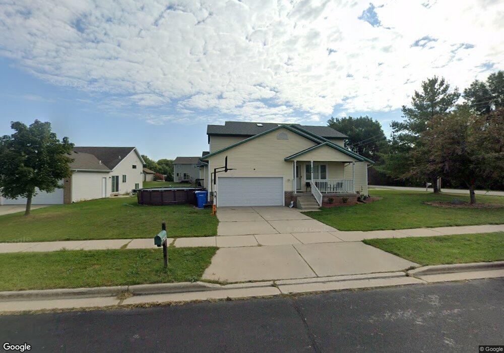
664 S Burr Oak Ave Oregon, WI 53575
Estimated Value: $556,000 - $906,000
6
Beds
6
Baths
3,637
Sq Ft
$184/Sq Ft
Est. Value
About This Home
This home is located at 664 S Burr Oak Ave, Oregon, WI 53575 and is currently estimated at $669,149, approximately $183 per square foot. 664 S Burr Oak Ave is a home located in Dane County with nearby schools including Rome Corners Intermediate School, Oregon Middle School, and Oregon High School.
Ownership History
Date
Name
Owned For
Owner Type
Purchase Details
Closed on
Jul 9, 2021
Sold by
Neol Becki L
Bought by
Noel Steven M and Noel Becki L
Current Estimated Value
Purchase Details
Closed on
Apr 29, 2021
Sold by
Lease Mary Jo
Bought by
Noel Becki L
Home Financials for this Owner
Home Financials are based on the most recent Mortgage that was taken out on this home.
Original Mortgage
$292,500
Interest Rate
2.9%
Mortgage Type
New Conventional
Purchase Details
Closed on
Oct 22, 2020
Sold by
Lease Mary Jo
Bought by
Lease Mary Jo and Mary Jo Lease Revocable Living Trust
Purchase Details
Closed on
Aug 31, 2005
Sold by
Lease James P
Bought by
Lease Mary Jo
Home Financials for this Owner
Home Financials are based on the most recent Mortgage that was taken out on this home.
Original Mortgage
$155,000
Interest Rate
5.89%
Mortgage Type
Future Advance Clause Open End Mortgage
Create a Home Valuation Report for This Property
The Home Valuation Report is an in-depth analysis detailing your home's value as well as a comparison with similar homes in the area
Home Values in the Area
Average Home Value in this Area
Purchase History
| Date | Buyer | Sale Price | Title Company |
|---|---|---|---|
| Noel Steven M | -- | None Available | |
| Noel Becki L | $390,000 | None Available | |
| Lease Mary Jo | -- | None Listed On Document | |
| Lease Mary Jo | $340,000 | None Available |
Source: Public Records
Mortgage History
| Date | Status | Borrower | Loan Amount |
|---|---|---|---|
| Previous Owner | Noel Becki L | $292,500 | |
| Previous Owner | Lease Mary Jo | $155,000 |
Source: Public Records
Tax History Compared to Growth
Tax History
| Year | Tax Paid | Tax Assessment Tax Assessment Total Assessment is a certain percentage of the fair market value that is determined by local assessors to be the total taxable value of land and additions on the property. | Land | Improvement |
|---|---|---|---|---|
| 2024 | $9,725 | $570,600 | $72,800 | $497,800 |
| 2023 | $9,436 | $570,600 | $72,800 | $497,800 |
| 2021 | $8,463 | $471,100 | $72,800 | $398,300 |
| 2020 | $8,152 | $439,400 | $72,800 | $366,600 |
| 2019 | $8,071 | $428,800 | $72,800 | $356,000 |
| 2018 | $7,672 | $407,200 | $72,800 | $334,400 |
| 2017 | $7,377 | $384,000 | $72,800 | $311,200 |
| 2016 | $7,298 | $369,100 | $72,800 | $296,300 |
| 2015 | $7,100 | $355,800 | $72,800 | $283,000 |
| 2014 | $6,887 | $345,800 | $72,800 | $273,000 |
| 2013 | $7,066 | $332,500 | $72,800 | $259,700 |
Source: Public Records
Map
Nearby Homes
- 859 Pleasant Oak Dr
- 182 Ames St
- 141 Amanda Ct
- 924 Brynhill Dr
- 163 Hickory Ct
- 168 Hickory Ct
- 192 State St
- 280 Ash St
- 485 Foxfield Rd
- 498 Foxfield Rd
- 507 Janesville St
- 126 Thomson Ln
- 920 Carnoustie Way
- 130 Jwana Cir
- 826 Sumac St
- 669 N Woods Edge Dr
- The Birchwood Plan at Autumn Ridge
- The Mulberry Plan at Autumn Ridge
- The Lily Plan at Autumn Ridge
- The Lavender Plan at Autumn Ridge
- 656 S Burr Oak Ave
- 1105 Lincoln Rd
- 1121 Union Rd
- 648 S Burr Oak Ave
- 648 S Burr Oak Ave Unit 648 South Burr Oak Avenue
- 702 Leeward Ln
- 1125 Union Rd
- L1 Lincoln Rd
- 1109 Lincoln Rd
- 1101 Union Rd
- 710 Leeward Ln
- 1131 Union Rd
- 640 S Burr Oak Ave
- 1113 Lincoln Rd
- 705 Leeward Ln
- 701 Leeward Ln Unit 701
- 718 Leeward Ln
- 713 Leeward Ln
- 1133 Union Rd
- 635 S Burr Oak Ave