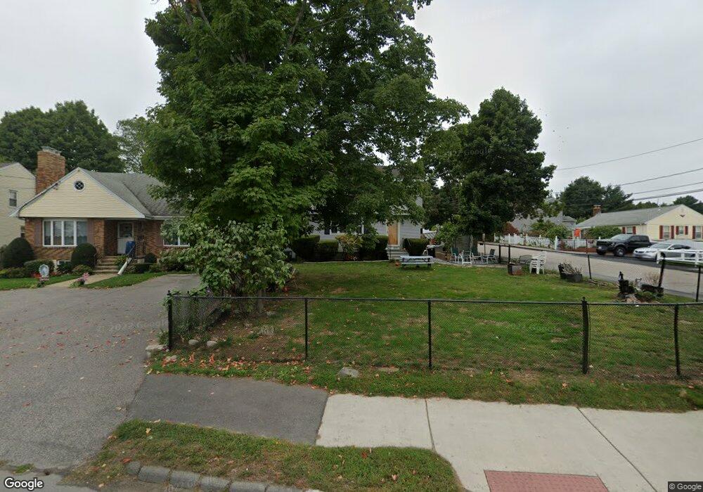
664 Trapelo Rd Waltham, MA 02452
North Waltham NeighborhoodEstimated Value: $892,738 - $1,002,000
4
Beds
2
Baths
2,212
Sq Ft
$425/Sq Ft
Est. Value
About This Home
This home is located at 664 Trapelo Rd, Waltham, MA 02452 and is currently estimated at $939,935, approximately $424 per square foot. 664 Trapelo Rd is a home located in Middlesex County with nearby schools including Northeast Elementary School, John F Kennedy Middle School, and Waltham Sr High School.
Ownership History
Date
Name
Owned For
Owner Type
Purchase Details
Closed on
May 18, 2016
Sold by
Maffei Joseph M
Bought by
Joseph M Maffei Ft
Current Estimated Value
Purchase Details
Closed on
Jun 18, 2004
Sold by
Maffei Anne Marie J
Bought by
Maffei Joseph M
Home Financials for this Owner
Home Financials are based on the most recent Mortgage that was taken out on this home.
Original Mortgage
$243,000
Interest Rate
6.12%
Purchase Details
Closed on
Dec 1, 1993
Sold by
Maffei Ralph A and Maffei Mary K
Bought by
Maffei Joseph M
Home Financials for this Owner
Home Financials are based on the most recent Mortgage that was taken out on this home.
Original Mortgage
$64,000
Interest Rate
6.69%
Mortgage Type
Purchase Money Mortgage
Create a Home Valuation Report for This Property
The Home Valuation Report is an in-depth analysis detailing your home's value as well as a comparison with similar homes in the area
Home Values in the Area
Average Home Value in this Area
Purchase History
| Date | Buyer | Sale Price | Title Company |
|---|---|---|---|
| Joseph M Maffei Ft | -- | -- | |
| Maffei Joseph M | -- | -- | |
| Maffei Joseph M | $80,000 | -- |
Source: Public Records
Mortgage History
| Date | Status | Borrower | Loan Amount |
|---|---|---|---|
| Previous Owner | Maffei Joseph M | $243,000 | |
| Previous Owner | Maffei Joseph M | $64,000 |
Source: Public Records
Tax History
| Year | Tax Paid | Tax Assessment Tax Assessment Total Assessment is a certain percentage of the fair market value that is determined by local assessors to be the total taxable value of land and additions on the property. | Land | Improvement |
|---|---|---|---|---|
| 2025 | $7,559 | $769,800 | $399,400 | $370,400 |
| 2024 | $7,221 | $749,100 | $381,700 | $367,400 |
| 2023 | $7,136 | $691,500 | $346,400 | $345,100 |
| 2022 | $7,118 | $639,000 | $311,000 | $328,000 |
| 2021 | $4,615 | $625,700 | $311,000 | $314,700 |
| 2020 | $7,083 | $592,700 | $289,800 | $302,900 |
| 2019 | $6,779 | $535,500 | $286,300 | $249,200 |
| 2018 | $0 | $487,500 | $265,100 | $222,400 |
| 2017 | $5,813 | $462,800 | $240,400 | $222,400 |
| 2016 | $5,491 | $448,600 | $226,200 | $222,400 |
| 2015 | $5,349 | $407,400 | $197,900 | $209,500 |
Source: Public Records
Map
Nearby Homes
- 107 Clocktower Dr Unit 3302
- 345 Bishops Forest Dr
- 289 Bishops Forest Dr
- 33 Jacqueline Rd Unit D
- 45 Webster Rd
- 1105 Lexington St Unit 6-4
- 14 Piedmont Ave
- 353 Concord Ave
- 133 Lake St
- 9 April Ln Unit 9
- 31 Greensbrook Way
- 89 Hardy Pond Rd
- 63 Montclair Ave
- 100 Shirley Rd
- 15 Bird Hill Rd
- 501 Lexington St Unit 11
- 23 Hillcrest St
- 28 Hillcrest St
- 249 Lake St
- 12 Curve St
Your Personal Tour Guide
Ask me questions while you tour the home.