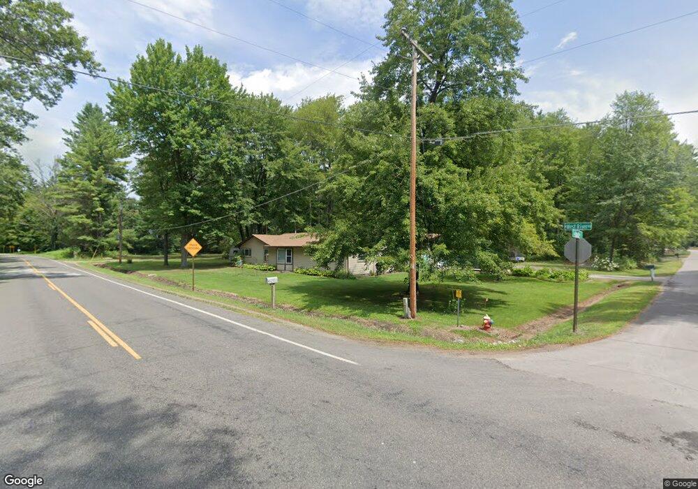
664 W Donald Ln Sanford, MI 48657
Estimated Value: $152,000 - $200,000
3
Beds
2
Baths
1,092
Sq Ft
$169/Sq Ft
Est. Value
About This Home
This home is located at 664 W Donald Ln, Sanford, MI 48657 and is currently estimated at $184,192, approximately $168 per square foot. 664 W Donald Ln is a home located in Midland County with nearby schools including Meridian Elementary School, Meridian Junior High School, and Meridian Early College High School.
Ownership History
Date
Name
Owned For
Owner Type
Purchase Details
Closed on
Sep 30, 2022
Sold by
Gary D Keefer D and Gary Shelby J
Bought by
Burns Richard Allen and Burns Cynthia Lou
Current Estimated Value
Purchase Details
Closed on
Nov 12, 2021
Sold by
Keefer Shelby J
Bought by
Burns Richard Allen and Burns Cynthia Lou
Home Financials for this Owner
Home Financials are based on the most recent Mortgage that was taken out on this home.
Original Mortgage
$95,000
Interest Rate
3.01%
Mortgage Type
Land Contract Argmt. Of Sale
Purchase Details
Closed on
Oct 22, 2001
Sold by
Deshano Const
Bought by
Keefer Gary D and Keefer Shelby J H
Create a Home Valuation Report for This Property
The Home Valuation Report is an in-depth analysis detailing your home's value as well as a comparison with similar homes in the area
Home Values in the Area
Average Home Value in this Area
Purchase History
| Date | Buyer | Sale Price | Title Company |
|---|---|---|---|
| Burns Richard Allen | $125,000 | Mt Pleasant Abstract & Title | |
| Burns Richard Allen | $125,000 | None Available | |
| Keefer Gary D | $99,900 | -- |
Source: Public Records
Mortgage History
| Date | Status | Borrower | Loan Amount |
|---|---|---|---|
| Previous Owner | Burns Richard Allen | $95,000 |
Source: Public Records
Tax History Compared to Growth
Tax History
| Year | Tax Paid | Tax Assessment Tax Assessment Total Assessment is a certain percentage of the fair market value that is determined by local assessors to be the total taxable value of land and additions on the property. | Land | Improvement |
|---|---|---|---|---|
| 2025 | $3,364 | $89,400 | $0 | $0 |
| 2024 | $688 | $79,100 | $0 | $0 |
| 2023 | $640 | $66,700 | $0 | $0 |
| 2022 | $2,918 | $54,500 | $0 | $0 |
| 2021 | $1,828 | $52,300 | $0 | $0 |
| 2020 | $1,812 | $52,400 | $0 | $0 |
| 2019 | $1,749 | $51,500 | $51,500 | $0 |
| 2018 | $1,718 | $49,800 | $49,800 | $0 |
| 2017 | $0 | $50,200 | $50,200 | $0 |
| 2016 | $1,537 | $49,400 | $49,400 | $0 |
| 2014 | -- | $47,500 | $47,500 | $0 |
Source: Public Records
Map
Nearby Homes
- 634 W Donald Ln
- 530 W Irish St
- 738 W Irish St
- 319 N Cedar St
- 33 Ferro St
- 3619 N Sadler Dr
- 1958 N Seven Mile
- 0 Crescent St
- 2039 Crescent Rd
- 0 N Meridian Rd Unit 20251025295
- 7285 N 5 Mile Rd
- 486 W Woodland Dr
- 444 W Crawford Dr
- 4011 N Francis Shores Rd
- 769 W Maplecrest Dr
- 1549 N 7 Mile Rd
- 450 W Wackerly Rd
- 4109 N Maplecrest Dr
- 1984 N Green Meadow St
- 4270 N Francis Shores Ave
- 2764 N West River Rd
- 658 W Donald St
- 658 W Donald Ln
- 658 W Donald Ln
- 605 W Brownlee Rd
- 2797 N West River Rd
- 2807 N West River Rd
- 634 W Donald Ln
- 2817 N West River Rd
- 597 W Brownlee Rd
- 623 W Peterson Dr
- 618 W Peterson Dr
- 618 W Peterson Dr
- 619 W Peterson Dr
- 616 W Brownlee Rd
- 575 W Brownlee Rd
- 602 W Brownlee Rd
- 602 W Peterson Dr
- 602 W Peterson Dr
- 620 W Donald Ln