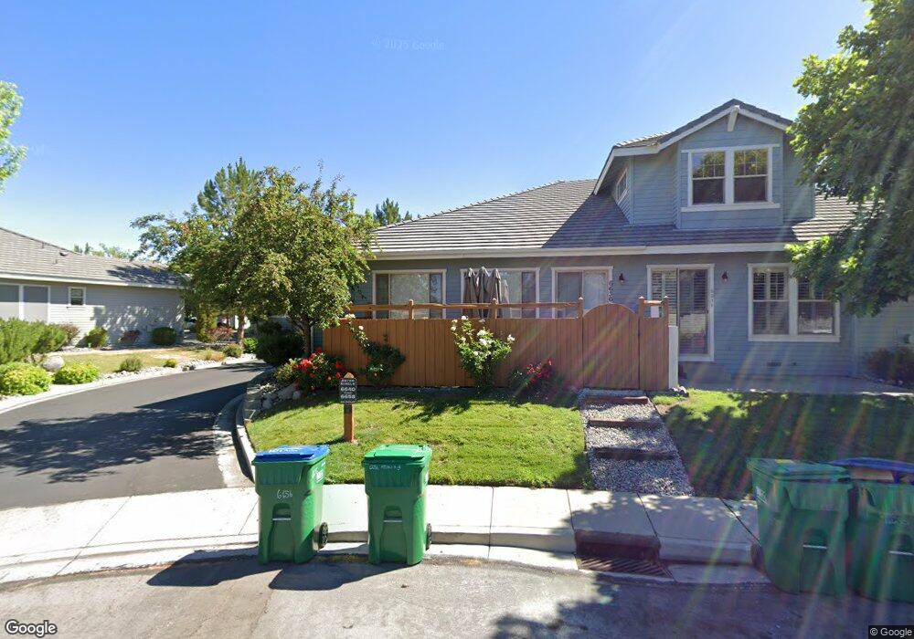
6640 Aston Cir Sparks, NV 89436
Wingfield Springs NeighborhoodEstimated Value: $507,000 - $553,000
3
Beds
3
Baths
2,028
Sq Ft
$259/Sq Ft
Est. Value
About This Home
This home is located at 6640 Aston Cir, Sparks, NV 89436 and is currently estimated at $525,278, approximately $259 per square foot. 6640 Aston Cir is a home located in Washoe County with nearby schools including Van Gorder Elementary School, Sky Ranch Middle School, and Spanish Springs High School.
Ownership History
Date
Name
Owned For
Owner Type
Purchase Details
Closed on
Aug 18, 2017
Sold by
Duerr H Richard and Duerr Shirley W
Bought by
Ardans Lance P and Ardans Lisa A
Current Estimated Value
Home Financials for this Owner
Home Financials are based on the most recent Mortgage that was taken out on this home.
Original Mortgage
$332,500
Outstanding Balance
$277,221
Interest Rate
3.93%
Mortgage Type
New Conventional
Estimated Equity
$248,057
Create a Home Valuation Report for This Property
The Home Valuation Report is an in-depth analysis detailing your home's value as well as a comparison with similar homes in the area
Home Values in the Area
Average Home Value in this Area
Purchase History
| Date | Buyer | Sale Price | Title Company |
|---|---|---|---|
| Ardans Lance P | $350,000 | Ticor Title Reno |
Source: Public Records
Mortgage History
| Date | Status | Borrower | Loan Amount |
|---|---|---|---|
| Open | Ardans Lance P | $332,500 |
Source: Public Records
Tax History Compared to Growth
Tax History
| Year | Tax Paid | Tax Assessment Tax Assessment Total Assessment is a certain percentage of the fair market value that is determined by local assessors to be the total taxable value of land and additions on the property. | Land | Improvement |
|---|---|---|---|---|
| 2025 | $3,290 | $141,365 | $38,934 | $102,431 |
| 2024 | $3,290 | $139,290 | $33,348 | $105,942 |
| 2023 | $3,047 | $130,387 | $36,708 | $93,679 |
| 2022 | $2,822 | $114,385 | $33,390 | $80,995 |
| 2021 | $2,614 | $108,075 | $26,880 | $81,195 |
| 2020 | $2,456 | $107,694 | $25,914 | $81,780 |
| 2019 | $2,339 | $104,906 | $25,746 | $79,160 |
| 2018 | $2,232 | $95,441 | $17,894 | $77,547 |
| 2017 | $2,143 | $90,838 | $17,763 | $73,075 |
| 2016 | $2,088 | $86,531 | $16,231 | $70,300 |
| 2015 | $2,084 | $86,675 | $16,319 | $70,356 |
| 2014 | $2,020 | $66,686 | $11,256 | $55,430 |
| 2013 | -- | $54,125 | $9,198 | $44,927 |
Source: Public Records
Map
Nearby Homes
- 6638 Aston Cir Unit 18
- 6485 Sun Flag Ct
- 6831 Island Queen Ct Unit 16
- 6978 Poco Bueno Cir
- 7050 Island Queen Ct Unit 16
- 2880 Thistle Belle Ct
- 3031 Honey Arbor Way
- 6517 Angels Orchard Dr
- 2691 Sutter Butte Ct
- 2478 Darby Rose Ln Unit 2
- 3084 Diamond Dust Ct
- 3175 Sierra Dust Ct Unit 8B
- 2861 Friar Rock Ct
- 6752 Eagle Wing Cir
- 7302 Little Easy St
- 2880 Friar Rock Ct
- 6851 Woodburn Ct
- 2850 Friar Rock Ct
- 2535 Demaris St
- 6658 Abbotswood Dr
- 6642 Aston Cir
- 6630 Aston Cir
- 6628 Aston Cir Unit 18
- 6646 Aston Cir Unit 1844
- 6646 Aston Cir Unit 18
- 6636 Aston Cir
- 6648 Aston Cir Unit 18
- 6658 Aston Cir
- 6622 Aston Cir
- 6656 Aston Cir Unit 18
- 6652 Aston Cir Unit 18
- 6650 Aston Cir
- 6620 Aston Cir
- 6604 Aston Cir Unit 18
- 6614 Aston Cir Unit 18
- 6606 Aston Cir
- 6664 Aston Cir
- 6662 Aston Cir
- 6612 Aston Cir Unit 18
- 6672 Aston Cir