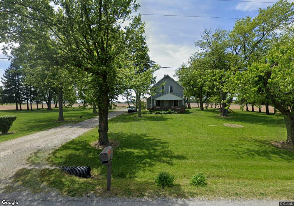
6640 W Us Highway 224 Decatur, IN 46733
Estimated Value: $179,000 - $410,000
4
Beds
1
Bath
1,870
Sq Ft
$141/Sq Ft
Est. Value
About This Home
This home is located at 6640 W Us Highway 224, Decatur, IN 46733 and is currently estimated at $263,302, approximately $140 per square foot. 6640 W Us Highway 224 is a home located in Adams County with nearby schools including Adams Central Elementary School, Adams Central Middle School, and Adams Central High School.
Ownership History
Date
Name
Owned For
Owner Type
Purchase Details
Closed on
Jul 31, 2006
Sold by
Elliot Tina
Bought by
Elliott Timothy W
Current Estimated Value
Create a Home Valuation Report for This Property
The Home Valuation Report is an in-depth analysis detailing your home's value as well as a comparison with similar homes in the area
Home Values in the Area
Average Home Value in this Area
Purchase History
| Date | Buyer | Sale Price | Title Company |
|---|---|---|---|
| Elliott Timothy W | -- | -- |
Source: Public Records
Tax History Compared to Growth
Tax History
| Year | Tax Paid | Tax Assessment Tax Assessment Total Assessment is a certain percentage of the fair market value that is determined by local assessors to be the total taxable value of land and additions on the property. | Land | Improvement |
|---|---|---|---|---|
| 2024 | $818 | $124,900 | $30,300 | $94,600 |
| 2023 | $760 | $116,800 | $29,900 | $86,900 |
| 2022 | $635 | $109,200 | $29,400 | $79,800 |
| 2021 | $570 | $101,000 | $25,900 | $75,100 |
| 2020 | $538 | $98,400 | $25,900 | $72,500 |
| 2019 | $501 | $97,700 | $26,200 | $71,500 |
| 2018 | $501 | $95,800 | $26,300 | $69,500 |
| 2017 | $483 | $92,700 | $24,200 | $68,500 |
| 2016 | $367 | $89,900 | $24,300 | $65,600 |
| 2014 | $410 | $94,200 | $27,100 | $67,100 |
| 2013 | $454 | $92,100 | $27,100 | $65,000 |
Source: Public Records
Map
Nearby Homes
- 6010 N 600 W
- 6068 N West St
- 5020 N 400 W
- 7805 N 600 E
- 3803 U S 224
- 3585 N 400 Rd W
- 4035 E 800 N
- 11063 N 700 E
- 6936 N State Road 1
- 3260 N 200 W
- 2591 Hogans Alley
- 2593 Hogans Alley
- Harmony Plan at Crosswind Lakes
- Chatham Plan at Crosswind Lakes
- 305 Piper Ct
- 410 Piper Ct
- 406 Piper Ct
- 1031 Palmer's Pass
- TBD E 900 N
- TBD N State Road 1
- 6766 W Us Highway 224
- 6757 W Us Highway 224
- 6536 W Us Highway 224
- 6775 W Us Highway 224
- 6777 W Us Highway 224
- 6787 W Us Highway 224
- 6849 W Us Highway 224
- 6900 W Us Highway 224
- 5889 N 700 W-1 Unit 1
- 6149 N 700 W
- 5687 N 700 W-1 Unit 1
- 5625 N 700 W
- 5625 N 700 W-1
- 5550 N 800 E
- 6061 W Us Highway 224
- 5465 N 700 W-1 Unit 1
- 5474 N 800 E
- 5866 N 600 W
- 6026 N 600 W
- 6050 N 600 W