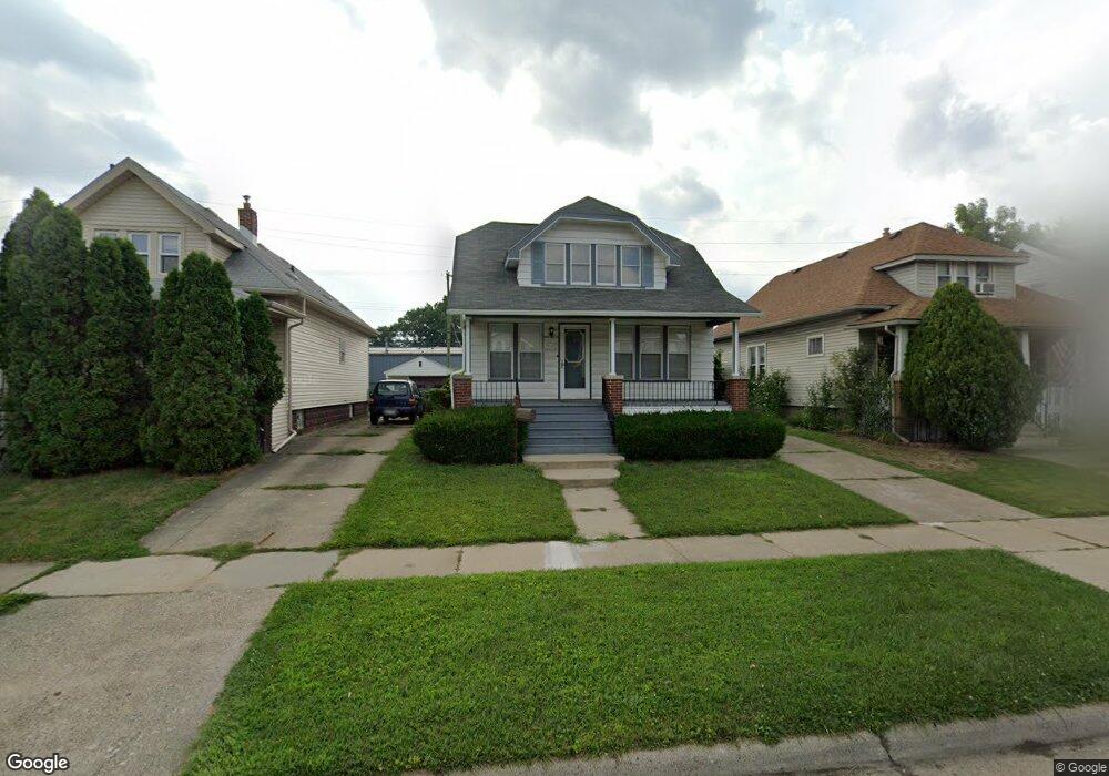
6640 Westpoint St Unit Bldg-Unit Taylor, MI 48180
Estimated Value: $167,249 - $188,000
2
Beds
2
Baths
1,296
Sq Ft
$136/Sq Ft
Est. Value
About This Home
This home is located at 6640 Westpoint St Unit Bldg-Unit, Taylor, MI 48180 and is currently estimated at $176,062, approximately $135 per square foot. 6640 Westpoint St Unit Bldg-Unit is a home located in Wayne County with nearby schools including Clarence Randall Elementary School, Hoover Middle School, and Quest Charter Academy.
Ownership History
Date
Name
Owned For
Owner Type
Purchase Details
Closed on
May 6, 2022
Sold by
Hassan Tabaja
Bought by
Tabaja Hassan and Tabaja Fouad
Current Estimated Value
Purchase Details
Closed on
Dec 23, 2021
Sold by
Bussard Jr John S
Bought by
Tabaja Hassan
Home Financials for this Owner
Home Financials are based on the most recent Mortgage that was taken out on this home.
Original Mortgage
$134,518
Interest Rate
3.12%
Mortgage Type
FHA
Purchase Details
Closed on
Jan 16, 2018
Sold by
Mayes John R
Bought by
Bussard John S
Purchase Details
Closed on
Oct 27, 2010
Sold by
Mazur Richard A and Mazur Carol F
Bought by
Mayes John R
Purchase Details
Closed on
Feb 9, 2009
Sold by
Mazur Richard A and Estate Of Helen Mazur
Bought by
Mazur Richard A
Create a Home Valuation Report for This Property
The Home Valuation Report is an in-depth analysis detailing your home's value as well as a comparison with similar homes in the area
Home Values in the Area
Average Home Value in this Area
Purchase History
| Date | Buyer | Sale Price | Title Company |
|---|---|---|---|
| Tabaja Hassan | -- | None Listed On Document | |
| Tabaja Hassan | $137,000 | None Listed On Document | |
| Bussard John S | $57,000 | First American Title Ins Co | |
| Mayes John R | $58,500 | Michigan Title Insurance Age | |
| Mazur Richard A | -- | None Available |
Source: Public Records
Mortgage History
| Date | Status | Borrower | Loan Amount |
|---|---|---|---|
| Previous Owner | Tabaja Hassan | $134,518 |
Source: Public Records
Tax History Compared to Growth
Tax History
| Year | Tax Paid | Tax Assessment Tax Assessment Total Assessment is a certain percentage of the fair market value that is determined by local assessors to be the total taxable value of land and additions on the property. | Land | Improvement |
|---|---|---|---|---|
| 2025 | $3,025 | $77,800 | $0 | $0 |
| 2024 | $3,025 | $69,800 | $0 | $0 |
| 2023 | $4,167 | $66,400 | $0 | $0 |
| 2022 | $2,921 | $64,000 | $0 | $0 |
| 2021 | $2,316 | $56,900 | $0 | $0 |
| 2020 | $2,293 | $47,300 | $0 | $0 |
| 2019 | $229,302 | $43,300 | $0 | $0 |
| 2018 | $1,292 | $37,500 | $0 | $0 |
| 2017 | $703 | $33,600 | $0 | $0 |
| 2016 | $1,599 | $32,600 | $0 | $0 |
| 2015 | $2,920 | $29,200 | $0 | $0 |
| 2013 | $2,920 | $30,600 | $0 | $0 |
| 2012 | $1,305 | $29,900 | $4,500 | $25,400 |
Source: Public Records
Map
Nearby Homes
- 6640 Westpoint St
- 6632 Westpoint St
- 6648 Westpoint St
- 6624 Westpoint St
- 6658 Westpoint St
- 6616 Westpoint St
- 6664 Westpoint St
- 6608 Westpoint St
- 6608 Westpoint St Unit 2
- 6608 Westpoint St Unit 1
- 6674 Westpoint St
- 6641 Westpoint St
- 6633 Westpoint St
- 6647 Westpoint St
- 6625 W Point St
- 6657 Westpoint St Unit Bldg-Unit
- 6657 Westpoint St
- 6617 Westpoint St
- 6665 Westpoint St
- 6607 Westpoint St Unit Bldg-Unit