Estimated Value: $475,000 - $572,000
4
Beds
3
Baths
2,906
Sq Ft
$179/Sq Ft
Est. Value
About This Home
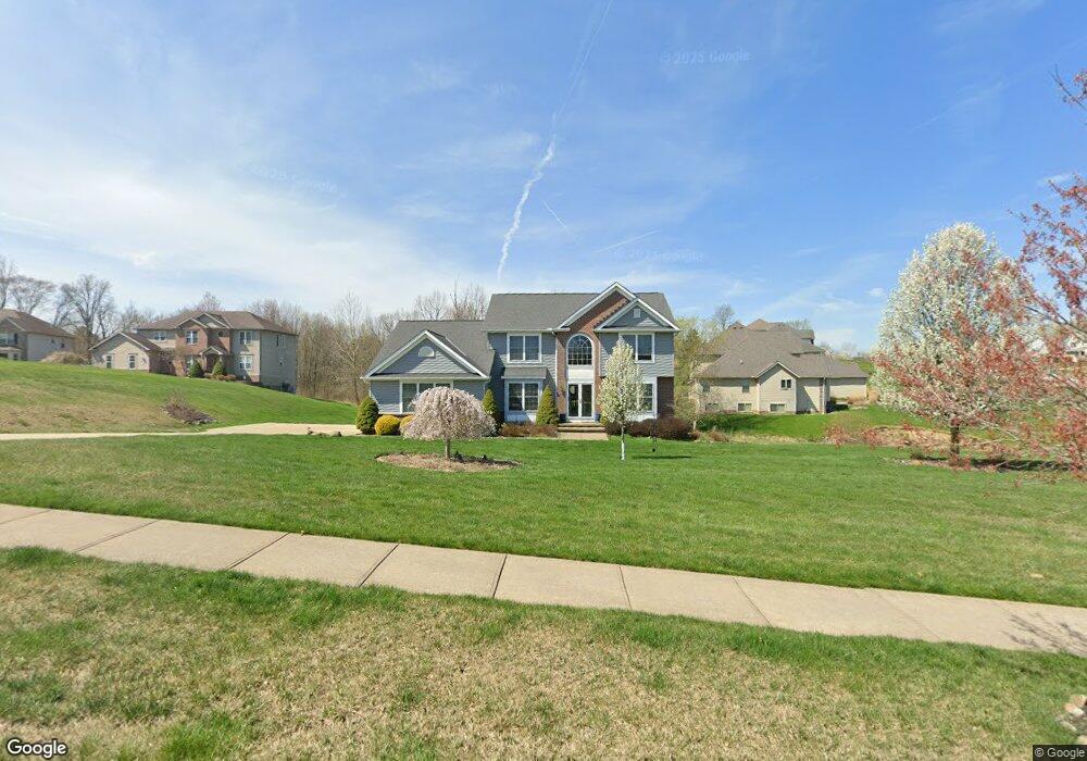
This home is located at 6640 Willow Tree Ln, Solon, OH 44139 and is currently estimated at $519,468, approximately $178 per square foot. 6640 Willow Tree Ln is a home located in Cuyahoga County with nearby schools including Orchard Middle School, Solon Middle School, and Solon High School.
Ownership History
Date
Name
Owned For
Owner Type
Purchase Details
Closed on
Jul 15, 2005
Sold by
Frank J Pla Inc
Bought by
Warren Marvin and Warren Lowistine
Current Estimated Value
Home Financials for this Owner
Home Financials are based on the most recent Mortgage that was taken out on this home.
Original Mortgage
$339,900
Outstanding Balance
$199,040
Interest Rate
7.6%
Mortgage Type
Fannie Mae Freddie Mac
Estimated Equity
$320,428
Purchase Details
Closed on
Dec 28, 2003
Sold by
Glenwillow Properties Inc
Bought by
Frank J Pla Inc
Home Financials for this Owner
Home Financials are based on the most recent Mortgage that was taken out on this home.
Original Mortgage
$114,000
Interest Rate
5.96%
Mortgage Type
Purchase Money Mortgage
Create a Home Valuation Report for This Property
The Home Valuation Report is an in-depth analysis detailing your home's value as well as a comparison with similar homes in the area
Home Values in the Area
Average Home Value in this Area
Purchase History
| Date | Buyer | Sale Price | Title Company |
|---|---|---|---|
| Warren Marvin | $339,900 | Title Xperts Agency Inc | |
| Frank J Pla Inc | $142,500 | Title Support |
Source: Public Records
Mortgage History
| Date | Status | Borrower | Loan Amount |
|---|---|---|---|
| Open | Warren Marvin | $339,900 | |
| Previous Owner | Frank J Pla Inc | $114,000 |
Source: Public Records
Tax History
| Year | Tax Paid | Tax Assessment Tax Assessment Total Assessment is a certain percentage of the fair market value that is determined by local assessors to be the total taxable value of land and additions on the property. | Land | Improvement |
|---|---|---|---|---|
| 2024 | $8,512 | $156,170 | $33,880 | $122,290 |
| 2023 | $8,829 | $129,780 | $26,390 | $103,390 |
| 2022 | $8,597 | $129,290 | $26,390 | $102,900 |
| 2021 | $8,499 | $129,290 | $26,390 | $102,900 |
| 2020 | $8,373 | $116,480 | $23,770 | $92,720 |
| 2019 | $8,108 | $332,800 | $67,900 | $264,900 |
| 2018 | $7,218 | $116,480 | $23,770 | $92,720 |
| 2017 | $7,249 | $107,280 | $23,490 | $83,790 |
| 2016 | $7,182 | $107,280 | $23,490 | $83,790 |
| 2015 | $7,159 | $107,280 | $23,490 | $83,790 |
| 2014 | $7,159 | $103,150 | $22,580 | $80,570 |
Source: Public Records
Map
Nearby Homes
- 6835 Richmond Rd Unit 120
- 26487 Buckthorn Rd
- 7346 Richmond Rd
- 25686 Buckthorn Rd
- 25644 Buckthorn Rd
- 25602 Buckthorn Rd
- 25684 Tryon Rd
- 7310 Lamson Rd
- 25105 Booker Ave
- 24910 Ridgeline Dr
- 24880 Ridgeline Dr
- 6569 Pau Ct
- 6538 Pau Ct
- 6308 Richmond Rd
- 6382 Stonehaven Ln
- 6357 Stonehaven Ln
- 7228 Grove Ave
- 7222 Grove Ave
- 6227 Whitetail Run
- 26240 Broadway Ave Unit 21
- 27300 Tinkers Valley Dr
- 27400 Tinkers Valley Dr
- 27400 Tinkers Valley Dr Unit 26
- 6650 Willow Tree Ln
- 27355 Tinkers Valley Dr
- 27405 Tinkers Valley Dr
- 6700 Willow Tree Ln
- 6655 Willow Tree Ln
- 27305 Tinkers Valley Dr
- 27450 Tinkers Valley Dr
- 6705 Willow Tree Ln
- 27200 Tinkers Valley Dr
- 6750 Willow Tree Ln
- 27255 Tinkers Valley Dr
- 6755 Willow Tree Ln
- 27500 Tinkers Valley Dr
- 27505 Tinkers Valley Dr
- 27150 Tinkers Valley Dr
- 27205 Tinkers Valley Dr
- 27550 Tinkers Valley Dr
Your Personal Tour Guide
Ask me questions while you tour the home.