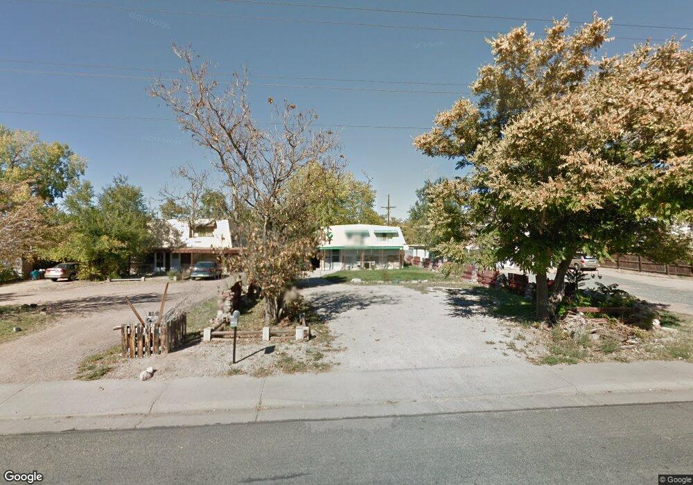
6641 E 69th Ave Commerce City, CO 80022
Kemp NeighborhoodEstimated Value: $421,333 - $494,000
4
Beds
2
Baths
3,045
Sq Ft
$149/Sq Ft
Est. Value
About This Home
This home is located at 6641 E 69th Ave, Commerce City, CO 80022 and is currently estimated at $453,333, approximately $148 per square foot. 6641 E 69th Ave is a home located in Adams County with nearby schools including Kemp Elementary School, Kearney Middle School, and Adams City High School.
Ownership History
Date
Name
Owned For
Owner Type
Purchase Details
Closed on
Nov 9, 2021
Sold by
Dbdd Xi Llc
Bought by
Dbdd Xxi Llc
Current Estimated Value
Home Financials for this Owner
Home Financials are based on the most recent Mortgage that was taken out on this home.
Original Mortgage
$1,418,240
Outstanding Balance
$1,298,671
Interest Rate
3.09%
Estimated Equity
-$845,338
Purchase Details
Closed on
Dec 21, 2015
Sold by
Abel Bertha L
Bought by
Bybee Sherre A and Wilbur Cheryl
Create a Home Valuation Report for This Property
The Home Valuation Report is an in-depth analysis detailing your home's value as well as a comparison with similar homes in the area
Home Values in the Area
Average Home Value in this Area
Purchase History
| Date | Buyer | Sale Price | Title Company |
|---|---|---|---|
| Dbdd Xxi Llc | -- | None Available | |
| Bybee Sherre A | -- | None Available |
Source: Public Records
Mortgage History
| Date | Status | Borrower | Loan Amount |
|---|---|---|---|
| Open | Dbdd Xxi Llc | $1,418,240 |
Source: Public Records
Tax History Compared to Growth
Tax History
| Year | Tax Paid | Tax Assessment Tax Assessment Total Assessment is a certain percentage of the fair market value that is determined by local assessors to be the total taxable value of land and additions on the property. | Land | Improvement |
|---|---|---|---|---|
| 2024 | $2,274 | $26,250 | $5,310 | $20,940 |
| 2023 | $2,001 | $29,630 | $5,750 | $23,880 |
| 2022 | $1,963 | $21,840 | $5,770 | $16,070 |
| 2021 | $1,991 | $21,840 | $5,770 | $16,070 |
| 2020 | $1,906 | $21,160 | $5,010 | $16,150 |
| 2019 | $1,902 | $21,160 | $5,010 | $16,150 |
| 2018 | $1,494 | $16,190 | $4,460 | $11,730 |
| 2017 | $788 | $16,190 | $4,460 | $11,730 |
| 2016 | $536 | $11,830 | $2,230 | $9,600 |
| 2015 | $546 | $5,910 | $1,110 | $4,800 |
| 2014 | $609 | $6,570 | $920 | $5,650 |
Source: Public Records
Map
Nearby Homes
- 6980 Niagara St
- 6601 E 71st Ave
- 6420 E 68th Ave
- 7131 Pontiac St
- 6751 Leyden St
- 6721 Leyden St
- 6711 Leyden St
- 7050 Kearney Ct
- 6625 Locust St
- 6251 E 66th Place
- 0 Lot 2 Unit REC2976963
- 7165 E 72nd Place
- 6560 Porter Way
- 5971 E 69th Ave
- 5971 E 69th Ave Unit 21
- 6641 E 73rd Place
- 6446 Monaco St
- 5680 E 67th Ave
- 7075 Garden Ln
- 7461 Locust St
- 6651 E 69th Ave
- 6621 E 69th Ave
- 6661 E 69th Ave
- 6930 Magnolia St
- 6920 Magnolia St
- 6671 E 69th Ave
- 6940 Magnolia St
- 6921 Niagara St
- 6681 E 69th Ave
- 6925 Niagara St
- 6670 E 69th Ave
- 6890 Magnolia St
- 6951 Niagara St
- 6950 Magnolia St
- 6950 Magnolia St Unit A
- 6690 E 69th Ave
- 6961 Niagara St
- 6880 Magnolia St
- 6960 Magnolia St
- 6881 Niagara St