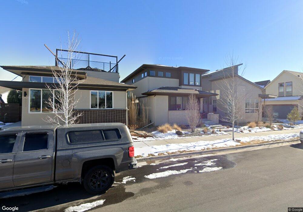
6642 Larsh Dr Denver, CO 80221
Twin Lakes NeighborhoodEstimated Value: $748,900 - $796,000
3
Beds
4
Baths
2,987
Sq Ft
$259/Sq Ft
Est. Value
About This Home
This home is located at 6642 Larsh Dr, Denver, CO 80221 and is currently estimated at $774,975, approximately $259 per square foot. 6642 Larsh Dr is a home located in Adams County with nearby schools including Trailside Academy and Midtown Montessori Academy.
Ownership History
Date
Name
Owned For
Owner Type
Purchase Details
Closed on
Nov 20, 2024
Sold by
Colb Marci and Colb Michael
Bought by
Marci Colb Living Trust and Colb
Current Estimated Value
Purchase Details
Closed on
Aug 6, 2015
Sold by
Midtown Residential Llc
Bought by
Colb Marci A and Colb Michael A
Home Financials for this Owner
Home Financials are based on the most recent Mortgage that was taken out on this home.
Original Mortgage
$386,413
Interest Rate
4.06%
Mortgage Type
New Conventional
Create a Home Valuation Report for This Property
The Home Valuation Report is an in-depth analysis detailing your home's value as well as a comparison with similar homes in the area
Home Values in the Area
Average Home Value in this Area
Purchase History
| Date | Buyer | Sale Price | Title Company |
|---|---|---|---|
| Marci Colb Living Trust | -- | None Listed On Document | |
| Colb Marci A | $483,017 | Land Title Guarantee Company |
Source: Public Records
Mortgage History
| Date | Status | Borrower | Loan Amount |
|---|---|---|---|
| Previous Owner | Colb Marci A | $386,413 |
Source: Public Records
Tax History
| Year | Tax Paid | Tax Assessment Tax Assessment Total Assessment is a certain percentage of the fair market value that is determined by local assessors to be the total taxable value of land and additions on the property. | Land | Improvement |
|---|---|---|---|---|
| 2025 | $7,857 | $53,040 | $9,180 | $43,860 |
| 2024 | $7,857 | $48,750 | $8,440 | $40,310 |
| 2023 | $7,825 | $54,530 | $5,890 | $48,640 |
| 2022 | $7,229 | $42,000 | $6,050 | $35,950 |
| 2021 | $6,963 | $42,000 | $6,050 | $35,950 |
| 2020 | $6,300 | $38,650 | $6,220 | $32,430 |
| 2019 | $6,311 | $38,650 | $6,220 | $32,430 |
| 2018 | $6,133 | $36,090 | $6,260 | $29,830 |
| 2017 | $6,024 | $36,090 | $6,260 | $29,830 |
| 2016 | $5,629 | $33,920 | $6,370 | $27,550 |
| 2015 | $2,034 | $13,260 | $6,370 | $6,890 |
Source: Public Records
Map
Nearby Homes
- 2005 W 66th Ave
- 1772 W 66th Ave
- 6712 Avrum Dr
- 6639 Raritan Dr
- 2074 W 66th Ave
- 6737 Alan Dr
- 1682 W 66th Ave
- 1824 W 68th Ave
- 2053 W 67th Place
- 2270 W 66th Ave
- 6767 Quivas Way
- 6632 Osage St
- 2365 W 67th Dr
- 1407 W 66th Ave
- 1411 W 67th Ave
- 1465 W 68th Ave
- 6799 Navajo St
- 1340 W 68th Ave
- 6628 Mariposa St
- 7020 Avrum Dr
- 6632 Larsh Dr
- 6652 Larsh Dr
- 1941 W 66th Ave
- 6643 Avrum Dr
- 1953 W 66th Ave
- 1933 W 66th Ave
- 6633 Avrum Dr
- 1938 W 67th Ave
- 6653 Avrum Dr
- 1950 W 67th Ave
- 1926 W 67th Ave
- 1980 W 66th Place
- 1914 W 67th Ave
- 1979 W 66th Ave
- 1897 W 66th Ave
- 1990 W 66th Place
- 1902 W 67th Ave
- 1991 W 66th Ave
- 2000 W 66th Place
- 1954 W 66th Ave
Your Personal Tour Guide
Ask me questions while you tour the home.