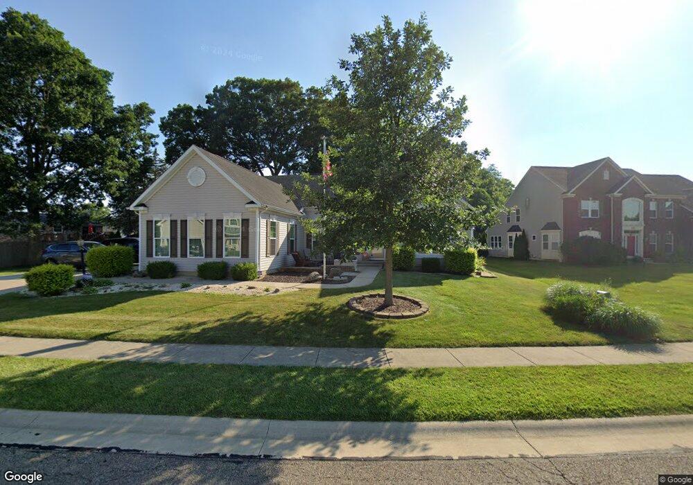
6644 List St NW Canton, OH 44708
Amherst Heights-Clearview NeighborhoodEstimated Value: $447,584 - $461,000
3
Beds
3
Baths
2,682
Sq Ft
$170/Sq Ft
Est. Value
About This Home
This home is located at 6644 List St NW, Canton, OH 44708 and is currently estimated at $455,396, approximately $169 per square foot. 6644 List St NW is a home with nearby schools including Amherst Elementary School, Jackson Memorial Middle School, and Jackson High School.
Ownership History
Date
Name
Owned For
Owner Type
Purchase Details
Closed on
Nov 19, 2024
Sold by
Bostic Family Trust and Bostic Larry R
Bought by
Bostic Larry R W and Bostic Cristy D
Current Estimated Value
Purchase Details
Closed on
Dec 23, 2019
Sold by
Bostic Larry R and Bostic Cristy D
Bought by
Bostic Larry R W and Bostic Cristy D
Purchase Details
Closed on
Dec 6, 2012
Sold by
Ivr Inc
Bought by
Bostic Larry R and Bostic Christy D
Home Financials for this Owner
Home Financials are based on the most recent Mortgage that was taken out on this home.
Original Mortgage
$276,260
Interest Rate
3.38%
Mortgage Type
VA
Create a Home Valuation Report for This Property
The Home Valuation Report is an in-depth analysis detailing your home's value as well as a comparison with similar homes in the area
Home Values in the Area
Average Home Value in this Area
Purchase History
| Date | Buyer | Sale Price | Title Company |
|---|---|---|---|
| Bostic Larry R W | -- | None Listed On Document | |
| Bostic Larry R W | -- | None Available | |
| Bostic Larry R | $276,300 | Nvr Title Agency Llc |
Source: Public Records
Mortgage History
| Date | Status | Borrower | Loan Amount |
|---|---|---|---|
| Previous Owner | Bostic Larry R | $276,260 |
Source: Public Records
Tax History Compared to Growth
Tax History
| Year | Tax Paid | Tax Assessment Tax Assessment Total Assessment is a certain percentage of the fair market value that is determined by local assessors to be the total taxable value of land and additions on the property. | Land | Improvement |
|---|---|---|---|---|
| 2025 | -- | $149,880 | $34,620 | $115,260 |
| 2024 | -- | $149,880 | $34,620 | $115,260 |
| 2023 | $5,919 | $135,590 | $31,150 | $104,440 |
| 2022 | $5,920 | $135,590 | $31,150 | $104,440 |
| 2021 | $5,922 | $135,590 | $31,150 | $104,440 |
| 2020 | $5,183 | $112,320 | $26,850 | $85,470 |
| 2019 | $4,988 | $112,320 | $26,850 | $85,470 |
| 2018 | $5,008 | $112,320 | $26,850 | $85,470 |
| 2017 | $4,406 | $96,710 | $24,080 | $72,630 |
| 2016 | $4,424 | $96,710 | $24,080 | $72,630 |
| 2015 | $2,918 | $96,710 | $24,080 | $72,630 |
| 2014 | $130 | $61,570 | $22,190 | $39,380 |
| 2013 | $1,557 | $61,570 | $22,190 | $39,380 |
Source: Public Records
Map
Nearby Homes
- Aviano Plan at Aberdeen Oaks
- Hudson Plan at Aberdeen Oaks
- Allegheny Plan at Aberdeen Oaks
- Columbia Plan at Aberdeen Oaks
- 2873 Olympia Dr NW
- 6436 Hensley St NW
- 2889 Vicksburg Ave NW
- 1760 Cadbury St NW
- 3151 Perry Dr NW
- 3467 Briardale Dr NW
- 3051 Blue Ash Ave NW
- 1545 Clearbrook Rd NW
- 1805 Blempton Rd NW
- 2984 Villa Glen Cir NW
- 2406 Nottingham St NW
- 2174 Via Luna Cir NE Unit 15
- 2172 Via Luna Cir NE Unit 16
- 2554 Mary Lou St NW
- 1702 Thornridge Rd NW
- 3436 Cardiff Ave NW
- 6672 List St NW
- 2950 Roanoke St NW
- 2940 Roanoke St NW
- 6651 List St NW
- 6690 List St NW
- 6639 List St NW
- 2930 Roanoke St NW
- 6687 List St NW
- 3221 List St NW
- 6704 List St NW
- 2922 Roanoke St NW
- 6703 List St NW
- 3209 List St NW
- 2951 Roanoke St NW
- 2939 Roanoke St NW
- 2910 Roanoke St NW
- 2931 Roanoke St NW
- 6715 List St NW
- 1861 Clearbrook Rd NW
- 3201 List St NW